MyTopo
Lakeview California US Topo Map
Couldn't load pickup availability
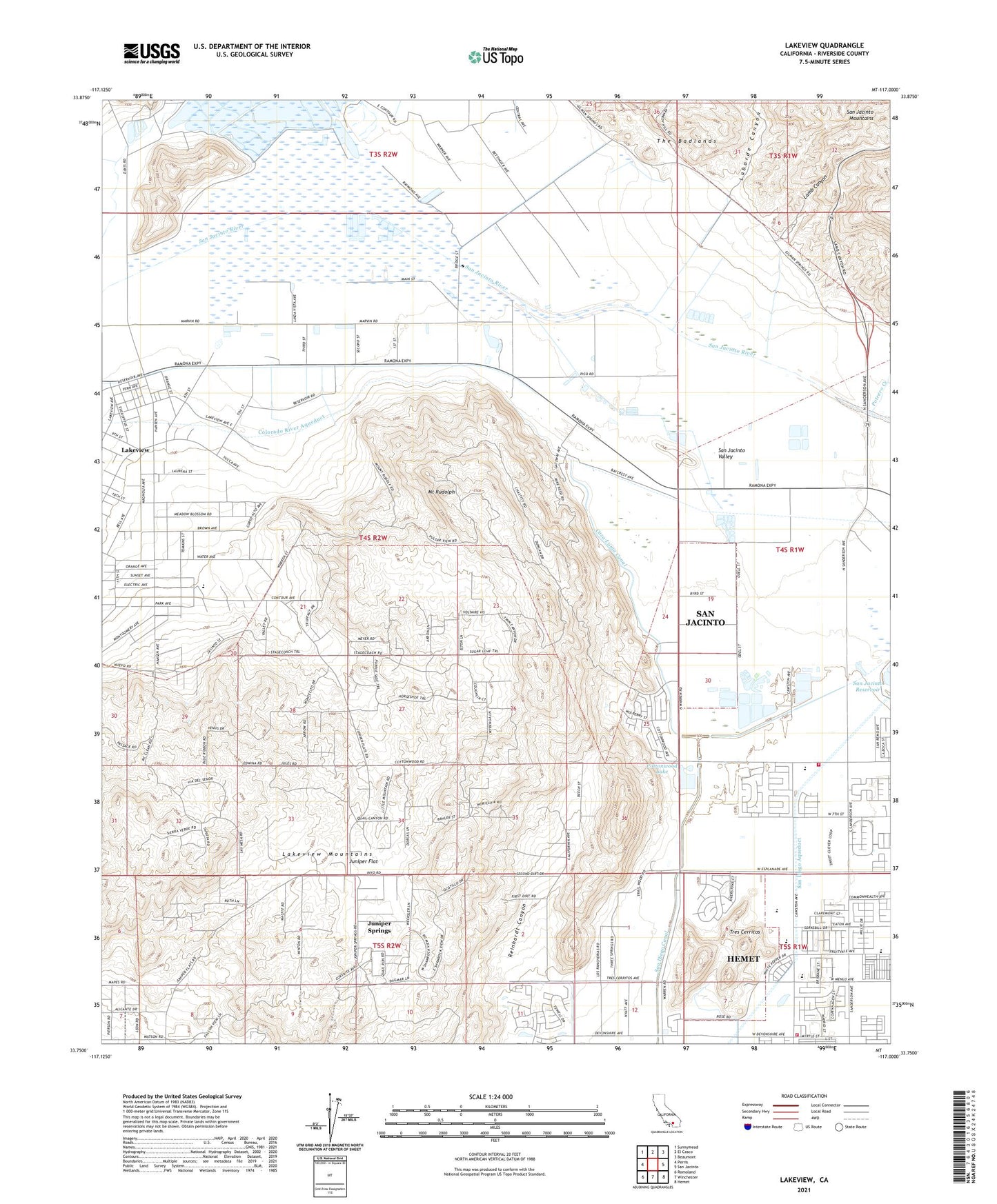
2023 topographic map quadrangle Lakeview in the state of California. Scale: 1:24000. Based on the newly updated USGS 7.5' US Topo map series, this map is in the following counties: Riverside. The map contains contour data, water features, and other items you are used to seeing on USGS maps, but also has updated roads and other features. This is the next generation of topographic maps. Printed on high-quality waterproof paper with UV fade-resistant inks.
Quads adjacent to this one:
West: Perris
Northwest: Sunnymead
North: El Casco
Northeast: Beaumont
East: San Jacinto
Southeast: Hemet
South: Winchester
Southwest: Romoland
This map covers the same area as the classic USGS quad with code o33117g1.
Contains the following named places: Bar V Ranch, Bar V Ranch School, Casa Loma, Casa Loma Canal, Colonial Country Club, Cornerstone Christian Assembly Church, Cottonwood Lake, Fruitvale Elementary School, Grace Preparatory School, Hemet Fire Department Station 3, Hidden Villa Ranch, Jesus Center, Juniper Flat, Juniper Springs, Laborde Canyon, Lakeview, Lakeview Census Designated Place, Lakeview Mountains, Lamb Canyon, MacLean Ranch, Maze Stone Historical Marker, Mount Rudolph, Naked City Campground, Potrero Creek, Reinhardt Canyon, Riverside County Fire Department Station 78 San Jacinto, San Diego Canal, San Jacinto Nuevo Y Potrero, San Jacinto Valley, Tres Cerritos, ZIP Codes: 92548, 92567, 92582