MyTopo
Perris California US Topo Map
Couldn't load pickup availability
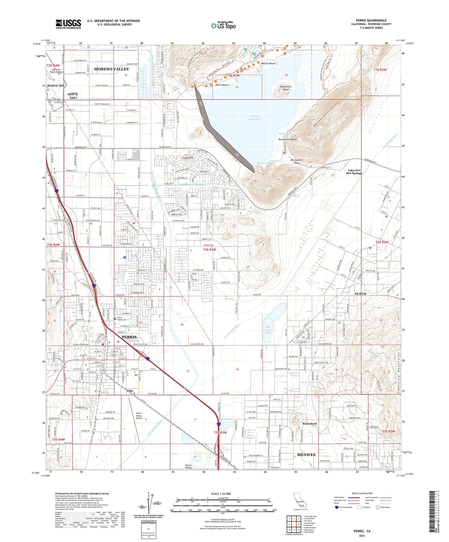
2021 topographic map quadrangle Perris in the state of California. Scale: 1:24000. Based on the newly updated USGS 7.5' US Topo map series, this map is in the following counties: Riverside. The map contains contour data, water features, and other items you are used to seeing on USGS maps, but also has updated roads and other features. This is the next generation of topographic maps. Printed on high-quality waterproof paper with UV fade-resistant inks.
Quads adjacent to this one:
West: Steele Peak
Northwest: Riverside East
North: Sunnymead
Northeast: El Casco
East: Lakeview
Southeast: Winchester
South: Romoland
Southwest: Lake Elsinore
This map covers the same area as the classic USGS quad with code o33117g2.
Contains the following named places: Alessandro Island, American Medical Response North Perris, American Medical Response Perris, Banta Beatty Park, Bernasconi Bay, Bernasconi Beach, Bernasconi Hills, Bernasconi Pass, Big Rock Bay, California Department of Forestry and Fire Protection Perris, Calvary Southern Baptist Church, Castle Heliport, Church of Christ, City of Perris, Coney Hill, De Anza Trail Monument, Ellis, Figadota Farm, First Baptist Church, First Congregational Church, Granite Spur, Kindred Hospital Riverside, Lake Perris State Recreation Area, Lakeview Hot Springs, May Ranch, Mayer Farms, McCanna Ranch, Moreno Beach, Mountain Shadows Middle School, Nan Sanders Elementary School, North Perris Medical Center, Nuevo, Nuevo Branch Riverside City and County Public Library, Nuevo Census Designated Place, Nuevo Community Church, Nuevo Post Office, Nuview Elementary School, Perris, Perris 1-068 Dam, Perris Beach, Perris Branch Riverside City and County Public Library, Perris City Hall, Perris Community Adult School, Perris Elementary School, Perris Elementary School Annex, Perris High School, Perris Junior High School, Perris Lake Continuation High School, Perris Post Office, Perris Reservoir, Perris Town Center Shopping Center, Perris Valley, Perris Valley Airport, Perris Valley Cemetery, Perris Valley Division, Perris Valley Hot Air Ballooning and Parachute Center, Perris Valley Storm Drain, Pinacate Middle School, Praise Fellowship Christian Academy, Rancho las Perris, Rancho Verde High School, Riverside County Fire Department Station 1 Perris, Riverside County Fire Department Station 3 - Nuview, Riverside County Fire Department Station 90, Riverside County Sheriff's Department, Riverside County Sheriff's Office Perris Station, Romoland Census Designated Place, Saint James Catholic Church, Saint James Catholic School, SCE Perris District Heliport, Ski Land Lake, Spectrum Shopping Center, Temple Christian Church, Trolley Museum, Val Verde Elementary School, Val Verde School District Office, Woodhaven Park, Yai Heki Regional Indian Museum, ZIP Code: 92571