MyTopo
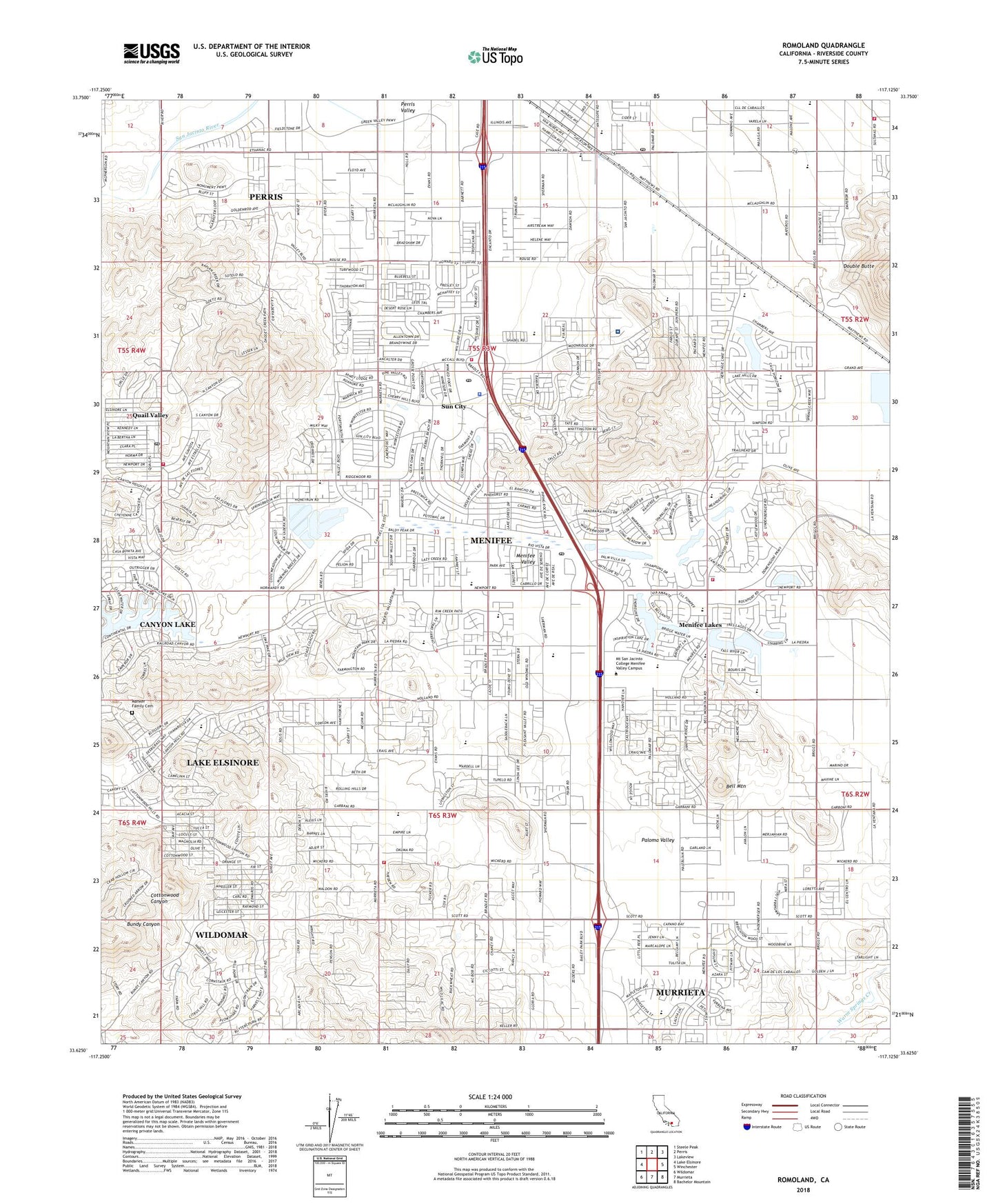
Romoland California US Topo Map
Couldn't load pickup availability
2023 topographic map quadrangle Romoland in the state of California. Scale: 1:24000. Based on the newly updated USGS 7.5' US Topo map series, this map is in the following counties: Riverside. The map contains contour data, water features, and other items you are used to seeing on USGS maps, but also has updated roads and other features. This is the next generation of topographic maps. Printed on high-quality waterproof paper with UV fade-resistant inks.
Quads adjacent to this one:
West: Lake Elsinore
Northwest: Steele Peak
North: Perris
Northeast: Lakeview
East: Winchester
Southeast: Bachelor Mountain
South: Murrieta
Southwest: Wildomar
This map covers the same area as the classic USGS quad with code o33117f2.
Contains the following named places: American Medical Response Sun City, Antelope School, Audie Murphy Ranch, Bell Mountain, Callie Kirkpatrick Elementary School, Chester W Morrison Elementary School, Church of Christ of the Valley, City of Menifee, Ethanac Siding, Faith Lutheran Church, Foundational Education School, Good Shepherd Lutheran School, Grace Evangelical Free Church, Harvest Valley Elementary School, His Light Christian Academy, Inland Urgent Care of Sun City, Leon Mine, Manker Family Cemetery, Masters Hands Christian School, Menifee, Menifee Elementary School, Menifee Global Medical Center, Menifee Lakes, Menifee Lakes Country Club, Menifee Town Center Shopping Center, Menifee Valley, Menifee Valley Middle School, Menifee-Antelope Community Hall, Motte Field Park, Newport Plaza Shopping Center, Oliver Christian School Center, Paloma Valley, Quail Valley, Quail Valley Census Designated Place, Quail Valley Country Club, Quail Valley Park, Quail Valley Post Office, Revival Christian Academy, Riverside County Fire Department Station 5 Quail Valley, Riverside County Fire Department Station 54 Homeland, Riverside County Fire Department Station 68 Menifee, Riverside County Fire Department Station 7 Sun City, Riverside County Fire Department Station 76 - Menifee Lakes, Romoland, Romoland Elementary School, Romoland Post Office, Roy W Kabian Memorial Park, SCE San Jacinto Valley Service Center Heliport, Sun City, Sun City Branch Riverside City and County Public Library, Sun City Census Designated Place, Sun City Chamber of Commerce, Sun City Convalescent Center, Sun City Finance Post Office, Sun City Golf Club North Course, Sun City Golf Course, Sun City Post Office, Sun City Shopping Center, Sun City Town Hall, Temple Beth Sholom, ZIP Codes: 92584, 92585, 92586