MyTopo
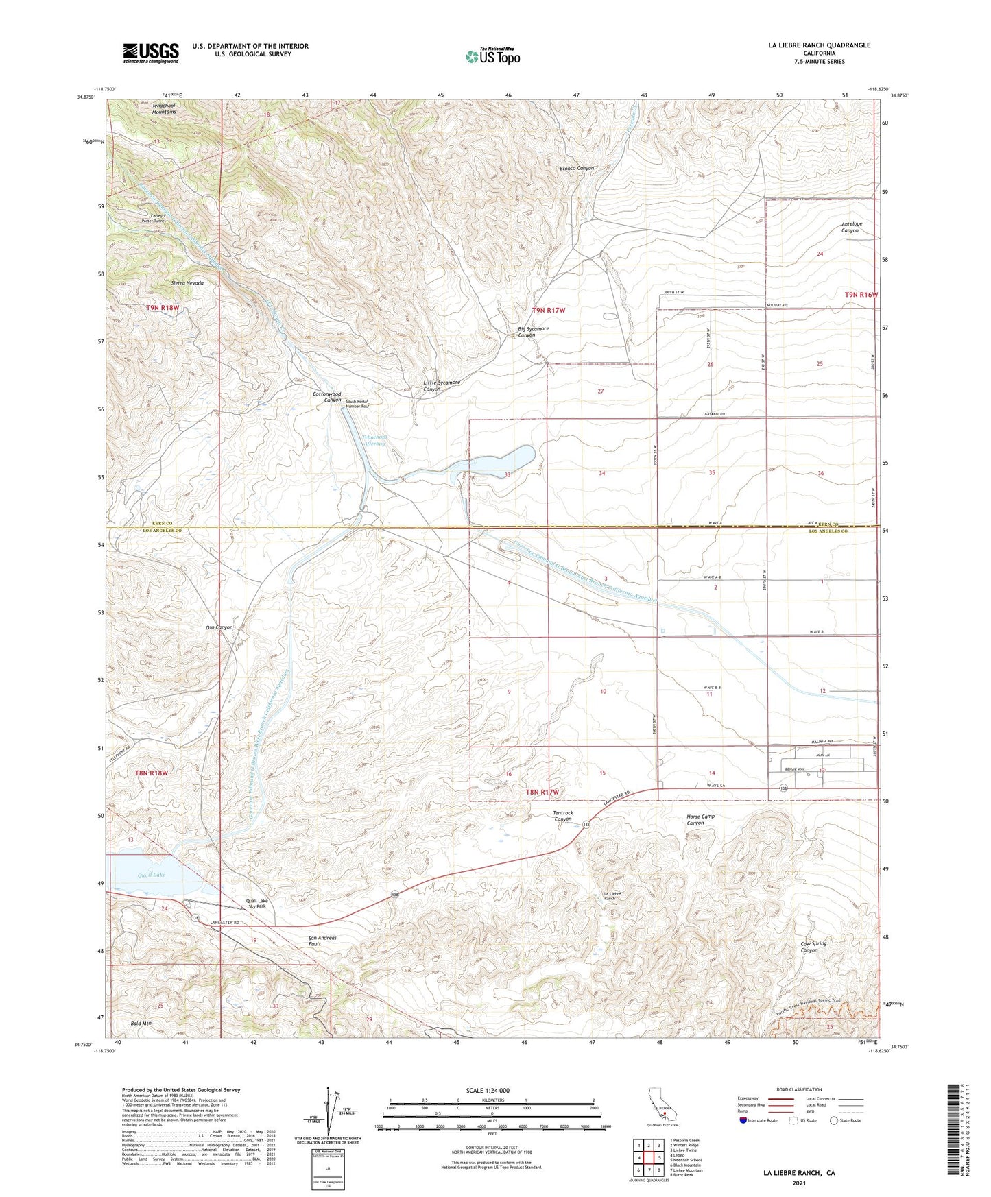
La Liebre Ranch California US Topo Map
Couldn't load pickup availability
Also explore the La Liebre Ranch Forest Service Topo of this same quad for updated USFS data
2021 topographic map quadrangle La Liebre Ranch in the state of California. Scale: 1:24000. Based on the newly updated USGS 7.5' US Topo map series, this map is in the following counties: Los Angeles, Kern. The map contains contour data, water features, and other items you are used to seeing on USGS maps, but also has updated roads and other features. This is the next generation of topographic maps. Printed on high-quality waterproof paper with UV fade-resistant inks.
Quads adjacent to this one:
West: Lebec
Northwest: Pastoria Creek
North: Winters Ridge
Northeast: Liebre Twins
East: Neenach School
Southeast: Burnt Peak
South: Liebre Mountain
Southwest: Black Mountain
This map covers the same area as the classic USGS quad with code o34118g6.
Contains the following named places: Antelope Canyon, Barnes Ranch, Big Sycamore Canyon, Bronco Canyon, Carley V Porter Tunnel, Cottonwood Canyon, Cow Spring Canyon, Horse Camp Canyon, La Liebre, La Liebre Ranch, Little Sycamore Canyon, Los Alamos Creek, Oso Canyon, Oso Pumping Plant, Pescado Creek, Quail Lake, Quail Lake Sky Park, South Portal Number Four, Tehachapi Afterbay, Tentrock Canyon