MyTopo
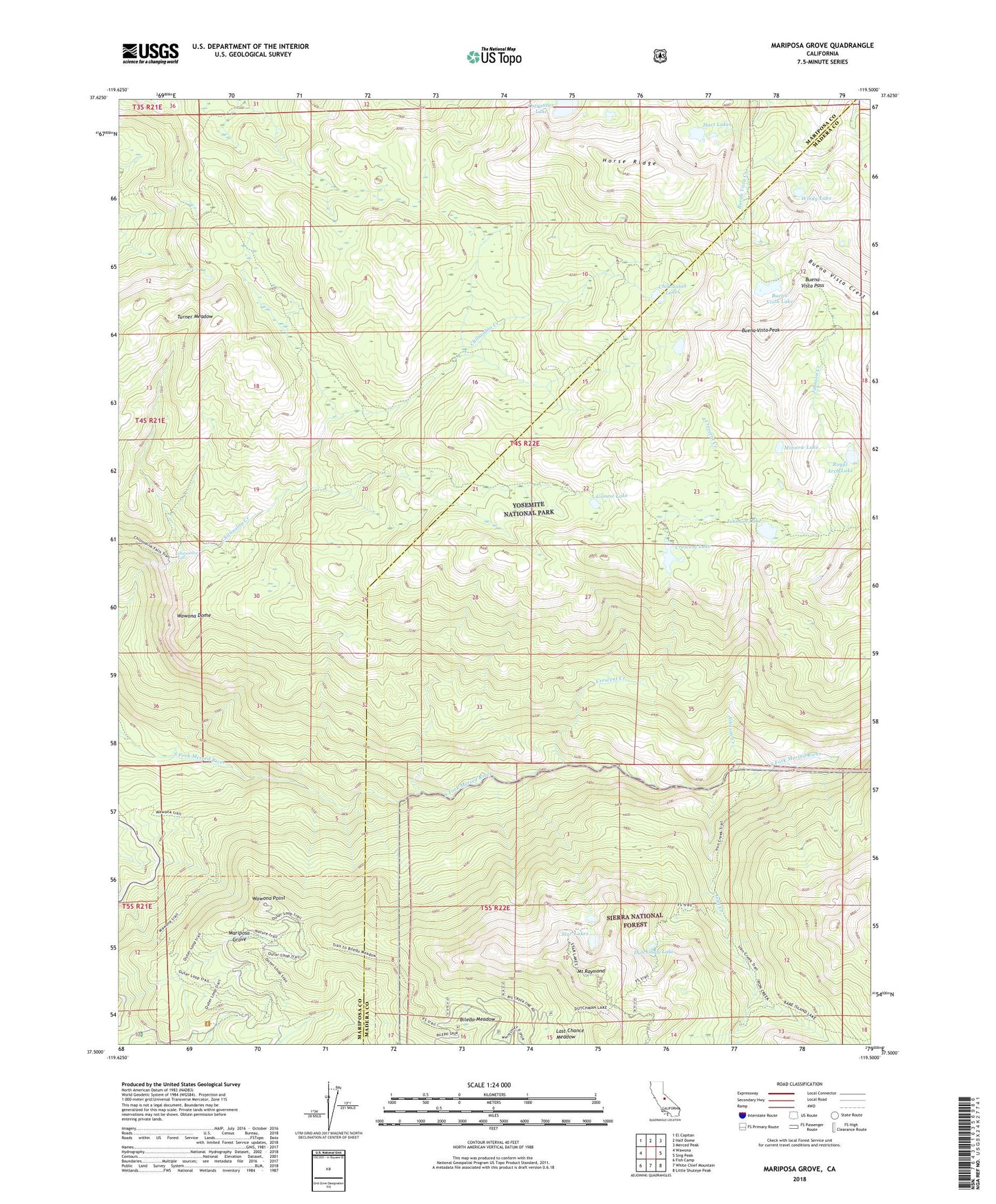
Mariposa Grove California US Topo Map
Couldn't load pickup availability
Also explore the Mariposa Grove Forest Service Topo of this same quad for updated USFS data
2021 topographic map quadrangle Mariposa Grove in the state of California. Scale: 1:24000. Based on the newly updated USGS 7.5' US Topo map series, this map is in the following counties: Mariposa, Madera. The map contains contour data, water features, and other items you are used to seeing on USGS maps, but also has updated roads and other features. This is the next generation of topographic maps. Printed on high-quality waterproof paper with UV fade-resistant inks.
Quads adjacent to this one:
West: Wawona
Northwest: El Capitan
North: Half Dome
Northeast: Merced Peak
East: Sing Peak
Southeast: Little Shuteye Peak
South: White Chief Mountain
Southwest: Fish Camp
This map covers the same area as the classic USGS quad with code o37119e5.
Contains the following named places: Big Tree, Biledo Meadow, Buena Vista Lake, Buena Vista Pass, Buena Vista Peak, Chilnualna Fall, Chilnualna Lakes, Crescent Creek, Crescent Lake, Dutchman Lake, Grizzly Giant, Grouse Lake, Hart Lakes, Horse Ridge, Iron Creek, Johnson Creek, Johnson Lake, Last Chance Meadow, Mariposa Grove, Minnow Lake, Mount Raymond, Mount Raymond Camp, Ostrander Lake, Royal Arch Lake, Star Lakes, Star Mine, Tunnel Tree, Turner Meadow, Wawona Dome, Wawona Point, Windy Lake