MyTopo
Lompoc Hills California US Topo Map
Couldn't load pickup availability
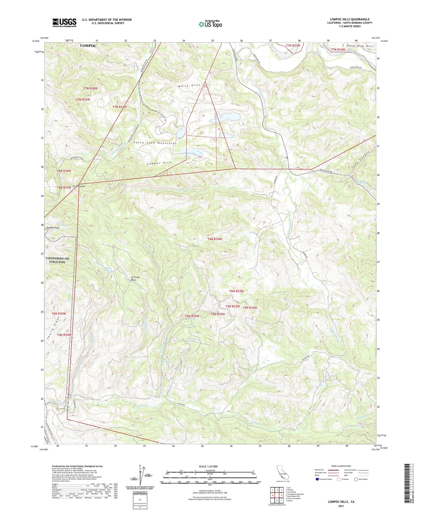
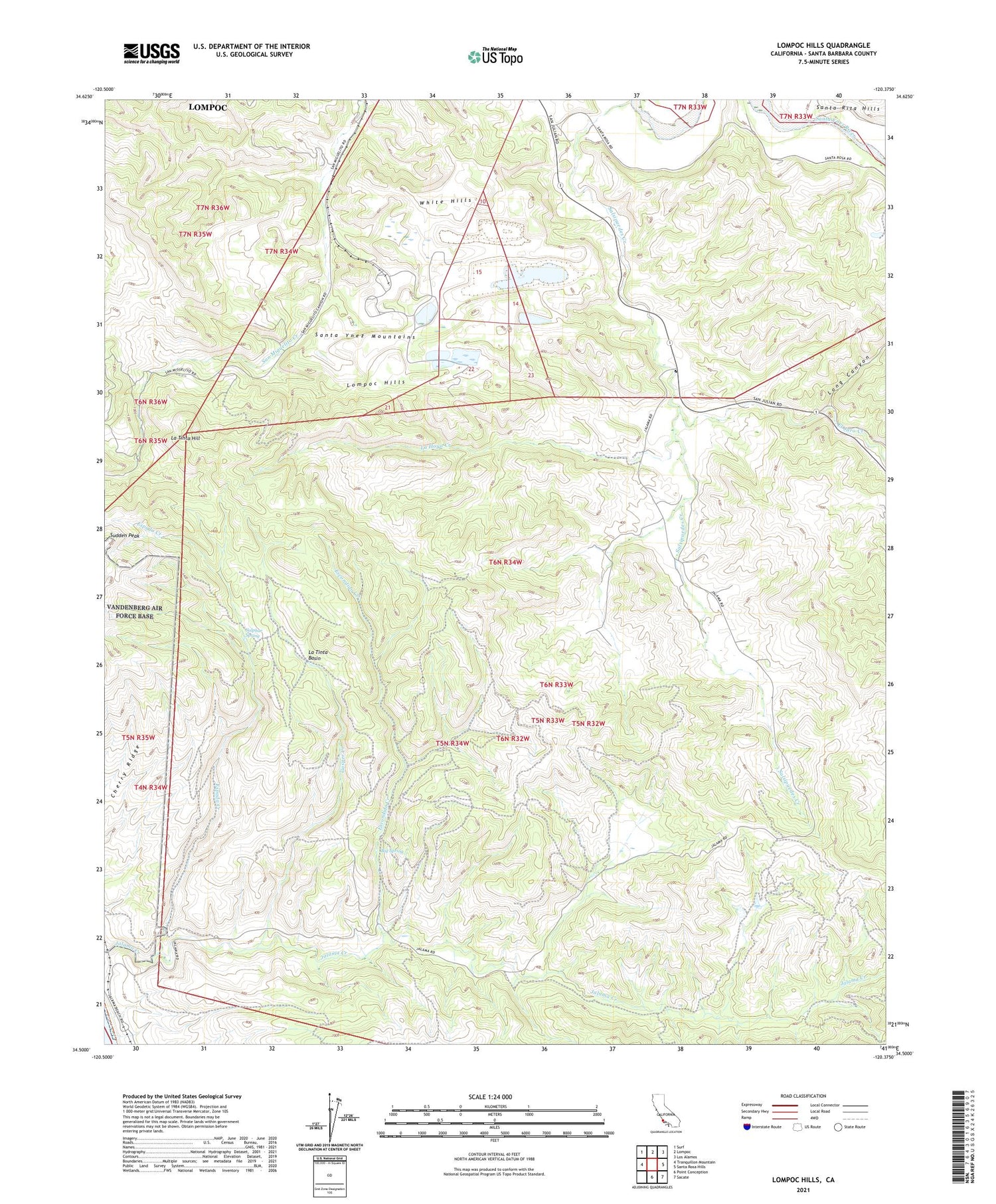
2021 topographic map quadrangle Lompoc Hills in the state of California. Scale: 1:24000. Based on the newly updated USGS 7.5' US Topo map series, this map is in the following counties: Santa Barbara. The map contains contour data, water features, and other items you are used to seeing on USGS maps, but also has updated roads and other features. This is the next generation of topographic maps. Printed on high-quality waterproof paper with UV fade-resistant inks.
Quads adjacent to this one:
West: Tranquillon Mountain
Northwest: Surf
North: Lompoc
Northeast: Los Alamos
East: Santa Rosa Hills
Southeast: Sacate
South: Point Conception
This map covers the same area as the classic USGS quad with code o34120e4.
Contains the following named places: Big Spring, Canada De Salsipuedes, Cherry Ridge, El Jaro Creek, El Jaro Quarry, Escondido Creek, Espada Creek, Gasper Creek, Jalama, Jalama Ranch, Jalama School, La Hoya Creek, La Mission Vieja De La Purisima, La Tinta Basin, La Tinta Hill, Lompoc City Landfill, Lompoc Division, Lompoc Hills, Long Canyon, Miguelito Canyon Quarry, Miguelito County Park, Sulphur Spring, White Hills