MyTopo
Santa Rosa Hills California US Topo Map
Couldn't load pickup availability
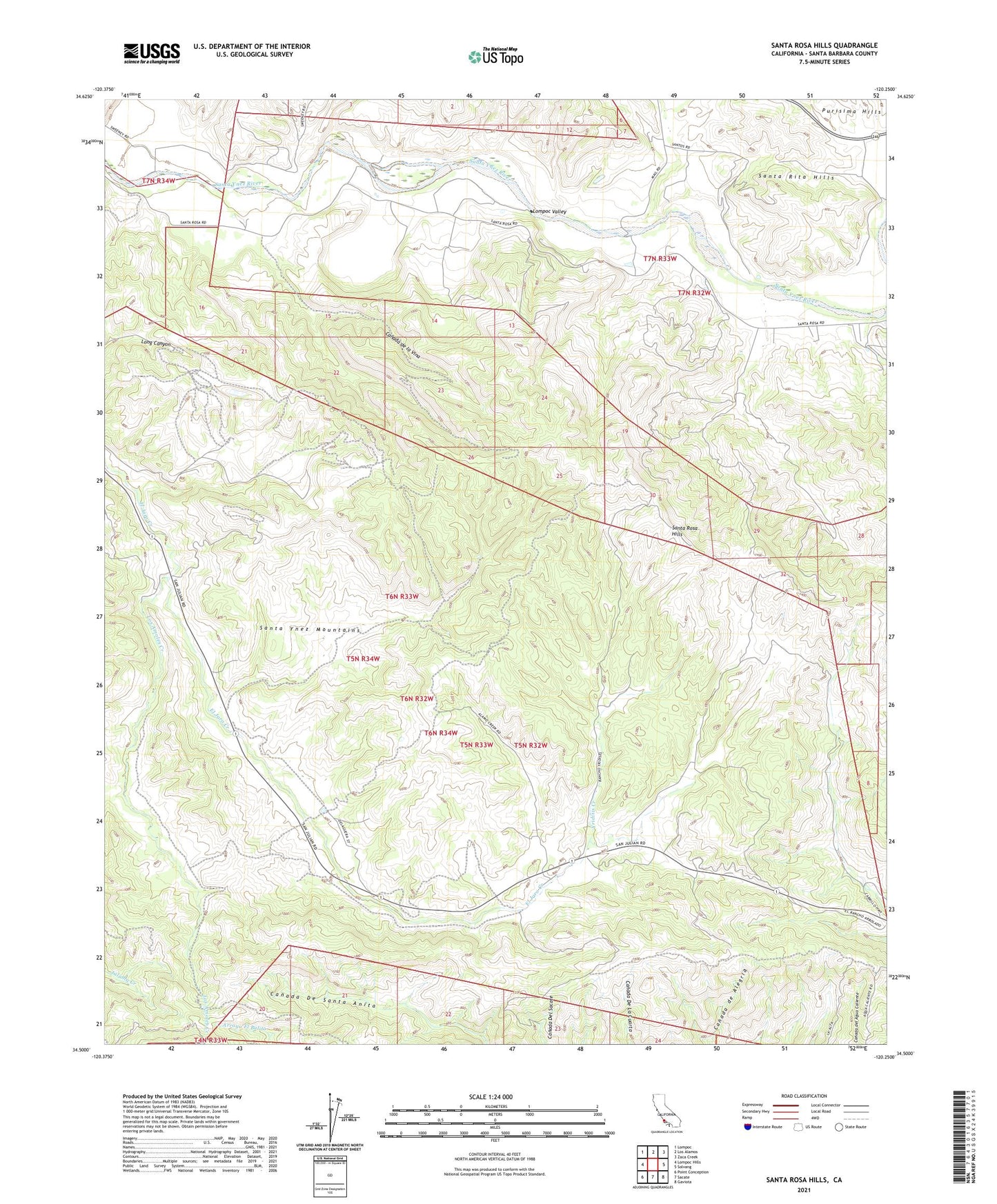
2021 topographic map quadrangle Santa Rosa Hills in the state of California. Scale: 1:24000. Based on the newly updated USGS 7.5' US Topo map series, this map is in the following counties: Santa Barbara. The map contains contour data, water features, and other items you are used to seeing on USGS maps, but also has updated roads and other features. This is the next generation of topographic maps. Printed on high-quality waterproof paper with UV fade-resistant inks.
Quads adjacent to this one:
West: Lompoc Hills
Northwest: Lompoc
North: Los Alamos
Northeast: Zaca Creek
East: Solvang
Southeast: Gaviota
South: Sacate
Southwest: Point Conception
This map covers the same area as the classic USGS quad with code o34120e3.
Contains the following named places: Alamo Creek, Atascoso Creek, Canada de la Vina, El Callejon Creek, Gaviotito Creek, Llanito Creek, Lompoc Valley, Los Amoles Creek, Palos Colorados Creek, Rancho de los Llanitos, Rancho San Julian, Rincanada Church, Rinconada School, San Julian, San Julian School, Sanford Winery and Vineyards, Santa Rosa, Santa Rosa Creek, Santa Rosa Hills, Santa Rosa Park, Yridisis Creek, Ytias Creek, ZIP Code: 93436