MyTopo
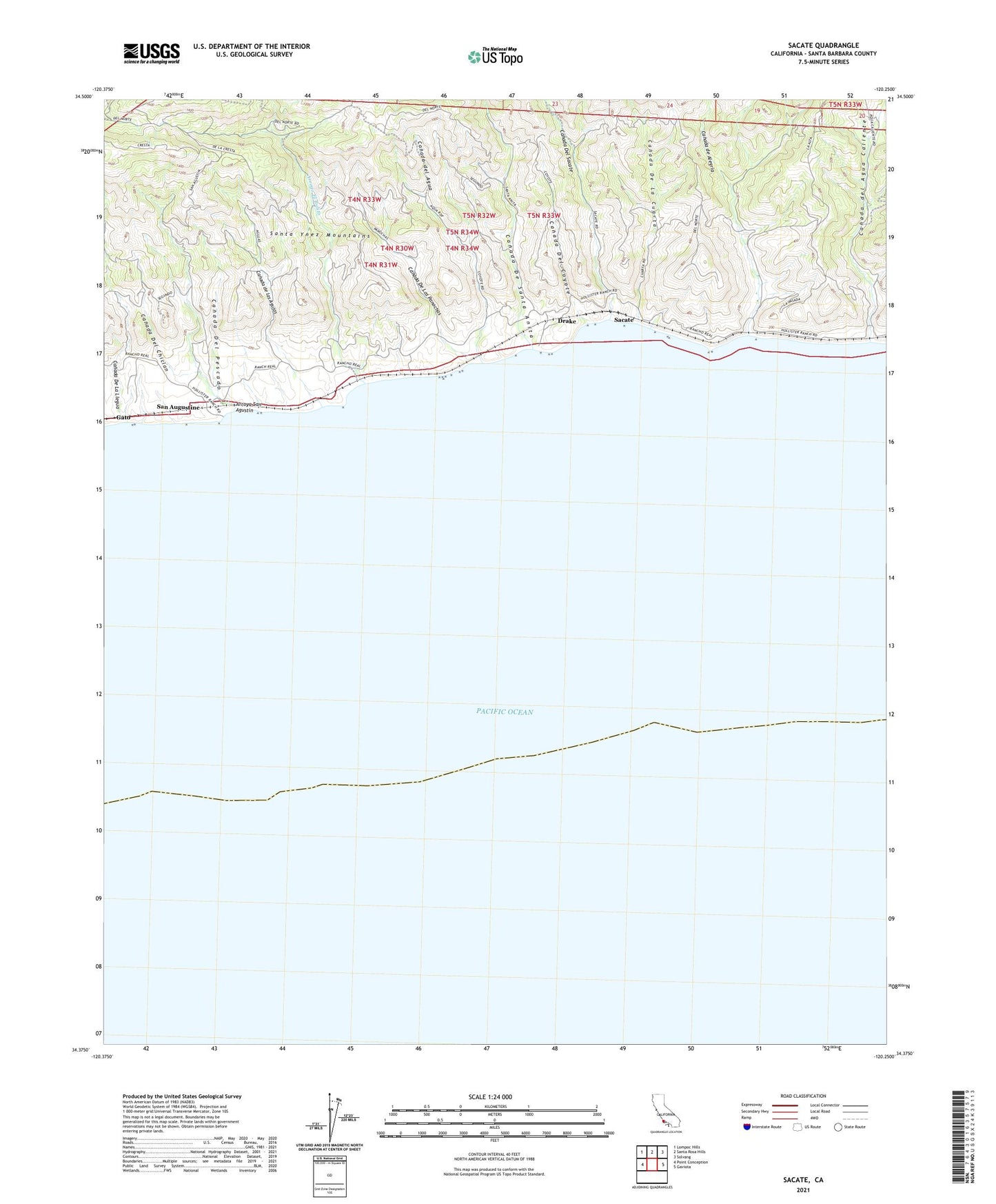
Sacate California US Topo Map
Couldn't load pickup availability
2021 topographic map quadrangle Sacate in the state of California. Scale: 1:24000. Based on the newly updated USGS 7.5' US Topo map series, this map is in the following counties: Santa Barbara. The map contains contour data, water features, and other items you are used to seeing on USGS maps, but also has updated roads and other features. This is the next generation of topographic maps. Printed on high-quality waterproof paper with UV fade-resistant inks.
Quads adjacent to this one:
West: Point Conception
Northwest: Lompoc Hills
North: Santa Rosa Hills
Northeast: Solvang
East: Gaviota
This map covers the same area as the classic USGS quad with code o34120d3.
Contains the following named places: Arroyo El Bulito, Arroyo San Agustin, Canada de Alegria, Canada De La Cuarta, Canada De La Llegua, Canada de las Agujas, Canada De Las Panochas, Canada De Santa Anita, Canada del Agua, Canada del Agua Caliente, Canada Del Chiclan, Canada Del Coyote, Canada Del Pescado, Canada Del Sacate, Drake, Sacate, San Augustine, Santa Anita Ranch, Sulphur Well