MyTopo
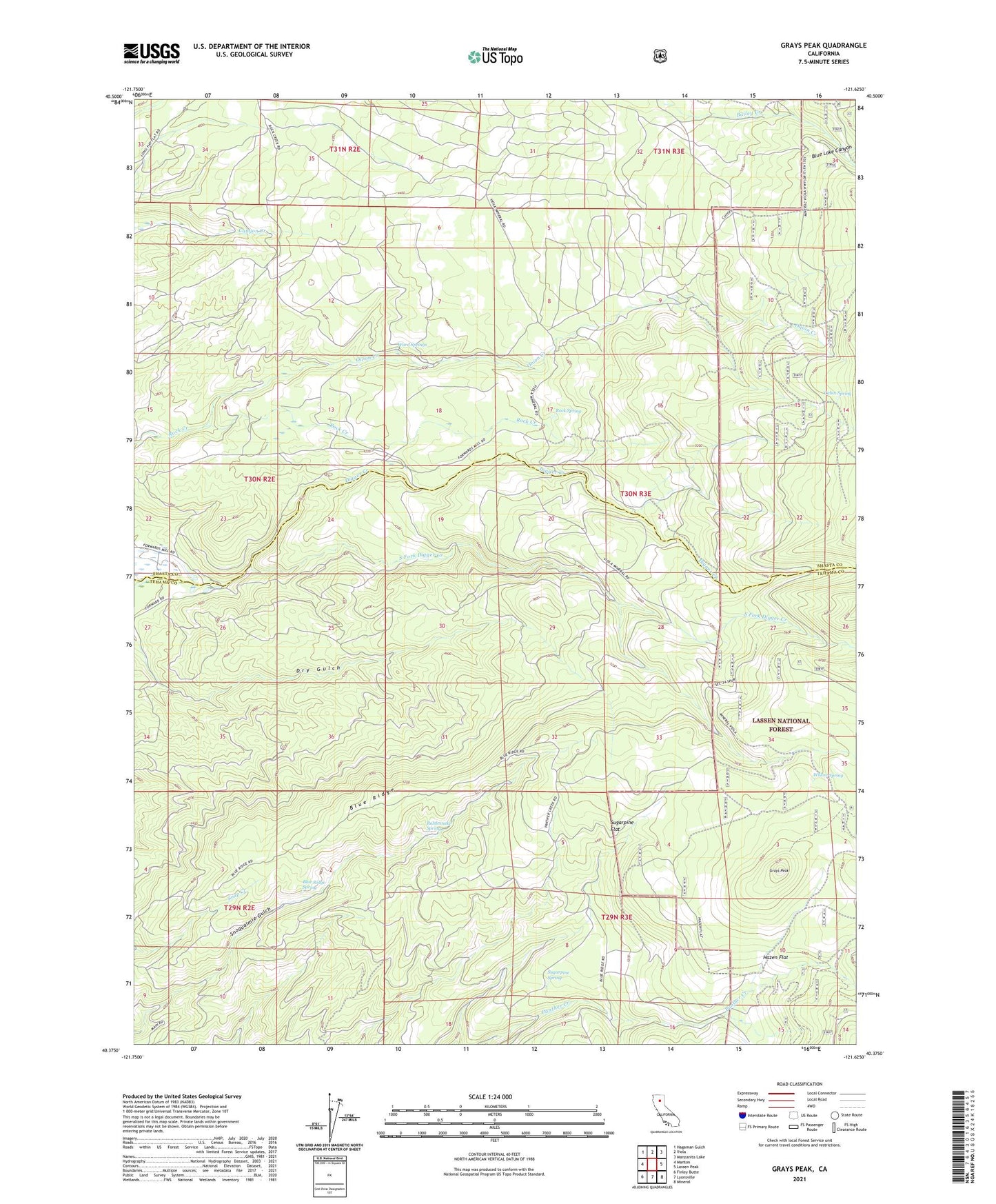
Grays Peak California US Topo Map
Couldn't load pickup availability
Also explore the Grays Peak Forest Service Topo of this same quad for updated USFS data
2021 topographic map quadrangle Grays Peak in the state of California. Scale: 1:24000. Based on the newly updated USGS 7.5' US Topo map series, this map is in the following counties: Tehama, Shasta. The map contains contour data, water features, and other items you are used to seeing on USGS maps, but also has updated roads and other features. This is the next generation of topographic maps. Printed on high-quality waterproof paper with UV fade-resistant inks.
Quads adjacent to this one:
West: Manton
Northwest: Hagaman Gulch
North: Viola
Northeast: Manzanita Lake
East: Lassen Peak
Southeast: Mineral
South: Lyonsville
Southwest: Finley Butte
This map covers the same area as the classic USGS quad with code o40121d6.
Contains the following named places: Blue Lake Canyon, Blue Ridge, Blue Ridge Spring, Cabin Spring, Camp Forward, Eagle Lake Ranger Station, Forward Mill, Fuller Ranger Station, Grays Peak, Hazen Flat, Lassen National Forest Supervisor Office, North Fork Bailey Creek, Onion Creek, Rattlesnake Spring, Rock Spring, Rockland School, South Fork Bailey Creek, South Fork Blue Creek, South Fork Digger Creek, Sugarpine Flat, Sugarpine Spring, Ward Springs, Willow Spring