MyTopo
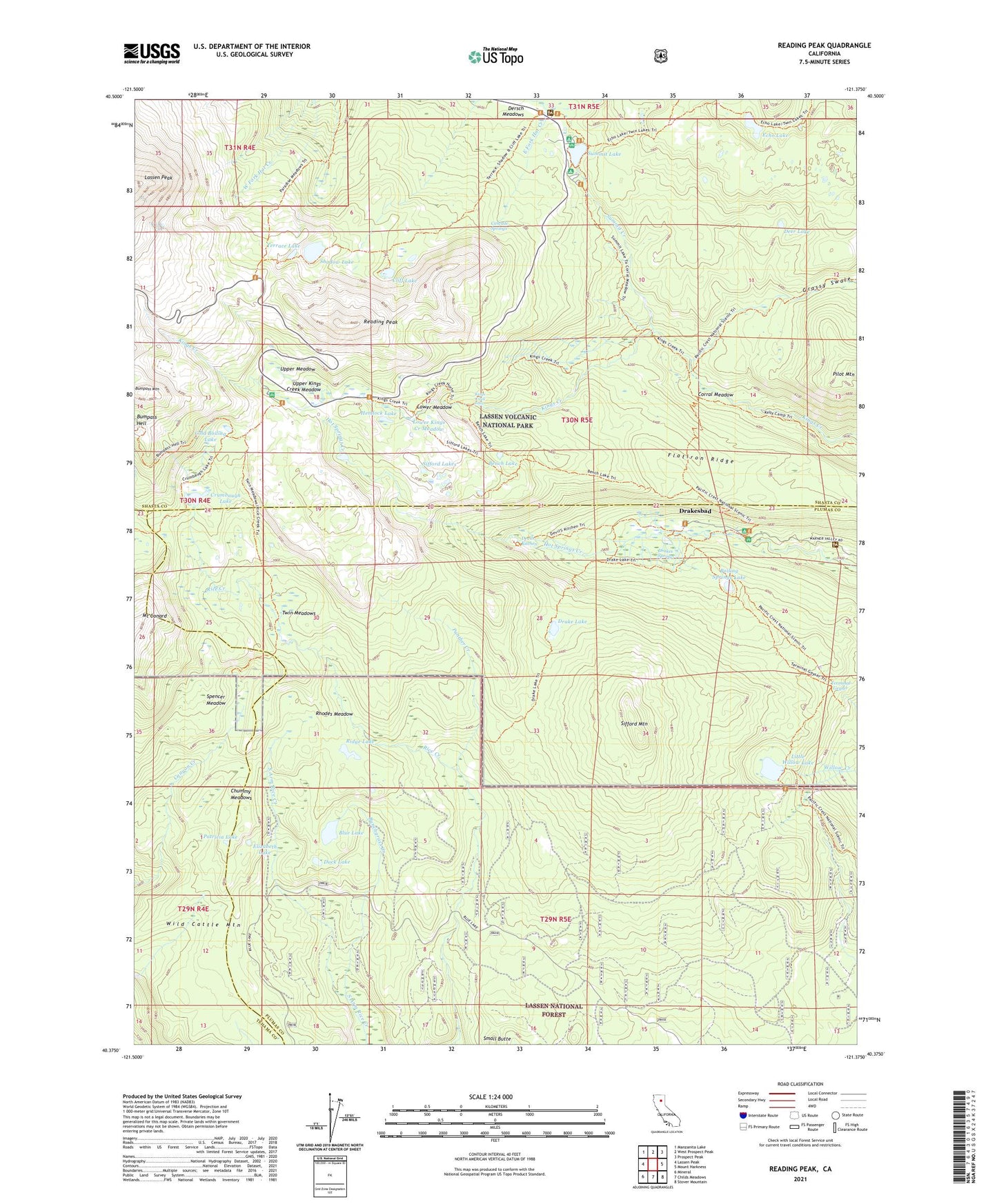
Reading Peak California US Topo Map
Couldn't load pickup availability
Also explore the Reading Peak Forest Service Topo of this same quad for updated USFS data
2021 topographic map quadrangle Reading Peak in the state of California. Scale: 1:24000. Based on the newly updated USGS 7.5' US Topo map series, this map is in the following counties: Plumas, Shasta, Tehama. The map contains contour data, water features, and other items you are used to seeing on USGS maps, but also has updated roads and other features. This is the next generation of topographic maps. Printed on high-quality waterproof paper with UV fade-resistant inks.
Quads adjacent to this one:
West: Lassen Peak
Northwest: Manzanita Lake
North: West Prospect Peak
Northeast: Prospect Peak
East: Mount Harkness
Southeast: Stover Mountain
South: Childs Meadows
Southwest: Mineral
This map covers the same area as the classic USGS quad with code o40121d4.
Contains the following named places: Bench Lake, Boiling Springs Lake, Bumpass Mountain, Bunchgrass Creek, Cascade Springs, Childs Meadows Trail, Chummy Meadows, Cliff Lake, Cold Boiling Lake, Conard Lake, Corral Meadow, Crumbaugh Lake, Deer Lake, Devils Kitchen, Drake Lake, Drakes Springs, Drakesbad, Dream Lake, Duck Lake, Echo Lake, Elizabeth Lake, Flatiron Ridge, Grassy Swale, Growler Trail, Hanna Trail, Hemlock Lake, Kings Creek Campground, Kings Creek Falls, Lassen Volcanic National Park, Lassen Volcanic Wilderness, Little Willow Lake, Lower Kings Creek Meadow, Lower Meadow, Panther Creek, Patricia Lake, Reading Peak, Rhodes Meadow, Ridge Lake, Shadow Lake, Sifford Lakes, Sifford Mountain, Small Butte, Spencer Meadow, Spencer Meadow Trail, Summit Creek, Summit Lake, Summit Lake Recreation Site, Terminal Geyser, Terrace Lake, Twin Meadows, Upper Kings Creek Meadow, Upper Meadow, Warner Valley Campground, Wild Cattle Mountain