MyTopo
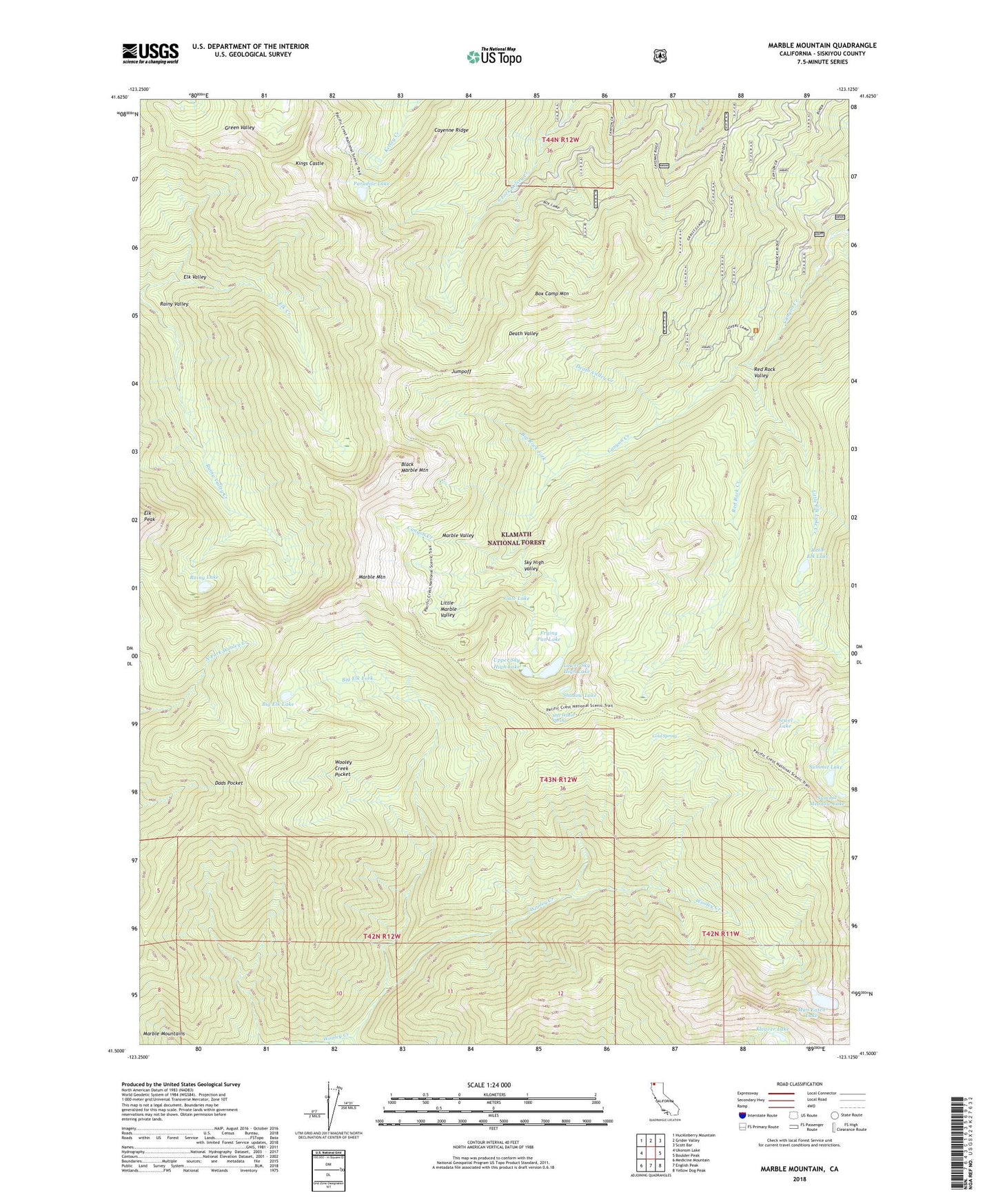
Marble Mountain California US Topo Map
Couldn't load pickup availability
Also explore the Marble Mountain Forest Service Topo of this same quad for updated USFS data
2022 topographic map quadrangle Marble Mountain in the state of California. Scale: 1:24000. Based on the newly updated USGS 7.5' US Topo map series, this map is in the following counties: Siskiyou. The map contains contour data, water features, and other items you are used to seeing on USGS maps, but also has updated roads and other features. This is the next generation of topographic maps. Printed on high-quality waterproof paper with UV fade-resistant inks.
Quads adjacent to this one:
West: Ukonom Lake
Northwest: Huckleberry Mountain
North: Grider Valley
Northeast: Scott Bar
East: Boulder Peak
Southeast: Yellow Dog Peak
South: English Peak
Southwest: Medicine Mountain
This map covers the same area as the classic USGS quad with code o41123e2.
Contains the following named places: Ananias Camp, Anthony Milne Camp, Big Elk Fork, Big Elk Lake, Big Rock Camp, Big Rock Fork, Black Marble Mountain, Box Camp, Box Camp Mountain, Cayenne Ridge, Cold Spring, Dads Pocket, Death Valley, Death Valley Creek, Deep Lake Creek, Elk Valley, Frying Pan Lake, Gate Lake, Gem Lake, Grindstone Camp, Jewel Lake, Jumpoff, Kings Castle, Kleaver Lake, Little Elk Lake, Little Elk Lake Creek, Little Marble Valley, Lovers Camp, Lower Sky High Lake, Man Eaten Lake, Marble Mountain, Marble Valley, Marble Valley Guard Station, Millers Cabin, Paradise Lake, Rainy Lake, Rainy Valley Creek, Red Rock Creek, Red Rock Valley, Shadow Lake, Sky High Lakes, Sky High Valley, Soft Water Spring, South Fork Wooley Creek, Summit Lake, Summit Meadow Lake, Upper Sky High Lake, Whisky Camp, Wooley Creek Pocket