MyTopo
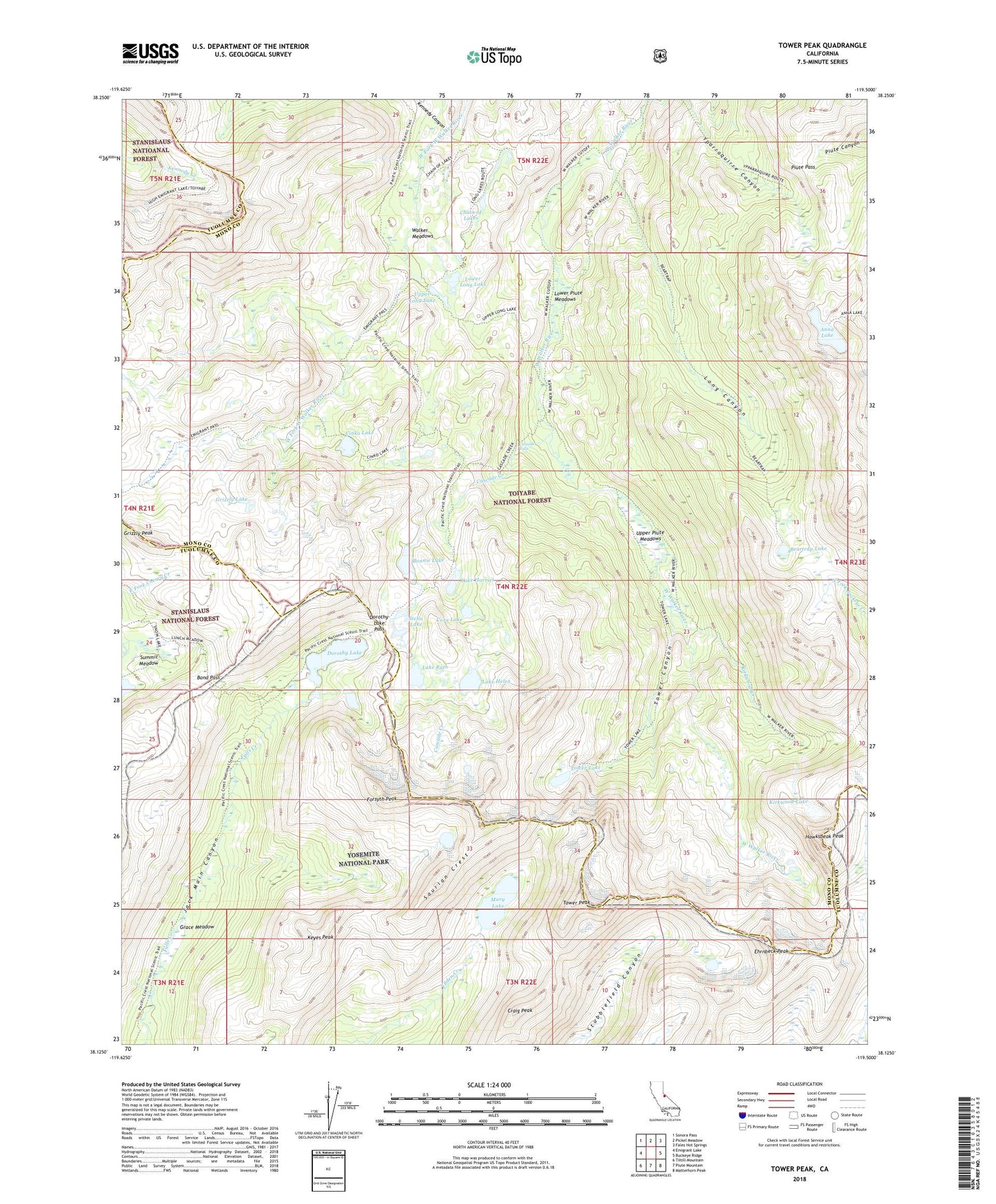
Tower Peak California US Topo Map
Couldn't load pickup availability
Also explore the Tower Peak Forest Service Topo of this same quad for updated USFS data
2022 topographic map quadrangle Tower Peak in the state of California. Scale: 1:24000. Based on the newly updated USGS 7.5' US Topo map series, this map is in the following counties: Mono, Tuolumne. The map contains contour data, water features, and other items you are used to seeing on USGS maps, but also has updated roads and other features. This is the next generation of topographic maps. Printed on high-quality waterproof paper with UV fade-resistant inks.
Quads adjacent to this one:
West: Emigrant Lake
Northwest: Sonora Pass
North: Pickel Meadow
Northeast: Fales Hot Springs
East: Buckeye Ridge
Southeast: Matterhorn Peak
South: Piute Mountain
Southwest: Tiltill Mountain
This map covers the same area as the classic USGS quad with code o38119b5.
Contains the following named places: Anna Lake, Beartrap Lake, Bond Pass, Bonnie Lake, Cascade Creek, Cascade Falls, Chain of Lakes, Cinko Lake, Cora Lake, Craig Peak, Dorothy Lake, Dorothy Lake Pass, Ehrnbeck Peak, Forsyth Peak, Grace Meadow, Grizzly Lake, Grizzly Peak, Hawksbeak Peak, Kennedy Canyon, Keyes Peak, Kirkwood Creek, Kirkwood Lake, Lake Harriet, Lake Helen, Lake Ruth, Long Canyon, Lower Long Lake, Lower Piute Meadows, Mary Lake, Montezuma Mine, Piute Cabin, Piute Pass, Saurian Crest, Stella Lake, Summit Meadow, Tower Canyon, Tower Lake, Tower Peak, Upper Long Lake, Upper Piute Meadows, Walker Meadows