MyTopo
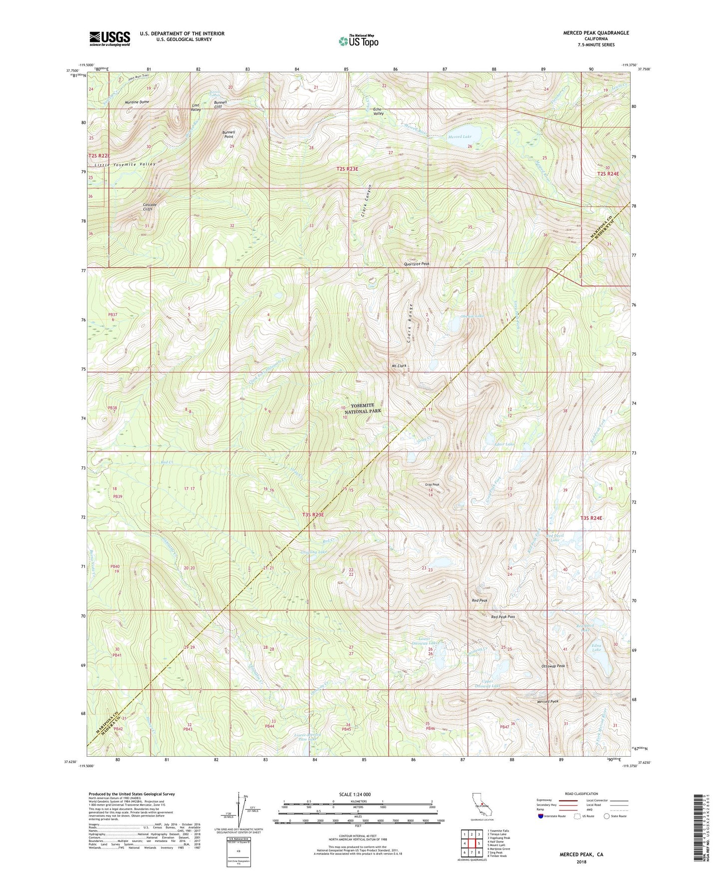
Merced Peak California US Topo Map
Couldn't load pickup availability
2021 topographic map quadrangle Merced Peak in the state of California. Scale: 1:24000. Based on the newly updated USGS 7.5' US Topo map series, this map is in the following counties: Mariposa, Madera. The map contains contour data, water features, and other items you are used to seeing on USGS maps, but also has updated roads and other features. This is the next generation of topographic maps. Printed on high-quality waterproof paper with UV fade-resistant inks.
Quads adjacent to this one:
West: Half Dome
Northwest: Yosemite Falls
North: Tenaya Lake
Northeast: Vogelsang Peak
East: Mount Lyell
Southeast: Timber Knob
South: Sing Peak
Southwest: Mariposa Grove
This map covers the same area as the classic USGS quad with code o37119f4.
Contains the following named places: Adair Lake, Bunnell Cascade, Bunnell Cliff, Bunnell Point, Cascade Cliffs, Clark Canyon, Clark Range, Echo Creek, Echo Valley, Edna Lake, Fletcher Creek, Gray Creek, Gray Peak, Gray Peak Fork, Grayling Lake, Lewis Creek, Lost Valley, Lower Merced Pass Lake, Lower Ottoway Lake, Merced Lake, Merced Lake High Sierra Camp, Merced Lake Ranger Station, Merced Peak, Moraine Dome, Mount Clark, Obelisk Lake, Ottoway Creek, Ottoway Lakes, Ottoway Peak, Quartzite Peak, Red Devil Lake, Red Peak, Red Peak Pass, Upper Ottoway Lake