MyTopo
Half Dome California US Topo Map
Couldn't load pickup availability
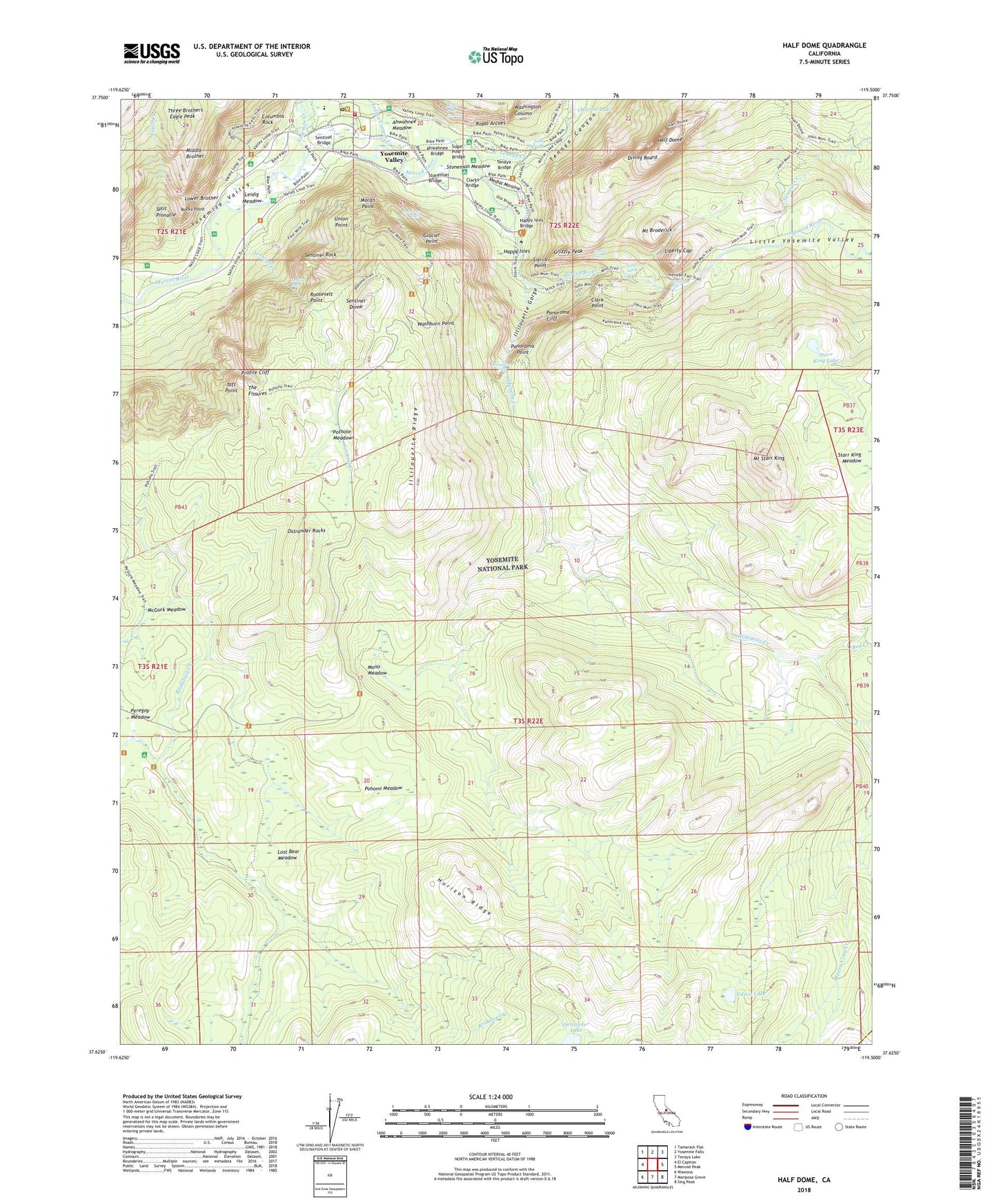
2021 topographic map quadrangle Half Dome in the state of California. Scale: 1:24000. Based on the newly updated USGS 7.5' US Topo map series, this map is in the following counties: Mariposa, Madera. The map contains contour data, water features, and other items you are used to seeing on USGS maps, but also has updated roads and other features. This is the next generation of topographic maps. Printed on high-quality waterproof paper with UV fade-resistant inks.
Quads adjacent to this one:
West: El Capitan
Northwest: Tamarack Flat
North: Yosemite Falls
Northeast: Tenaya Lake
East: Merced Peak
Southeast: Sing Peak
South: Mariposa Grove
Southwest: Wawona
This map covers the same area as the classic USGS quad with code o37119f5.
Contains the following named places: Ahwahnee Bridge, Ahwahnee Meadow, Bridalveil Campground, Buena Vista Creek, Buena Vista Trail, Camp Curry Historic District, Camp Curry Post Office, Cathedral Beach Picnic Area, Clark Fork, Clark Fork Illilouette Creek, Clark Point, Clarks Bridge, Columbia Rock, Curry Village, Curry Village Post Office, Delaware North Company Fire Department Yosemite, Diving Board, Eagle Creek, Eagle Peak, Edson Lake, Emerald Pool, Four Mile Trail, Glacier Point, Grizzly Peak, Group Camp, Half Dome, Happy Isles, Happy Isles Bridge, Hoover Creek, Horizon Ridge, Housekeeping Camp, Illilouette Creek, Illilouette Falls, Illilouette Gorge, Illilouette Ridge, Indian Canyon Creek, Iron Spring, Leconte Memorial Lodge, Leidig Meadow, Liberty Cap, Little Yosemite Valley, Lost Bear Meadow, Lost Lake, Lower Brother, Lower Pines Campground, Lower River Campground, Medial Moraine, Middle Brother, Mirror Lake, Mist Trail, Mono Meadow, Mono Meadow Trail, Moran Point, Mount Broderick, Mount Starr King, Nevada Fall, North Pines Campground, Ostrander Rocks, Panorama Cliff, Panorama Point, Panorama Trail, Peregoy Meadow, Pohono Meadow, Pothole Meadows, Profile Cliff, Rangers' Club, Red Creek, Rocky Point, Roosevelt Point, Royal Arch Cascade, Royal Arch Creek, Royal Arches, Sentinel Beach Picnic Area, Sentinel Bridge, Sentinel Creek, Sentinel Dome, Sentinel Fall, Sentinel Rock, Sierra Point, Silver Apron, Split Pinnacle, Staircase Falls, Starr King Lake, Starr King Meadow, Stoneman Bridge, Stoneman Meadow, Sugar Pine Bridge, Sunnyside Campground, Sunrise Creek, Taft Point, Tenaya Bridge, Tenaya Canyon, Tenaya Creek, The Ahwahnee, The Fissures, Three Brothers, Union Point, Upper Pines Campground, Upper River Campground, Vernal Fall, Washburn Point, Washington Column, Yosemite Creek, Yosemite Lodge, Yosemite Lodge Post Office, Yosemite National Park Post Office, Yosemite National Park Valley Elementary School, Yosemite Pioneer Cemetery, Yosemite Valley Census Designated Place, Yosemite Valley Division, Yosemite Village