MyTopo
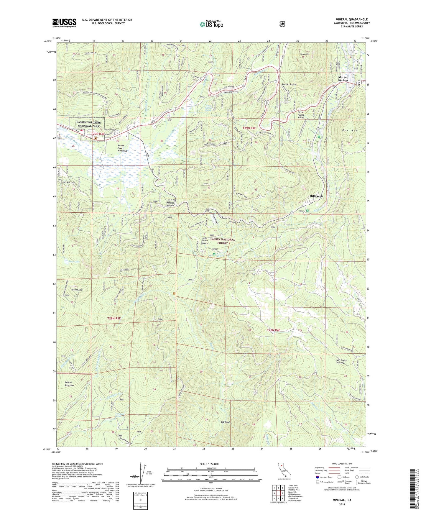
Mineral California US Topo Map
Couldn't load pickup availability
Also explore the Mineral Forest Service Topo of this same quad for updated USFS data
2022 topographic map quadrangle Mineral in the state of California. Scale: 1:24000. Based on the newly updated USGS 7.5' US Topo map series, this map is in the following counties: Tehama. The map contains contour data, water features, and other items you are used to seeing on USGS maps, but also has updated roads and other features. This is the next generation of topographic maps. Printed on high-quality waterproof paper with UV fade-resistant inks.
Quads adjacent to this one:
West: Lyonsville
Northwest: Grays Peak
North: Lassen Peak
Northeast: Reading Peak
East: Childs Meadows
Southeast: Humboldt Peak
South: Onion Butte
Southwest: Barkley Mountain
This map covers the same area as the classic USGS quad with code o40121c5.
Contains the following named places: Battle Creek Meadows, Bear Wallow Campground, Belfast Meadows, Big Bend, Big Bend Camp, Black Oak Campground, Brokenshire Picnic Area, Camp Tehama, Doe Mountain, Hole in the Ground, Hole in the Ground Campground, Jones Valley, Lassen Volcanic National Park Fire Management, Lassen Volcanic National Park Headquarters, Little Round Valley, Martin Creek, Mill Creek, Mill Creek Campground, Mill Creek Plateau, Mineral, Mineral Elementary School, Mineral Post Office, Mineral Ranger Station, Mineral Summit, Mineral Work Center, Morgan Mountain, Morgan Springs, Morgan Summit, Nanny Creek, Pear Lake, Rock Gulch Creek, Ski Hill, Summit Creek, Tamarack Spring, Tehama County Fire Department Station 20 Mineral, Turner Mountain, Turner Mountain Lookout, White Sulphur Spring, ZIP Code: 96063