MyTopo
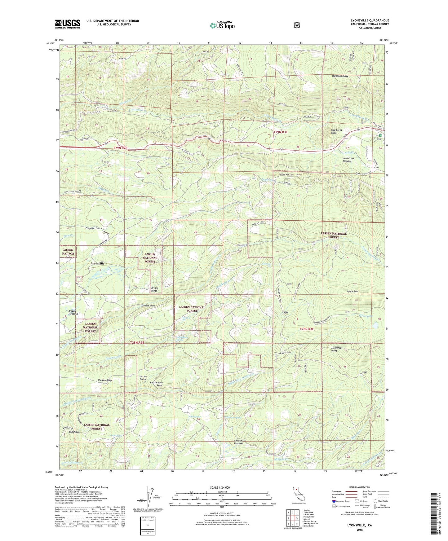
Lyonsville California US Topo Map
Couldn't load pickup availability
Also explore the Lyonsville Forest Service Topo of this same quad for updated USFS data
2022 topographic map quadrangle Lyonsville in the state of California. Scale: 1:24000. Based on the newly updated USGS 7.5' US Topo map series, this map is in the following counties: Tehama. The map contains contour data, water features, and other items you are used to seeing on USGS maps, but also has updated roads and other features. This is the next generation of topographic maps. Printed on high-quality waterproof paper with UV fade-resistant inks.
Quads adjacent to this one:
West: Finley Butte
Northwest: Manton
North: Grays Peak
Northeast: Lassen Peak
East: Mineral
Southeast: Onion Butte
South: Barkley Mountain
Southwest: Panther Spring
This map covers the same area as the classic USGS quad with code o40121c6.
Contains the following named places: Balls Camp, Battle Creek Rod and Gun Club, Belle Mill Cemetery, Boots Bend, Brazell Meadows, Bryant Ridge, Camp Five, Cline Ranch, Cold Creek, Cold Creek Butte, Cold Creek Meadows, Deadhorse Falls, Diamond Lake, Doty Spring, Dotys Camp, Glines Ranch, Hampton Butte, Howard Meadows, Howard Spring, Jackass Gulch, Lassen Lodge, Lyons Peak, Lyonsville, Maidenhair Spring, Monterey Point, Panther Creek, Rattlesnake Point, Shelton Camp, Shelton Ridge, Tent Camp, Turner Lake, Turner Mountain Trail, Wible Spring