MyTopo
Monarch Peak California US Topo Map
Couldn't load pickup availability
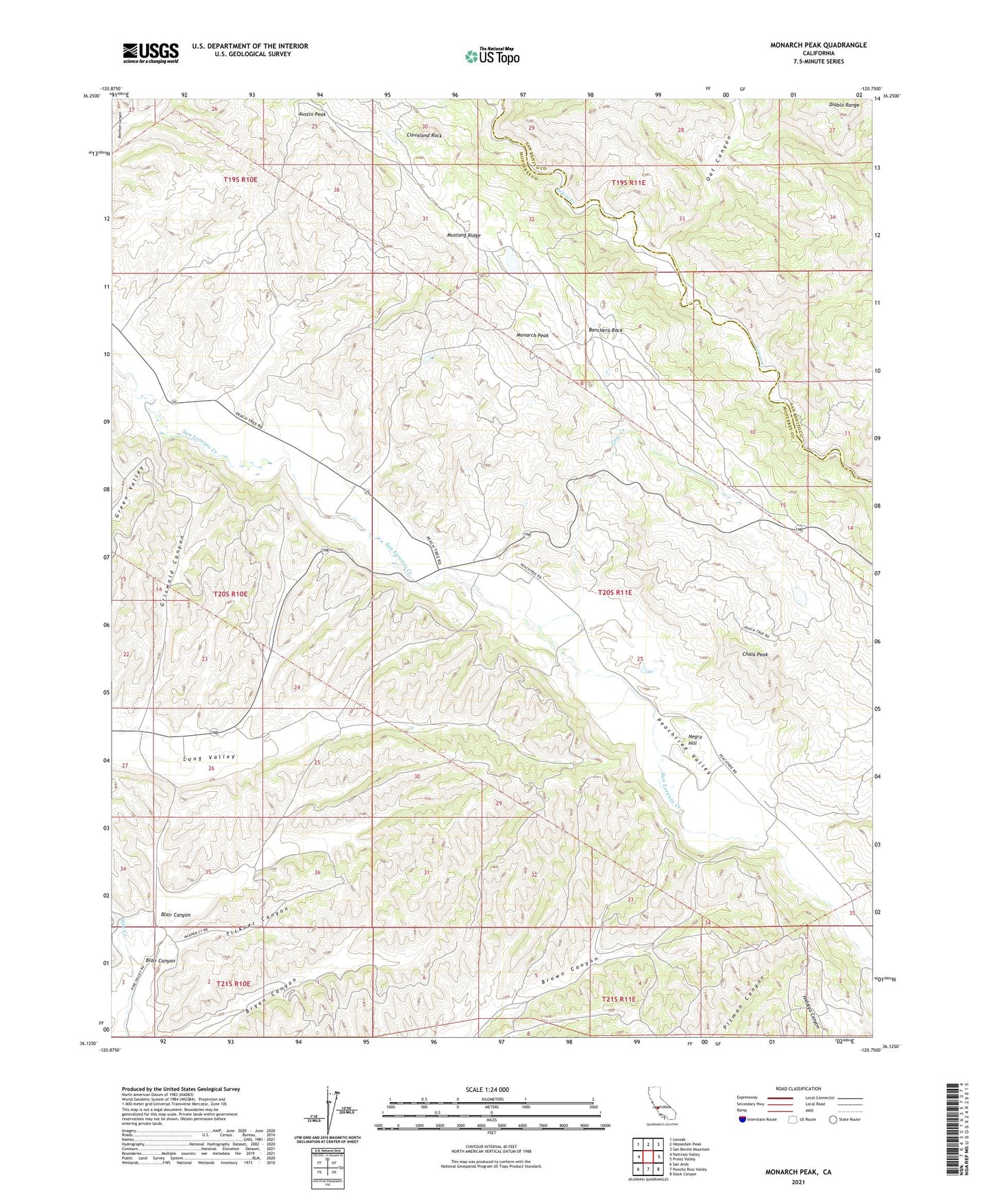
2021 topographic map quadrangle Monarch Peak in the state of California. Scale: 1:24000. Based on the newly updated USGS 7.5' US Topo map series, this map is in the following counties: Monterey, San Benito. The map contains contour data, water features, and other items you are used to seeing on USGS maps, but also has updated roads and other features. This is the next generation of topographic maps. Printed on high-quality waterproof paper with UV fade-resistant inks.
Quads adjacent to this one:
West: Nattrass Valley
Northwest: Lonoak
North: Hepsedam Peak
Northeast: San Benito Mountain
East: Priest Valley
Southeast: Slack Canyon
South: Pancho Rico Valley
Southwest: San Ardo
This map covers the same area as the classic USGS quad with code o36120b7.
Contains the following named places: Austin Peak, Banchero Rock, Blair Canyon, Chalk Peak, Cleveland Rock, Cow Creek, Griswold Canyon, Lewis Creek School, Monarch Peak, Mustang Fire Control Station, Mustang Ridge, Negro Hill, Oat Canyon, San Lorenzo, Tickner Canyon