MyTopo
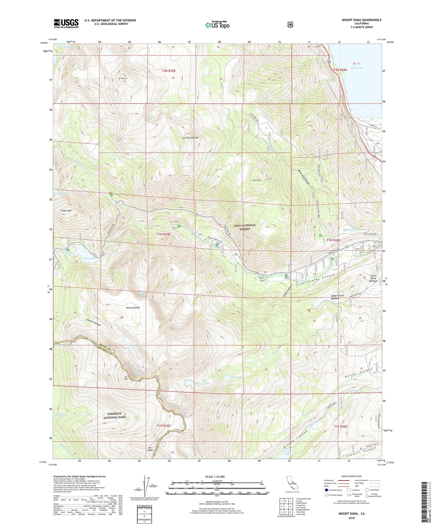
Mount Dana California US Topo Map
Couldn't load pickup availability
Also explore the Mount Dana Forest Service Topo of this same quad for updated USFS data
2021 topographic map quadrangle Mount Dana in the state of California. Scale: 1:24000. Based on the newly updated USGS 7.5' US Topo map series, this map is in the following counties: Mono, Tuolumne. The map contains contour data, water features, and other items you are used to seeing on USGS maps, but also has updated roads and other features. This is the next generation of topographic maps. Printed on high-quality waterproof paper with UV fade-resistant inks.
Quads adjacent to this one:
West: Tioga Pass
Northwest: Dunderberg Peak
North: Lundy
Northeast: Negit Island
East: Lee Vining
Southeast: June Lake
South: Koip Peak
Southwest: Vogelsang Peak
This map covers the same area as the classic USGS quad with code o37119h2.
Contains the following named places: Aspen Campground, Beartrack Canyon, Big Bend Campground, Bloody Canyon, Bohler Canyon, Boulder Campground, Dana Lake, Dana Plateau, Ellery Campground, Ellery Lake, Ellery Lake Campground, Gibbs Canyon, Gibbs Lake, Gibbs Lake Trailhead, Glacier Canyon, Junction Campground, Kidney Lake, Lee Vining Peak, Lee Vining Ranger Station, Log Cabin Mine, Log Cabin Wilderness Boy Scout Camp, Lower Horse Meadow, Mine Creek, Mono Dome, Mono Lake Post Office, Moraine Campground, Mount Dana, Mount Gibbs, Mount Warren, Rhinedollar 104-041 Dam, Tioga Junction Campground, Tioga Pass Resort, Tioga Peak, Upper Horse Meadow, Walker Lake 6-035 Dam, Warren Fork, Warren Fork Campground, Warren Fork Trailhead