MyTopo
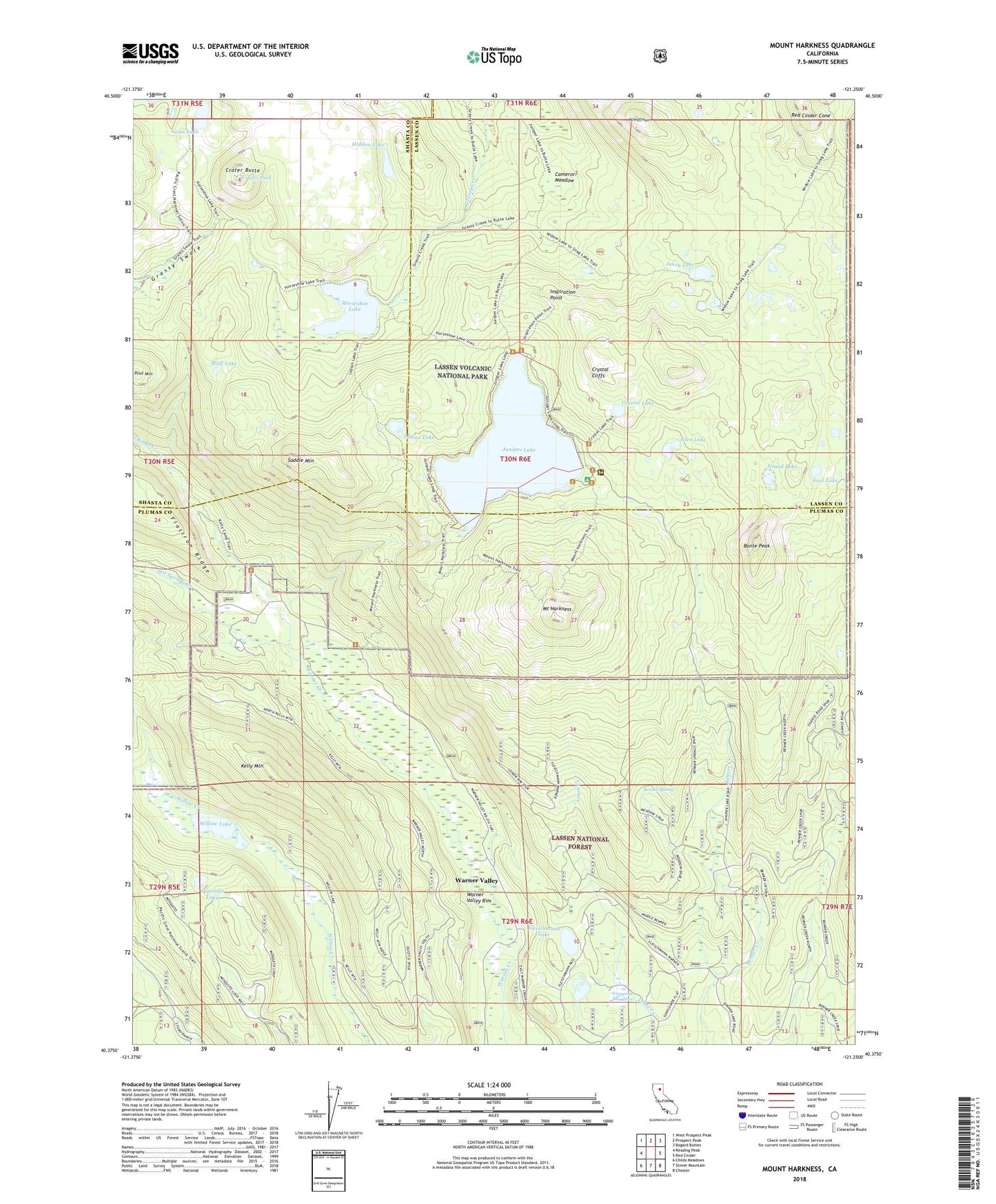
Mount Harkness California US Topo Map
Couldn't load pickup availability
Also explore the Mount Harkness Forest Service Topo of this same quad for updated USFS data
2022 topographic map quadrangle Mount Harkness in the state of California. Scale: 1:24000. Based on the newly updated USGS 7.5' US Topo map series, this map is in the following counties: Plumas, Lassen, Shasta. The map contains contour data, water features, and other items you are used to seeing on USGS maps, but also has updated roads and other features. This is the next generation of topographic maps. Printed on high-quality waterproof paper with UV fade-resistant inks.
Quads adjacent to this one:
West: Reading Peak
Northwest: West Prospect Peak
North: Prospect Peak
Northeast: Bogard Buttes
East: Red Cinder
Southeast: Chester
South: Stover Mountain
Southwest: Childs Meadows
This map covers the same area as the classic USGS quad with code o40121d3.
Contains the following named places: Benner Creek Campground, Benner Spring, Blue Lake, Bluff Lake, Bonte Peak, Cameron Meadow, Cameron Meadows, Crater Butte, Crater Pool, Crystal Cliffs, Crystal Lake, Domingo Lake, East Lake, Fleischmann Boy Scout Camp, Fleischmann Lake, Glen Lake, Hidden Lake, Horseshoe Lake, Hot Springs Creek, Indian Lake, Inspiration Point, Island Lake, Jakey Lake, Juniper Lake, Kelly Camp, Kelly Mountain, Kings Creek, Lee Camp, Mount Harkness, Mount Hoffman, Pilot Mountain, Red Cinder Cone, Saddle Mountain, Swan Lake, Warner Valley Census Designated Place, Warner Valley Rim, Willow Lake, ZIP Code: 96020