MyTopo
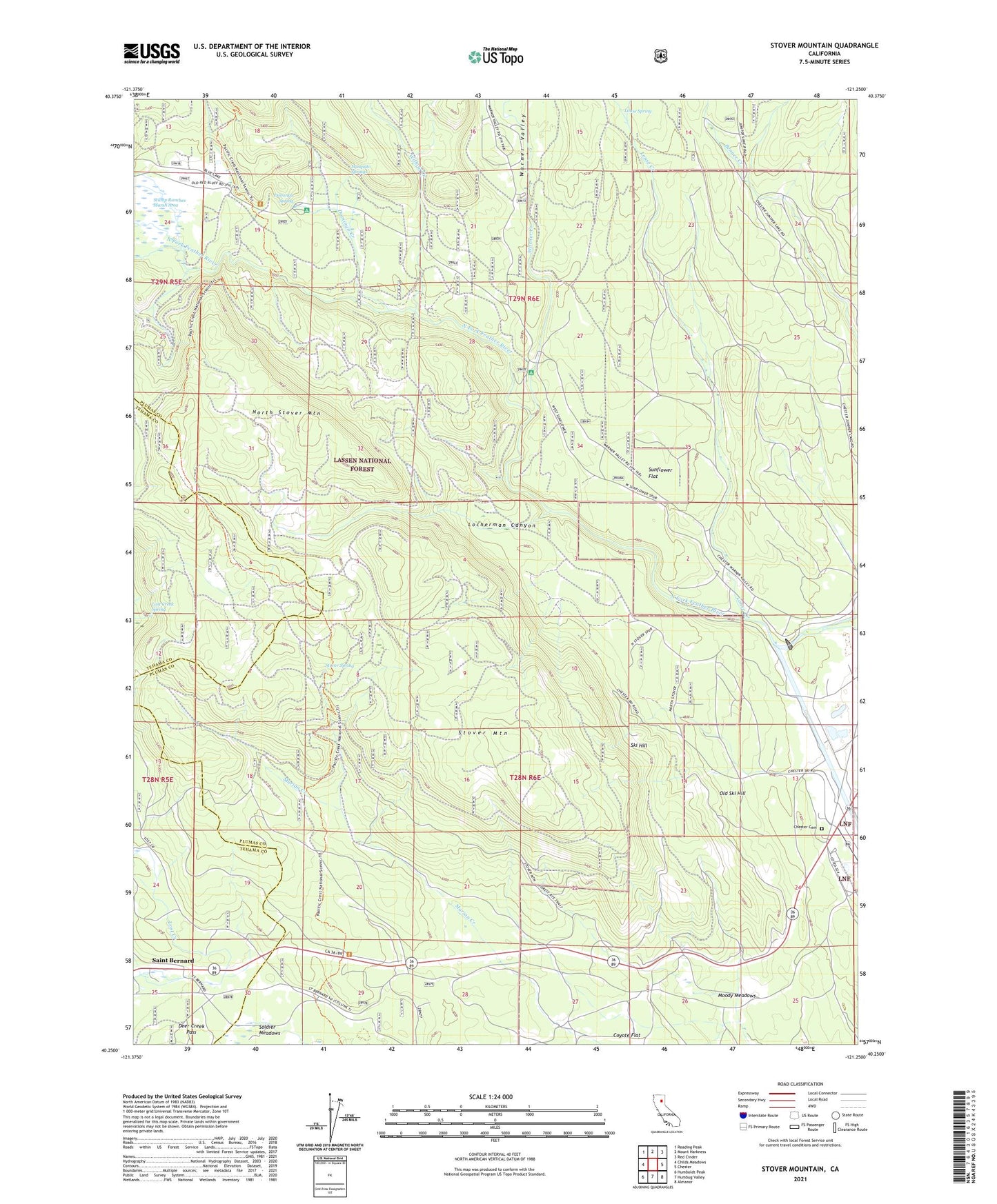
Stover Mountain California US Topo Map
Couldn't load pickup availability
Also explore the Stover Mountain Forest Service Topo of this same quad for updated USFS data
2021 topographic map quadrangle Stover Mountain in the state of California. Scale: 1:24000. Based on the newly updated USGS 7.5' US Topo map series, this map is in the following counties: Plumas, Tehama. The map contains contour data, water features, and other items you are used to seeing on USGS maps, but also has updated roads and other features. This is the next generation of topographic maps. Printed on high-quality waterproof paper with UV fade-resistant inks.
Quads adjacent to this one:
West: Childs Meadows
Northwest: Reading Peak
North: Mount Harkness
Northeast: Red Cinder
East: Chester
Southeast: Almanor
South: Humbug Valley
Southwest: Humboldt Peak
This map covers the same area as the classic USGS quad with code o40121c3.
Contains the following named places: Chester Cemetery, Chester Diversion Dam, Chester Pit, Deer Creek Pass, Domingo Creek, Domingo Spring, Domingo Spring Campground, Feather River, High Bridge, High Bridge Campground, Locherman Canyon, Lost Creek Maintenance Station, Lost Creek Spring, Louse Creek, Louse Spring, Marian Creek, Moody Meadows, Mosquito Springs, North Stover Mountain, Old Ski Hill, Rice Creek Campground, Saint Bernard, Ski Hill, Stover Camp, Stover Mountain, Stover Mountain Ski Area, Stover Spring, Stump Ranches Marsh Area, Sunflower Flat, United States Forest Service Outdoor Classroom, Warner Creek, Warner Creek Campground, Warner Valley, Willow Creek, Willow Creek Homesite