
MyTopo
Mount Morgan California US Topo Map
Couldn't load pickup availability
Also explore the Mount Morgan Forest Service Topo of this same quad for updated USFS data
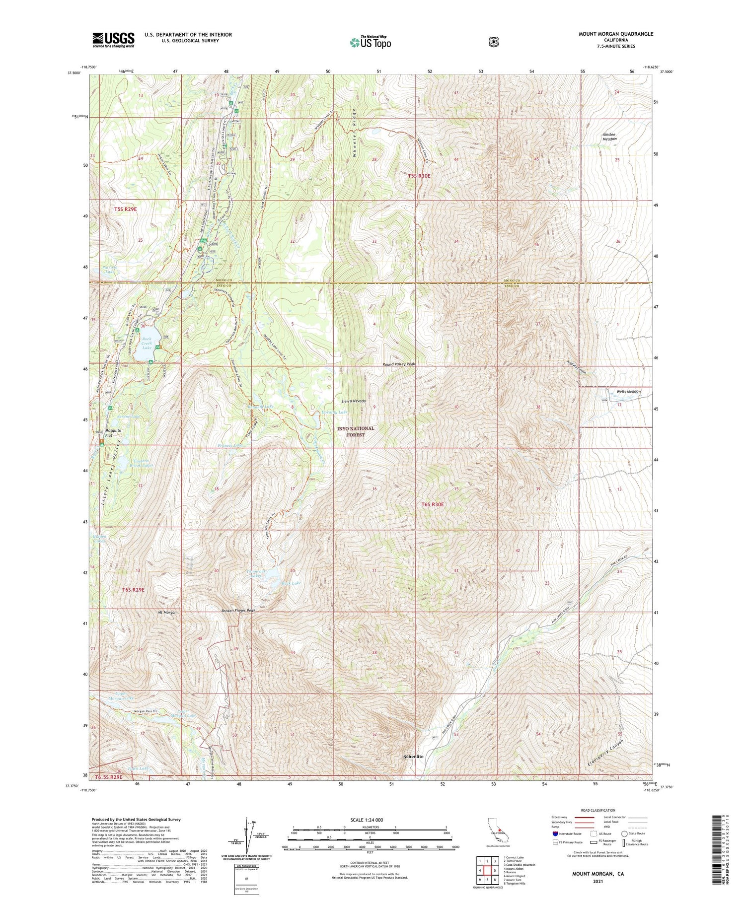
2021 topographic map quadrangle Mount Morgan in the state of California. Scale: 1:24000. Based on the newly updated USGS 7.5' US Topo map series, this map is in the following counties: Inyo, Mono. The map contains contour data, water features, and other items you are used to seeing on USGS maps, but also has updated roads and other features. This is the next generation of topographic maps. Printed on high-quality waterproof paper with UV fade-resistant inks.
Quads adjacent to this one:
West: Mount Abbot
Northwest: Convict Lake
North: Toms Place
Northeast: Casa Diablo Mountain
East: Rovana
Southeast: Tungsten Hills
South: Mount Tom
Southwest: Mount Hilgard
This map covers the same area as the classic USGS quad with code o37118d6.
Contains the following named places: Adamson Mine, Ainslee Meadow, Broken Finger Peak, Buck Lake, Dorothy Lake, East Fork Campground, East Fork Rock Creek, Eastern Brook Lakes, Elderberry Canyon, Finch Lake, Francis Lake, Hidden Lakes, Kenneth Lake, Lake Inlet Campground, Lake Outlet Campground, Little Lakes Valley, Lower Morgan Lake, Mayfield Canyon, Mono Pass Trailhead, Mosquito Flat, Mosquito Flat Campground, Mount Morgan, Palisade Campground, Patricia Lake, Pine Creek Mine, Pine Grove Campground, Rock Creek Boating Site, Rock Creek Lake, Rock Creek Lake Campground, Rock Creek Lake Picnic Site, Rock Creek Lake Resort, Rock Creek Pack Station, Rock Creek Picnic Site, Round Valley Peak, Round Valley Peak Prospect, Scheelite, Serene Lake, Tamarack Lakes, Tamarack Lakes Trailhead, Upper Morgan Lake, Wells Meadow, Wheeler Ridge


