
MyTopo
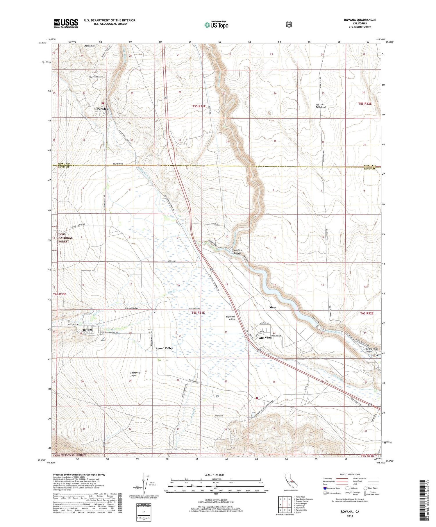
Rovana California US Topo Map
Couldn't load pickup availability
Also explore the Rovana Forest Service Topo of this same quad for updated USFS data
2021 topographic map quadrangle Rovana in the state of California. Scale: 1:24000. Based on the newly updated USGS 7.5' US Topo map series, this map is in the following counties: Inyo, Mono. The map contains contour data, water features, and other items you are used to seeing on USGS maps, but also has updated roads and other features. This is the next generation of topographic maps. Printed on high-quality waterproof paper with UV fade-resistant inks.
Quads adjacent to this one:
West: Mount Morgan
Northwest: Toms Place
North: Casa Diablo Mountain
Northeast: Chidago Canyon
East: Fish Slough
Southeast: Bishop
South: Tungsten Hills
Southwest: Mount Tom
This map covers the same area as the classic USGS quad with code o37118d5.
Contains the following named places: Alta Vista, Birchim Canyon, Department of Forestry and Fire Protection Bishop Station, Horton Creek Campground, Inyo-Mono Ecology Center, Little Shot Mine, Lower Rock Creek, Mesa Census Designated Place, Owens River Gorge, Paradise Camp, Paradise Census Designated Place, Paradise Fire Protection District, Pine Creek, Pleasant Valley 6-045 Dam, Pleasant Valley Campground, Pleasant Valley Reservoir, Rattlesnake Prospect, Round Valley, Round Valley Census Designated Place, Round Valley Elementary School, Round Valley Mine, Round Valley Quarry, Rovana, Sherwin Grade, Vanadium Ranch, Western Mine


