MyTopo
Tungsten Hills California US Topo Map
Couldn't load pickup availability
Also explore the Tungsten Hills Forest Service Topo of this same quad for updated USFS data
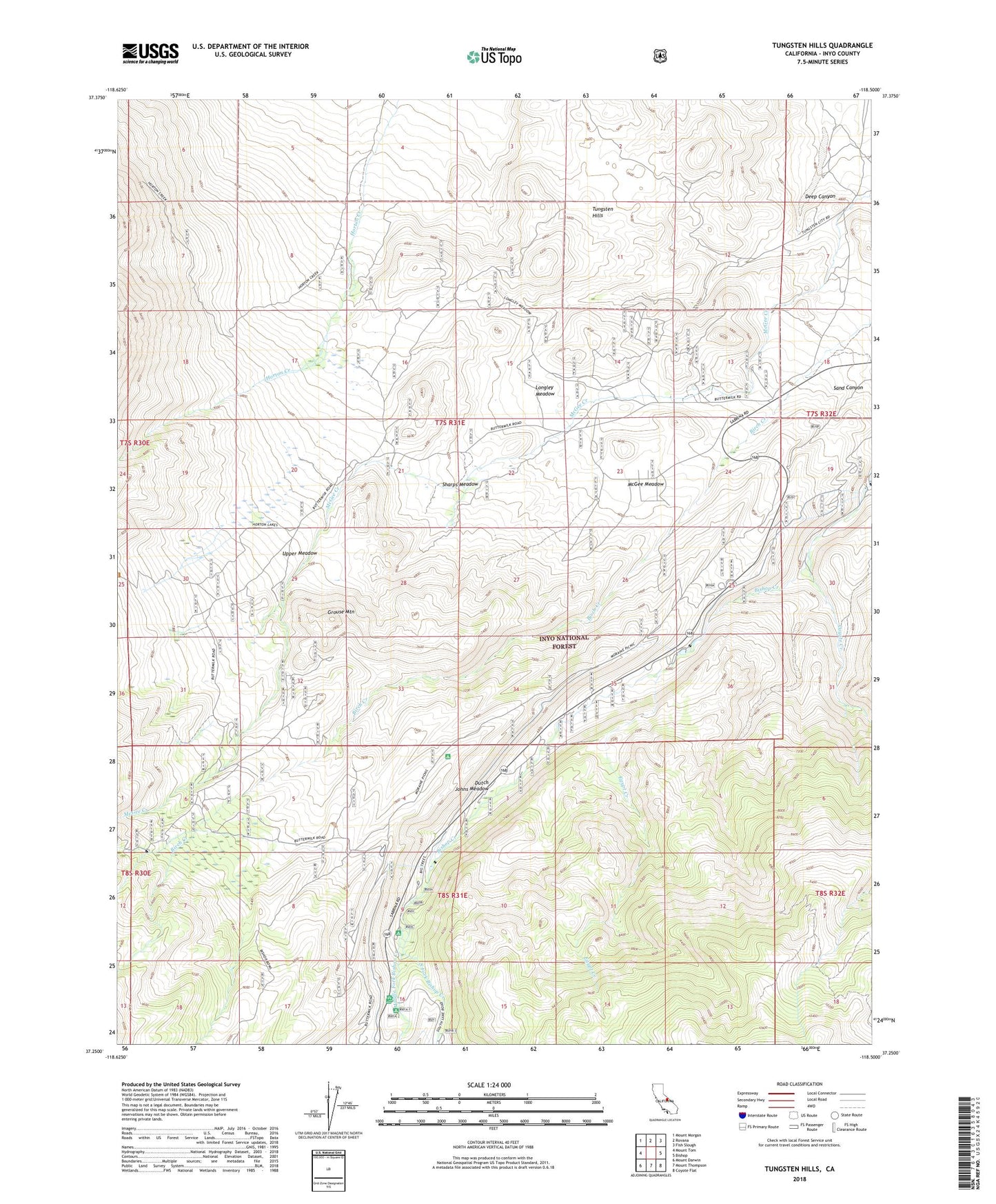
2021 topographic map quadrangle Tungsten Hills in the state of California. Scale: 1:24000. Based on the newly updated USGS 7.5' US Topo map series, this map is in the following counties: Inyo. The map contains contour data, water features, and other items you are used to seeing on USGS maps, but also has updated roads and other features. This is the next generation of topographic maps. Printed on high-quality waterproof paper with UV fade-resistant inks.
Quads adjacent to this one:
West: Mount Tom
Northwest: Mount Morgan
North: Rovana
Northeast: Fish Slough
East: Bishop
Southeast: Coyote Flat
South: Mount Thompson
Southwest: Mount Darwin
This map covers the same area as the classic USGS quad with code o37118c5.
Contains the following named places: Aeroplane Mine, Big Trees Campground, Buttermilk Country, Coyote Creek, Deep Canyon, Dutch Johns Meadow, Egypt Creek, Forks Campground, Grouse Mountain, Hilltop Prospect, Horton Lakes Trailhead, Jackrabbit Mine, Little Egypt Prospect, Little Sister Mine, Longley Meadow, Lucky Strike Mine, McGee Meadow, Middle Fork Bishop Creek, Raindrop Prospect, Sharps Meadow, South Fork Bishop Creek, Starlight Estates, Tungsten Blue Mine, Tungsten Hills, Tungsten Peak Prospect, Upper Meadow, Van Loon Prospect, White Caps Mine