MyTopo
Mount Ritter California US Topo Map
Couldn't load pickup availability
Also explore the Mount Ritter Forest Service Topo of this same quad for updated USFS data
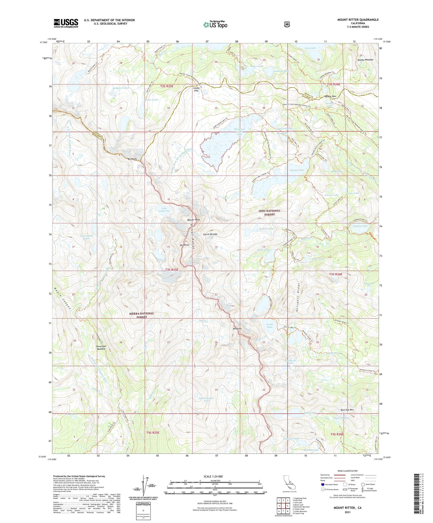
2021 topographic map quadrangle Mount Ritter in the state of California. Scale: 1:24000. Based on the newly updated USGS 7.5' US Topo map series, this map is in the following counties: Madera, Mono. The map contains contour data, water features, and other items you are used to seeing on USGS maps, but also has updated roads and other features. This is the next generation of topographic maps. Printed on high-quality waterproof paper with UV fade-resistant inks.
Quads adjacent to this one:
West: Mount Lyell
Northwest: Vogelsang Peak
North: Koip Peak
Northeast: June Lake
East: Mammoth Mountain
Southeast: Crystal Crag
South: Cattle Mountain
Southwest: Timber Knob
This map covers the same area as the classic USGS quad with code o37119f2.
Contains the following named places: Agnew Pass, Altha Lake, Badger Lakes, Banner Peak, Beck Lakes, Bench Canyon, Cabin Lake, Cecile Lake, Clarice Lake, Clark Lakes, Davis Lakes, Deadhorse Lake, Dike Creek, Ediza Lake, Emerald Lake, Garnet Lake, Hemlock Crossing, Holcomb Lake, Iceberg Lake, Island Pass, Lake Catherine, Laura Lake, Lois Lake, Long Creek, Lost Lake, Marie Lakes, Minaret Lake, Minaret Mine, Minarets, Mount Davis, Mount Ritter, Noname Lake, Nydiver Lakes, Red Top Mountain, Ritter Range, Rodgers Lakes, Ruby Lake, Shadow Lake, Shellenbarger Lake, Slide Creek, Spooky Meadow, Stevenson Meadow, Sullivan Lake, Summit Lake, Superior Lake, Thousand Island Lake, Twin Island Lakes, Volcanic Ridge, Weber Lake