MyTopo
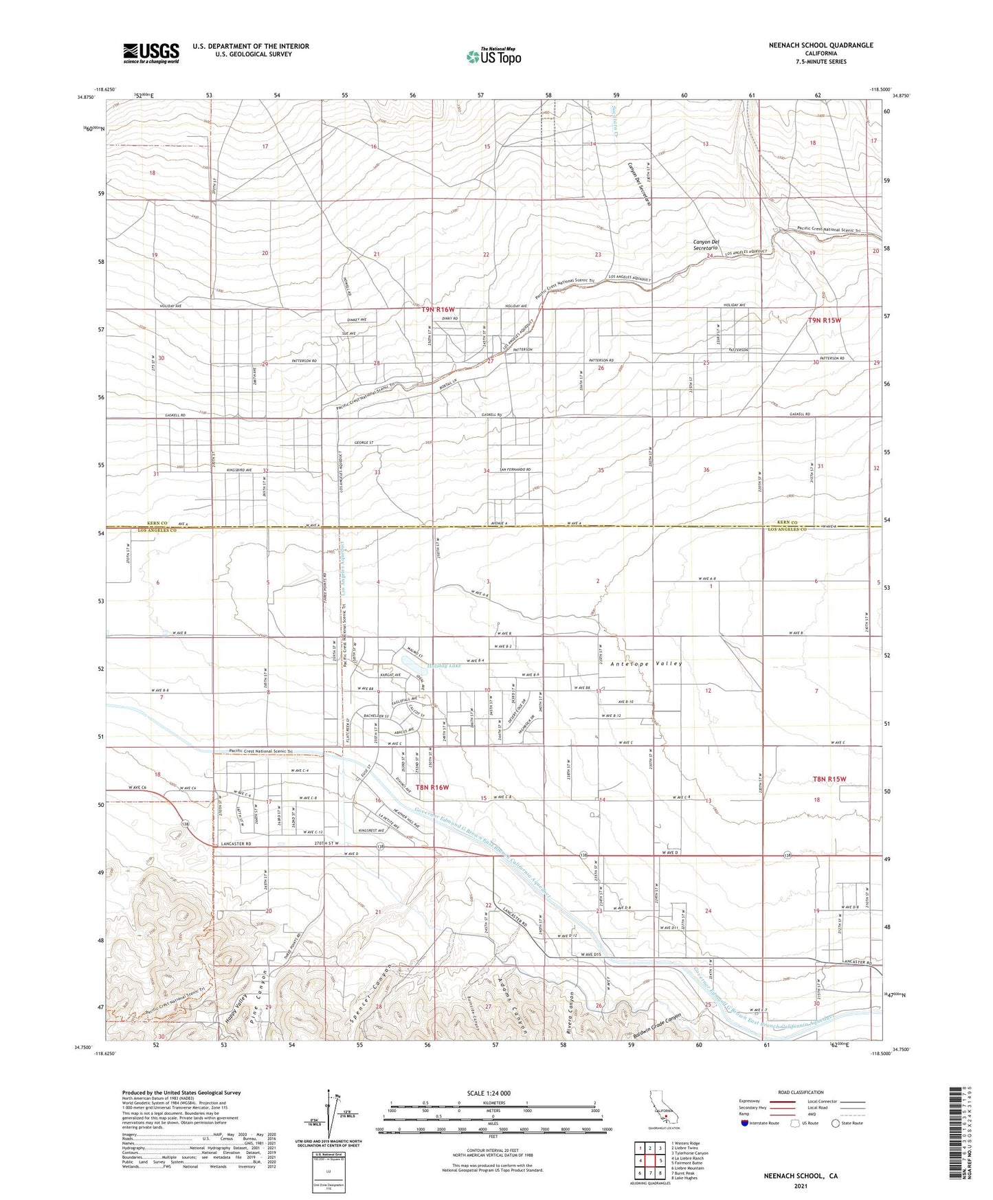
Neenach School California US Topo Map
Couldn't load pickup availability
Also explore the Neenach School Forest Service Topo of this same quad for updated USFS data
2021 topographic map quadrangle Neenach School in the state of California. Scale: 1:24000. Based on the newly updated USGS 7.5' US Topo map series, this map is in the following counties: Los Angeles, Kern. The map contains contour data, water features, and other items you are used to seeing on USGS maps, but also has updated roads and other features. This is the next generation of topographic maps. Printed on high-quality waterproof paper with UV fade-resistant inks.
Quads adjacent to this one:
West: La Liebre Ranch
Northwest: Winters Ridge
North: Liebre Twins
Northeast: Tylerhorse Canyon
East: Fairmont Butte
Southeast: Lake Hughes
South: Burnt Peak
Southwest: Liebre Mountain
This map covers the same area as the classic USGS quad with code o34118g5.
Contains the following named places: Adams Canyon, Antelope Station, Arthur B. Ripley Desert Woodland State Park, Baldwin Grade Canyon, Belle Louise Ranch, Burnside Canyon, Canyon Del Secretario, Cole Ranch, Gorrindo Ranch, Happy Valley, Holiday Lake, Manzana Ranch, Neenach Elementary School, Neenach Ranch, Neenach Substation, Pecks Ranch, Pine Canyon, Rivera Canyon, Snyder Ranch, Spencer Canyon, Spencer Ranch