MyTopo
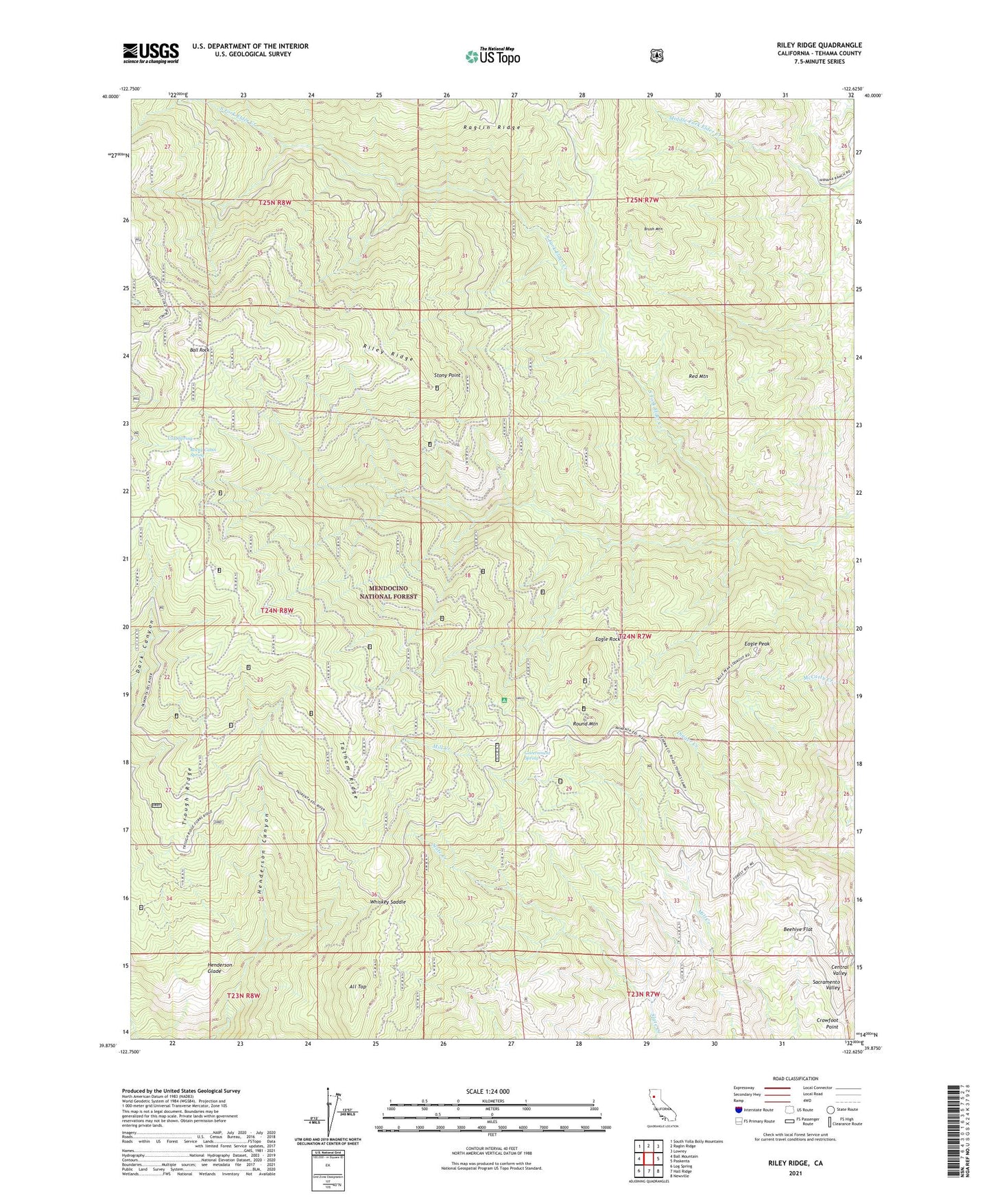
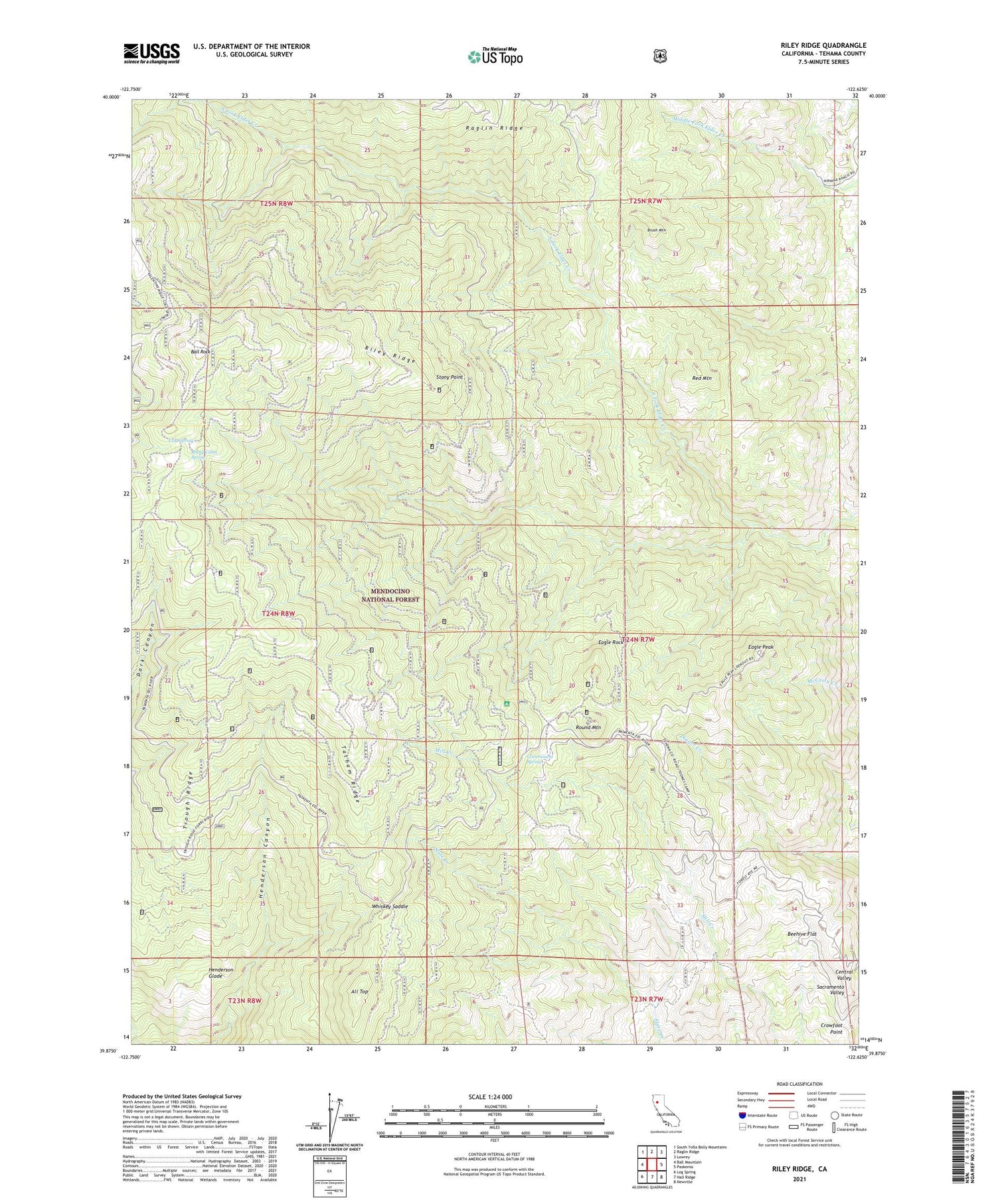
Riley Ridge California US Topo Map
Couldn't load pickup availability
Also explore the Riley Ridge Forest Service Topo of this same quad for updated USFS data
2021 topographic map quadrangle Riley Ridge in the state of California. Scale: 1:24000. Based on the newly updated USGS 7.5' US Topo map series, this map is in the following counties: Tehama. The map contains contour data, water features, and other items you are used to seeing on USGS maps, but also has updated roads and other features. This is the next generation of topographic maps. Printed on high-quality waterproof paper with UV fade-resistant inks.
Quads adjacent to this one:
West: Ball Mountain
Northwest: South Yolla Bolly Mountains
North: Raglin Ridge
Northeast: Lowrey
East: Paskenta
Southeast: Newville
South: Hall Ridge
Southwest: Log Spring
This map covers the same area as the classic USGS quad with code o39122h6.
Contains the following named places: All Top, Ball Rock, Beehive Flat, Brush Mountain, Cold Spring, Crowfoot Point, Dawson Place, Eagle Peak, Eagle Rock, Eagle Rock Camp, Government Spring, Henderson Glade, Horse Camp Recreation Site, KALF-FM (Red Bluff), KCEZ-FM (Corning), Kleinsorge Mine, Mitchell Place, Patton Mill, Pellow Place, Postpile Camp, Red Mountain, Riley Cabin, Riley Ridge, Rocky Cabin Recreation Site, Rocky Cabin Spring, Round Mountain, South Elder Mine, Steuben Place, Stony Point, Tatham Ridge, Trough Ridge, Whiskey Saddle, Whitlock Campground, Williams Camp