
MyTopo
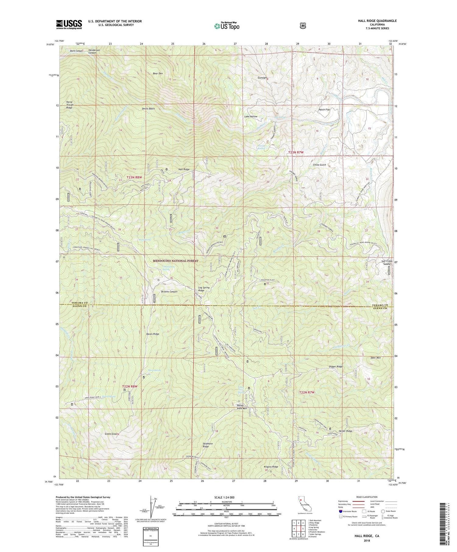
Hall Ridge California US Topo Map
Couldn't load pickup availability
Also explore the Hall Ridge Forest Service Topo of this same quad for updated USFS data
2022 topographic map quadrangle Hall Ridge in the state of California. Scale: 1:24000. Based on the newly updated USGS 7.5' US Topo map series, this map is in the following counties: Tehama, Glenn. The map contains contour data, water features, and other items you are used to seeing on USGS maps, but also has updated roads and other features. This is the next generation of topographic maps. Printed on high-quality waterproof paper with UV fade-resistant inks.
Quads adjacent to this one:
West: Log Spring
Northwest: Ball Mountain
North: Riley Ridge
Northeast: Paskenta
East: Newville
Southeast: Chrome
South: Alder Springs
Southwest: Plaskett Meadows
This map covers the same area as the classic USGS quad with code o39122g6.
Contains the following named places: Bear Den, Black Bear Camp, Bowers Creek, Buck Spring, China Gulch, Commissary Spring, Conklin Orchard, Dark Canyon, Daves Ridge, Daves Spring, Davies Orchard, Dead Rabbit, Deer Mountain, Del Harleson Camp, Devils Basin, Digger Ridge, Gunsight, Hall Ridge, Hatch Flat, Heifer Ridge, Henderson Canyon, Horse Trough Creek, Houghton Place, Jeffers Ranch, Kilgore Ridge, Lake Hollow, Mud Flat Campground, Round Spring, Salt Creek Saddle, Scotts Glade, Skidmore Ridge, Slate Creek, The Gorge, Valley View Lookout Tower, Valley View Mountain, Valley View Orchard, Valley View Spring, Whitlock Place, Wilder Place, Zumwalt Creek


