
MyTopo
Oasis California US Topo Map
Couldn't load pickup availability
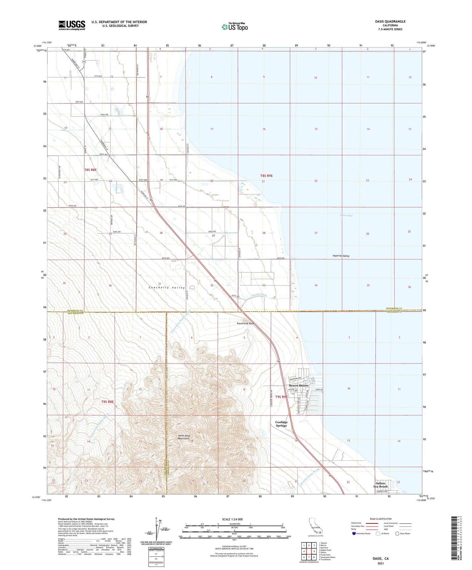
2021 topographic map quadrangle Oasis in the state of California. Scale: 1:24000. Based on the newly updated USGS 7.5' US Topo map series, this map is in the following counties: Riverside, Imperial, San Diego. The map contains contour data, water features, and other items you are used to seeing on USGS maps, but also has updated roads and other features. This is the next generation of topographic maps. Printed on high-quality waterproof paper with UV fade-resistant inks.
Quads adjacent to this one:
West: Rabbit Peak
Northwest: Valerie
North: Mecca
Northeast: Mortmar
East: Salton
Southeast: Truckhaven
South: Seventeen Palms
Southwest: Fonts Point
This map covers the same area as the classic USGS quad with code o33116d1.
Contains the following named places: Coachella Valley, Coolidge Springs, Desert Shores, Desert Shores Census Designated Place, Fish Spring, Garner Wash, Oasis, Oasis Lateral, Oasis Maintenance Station, Oriols Service Station, Riverside County Fire Department Station 42 Oasis, Salton Sea Beach, Salton Sea Beach Census Designated Place, Salton Sea Beach Marina, Travertine Palms, Travertine Palms Wash, Travertine Rock, West Shore Ambulance Service, Wonderstone Wash, ZIP Code: 92274


