MyTopo
Truckhaven California US Topo Map
Couldn't load pickup availability
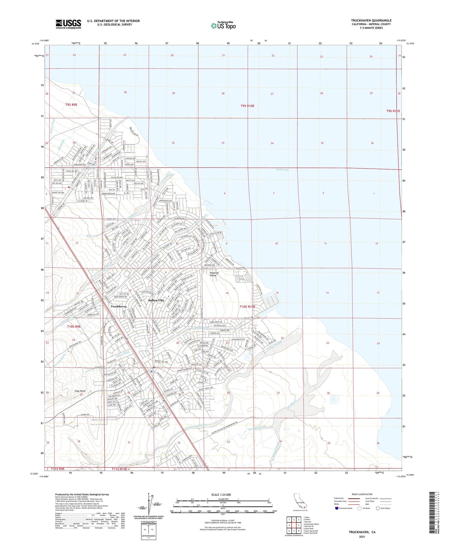
2021 topographic map quadrangle Truckhaven in the state of California. Scale: 1:24000. Based on the newly updated USGS 7.5' US Topo map series, this map is in the following counties: Imperial. The map contains contour data, water features, and other items you are used to seeing on USGS maps, but also has updated roads and other features. This is the next generation of topographic maps. Printed on high-quality waterproof paper with UV fade-resistant inks.
Quads adjacent to this one:
West: Seventeen Palms
Northwest: Oasis
North: Salton
Northeast: Durmid
East: Durmid SE
Southeast: Kane Spring NE
South: Kane Spring NW
Southwest: Shell Reef
This map covers the same area as the classic USGS quad with code o33115c8.
Contains the following named places: Amerosa Wash, Anza Ditch, Arroyo Salada, Big Wash, Biloxi Wash, Campbell Wash, Clay Point, Coral Wash, Grave Wash, Gravel Wash, Iberia Wash, Imperial County Sheriff's Office Salton City, Palm Wash, Salton City, Salton City Census Designated Place, Salton City Post Office, Salton Golf Course, Salton Sea Base B-2, Salton Sea Test Base B-1, Squeaky Springs, Surprise Wash, Truckhaven, Tule Wash, Verde Wash, Zenas Wash