
MyTopo
Rabbit Peak California US Topo Map
Couldn't load pickup availability
Also explore the Rabbit Peak Forest Service Topo of this same quad for updated USFS data
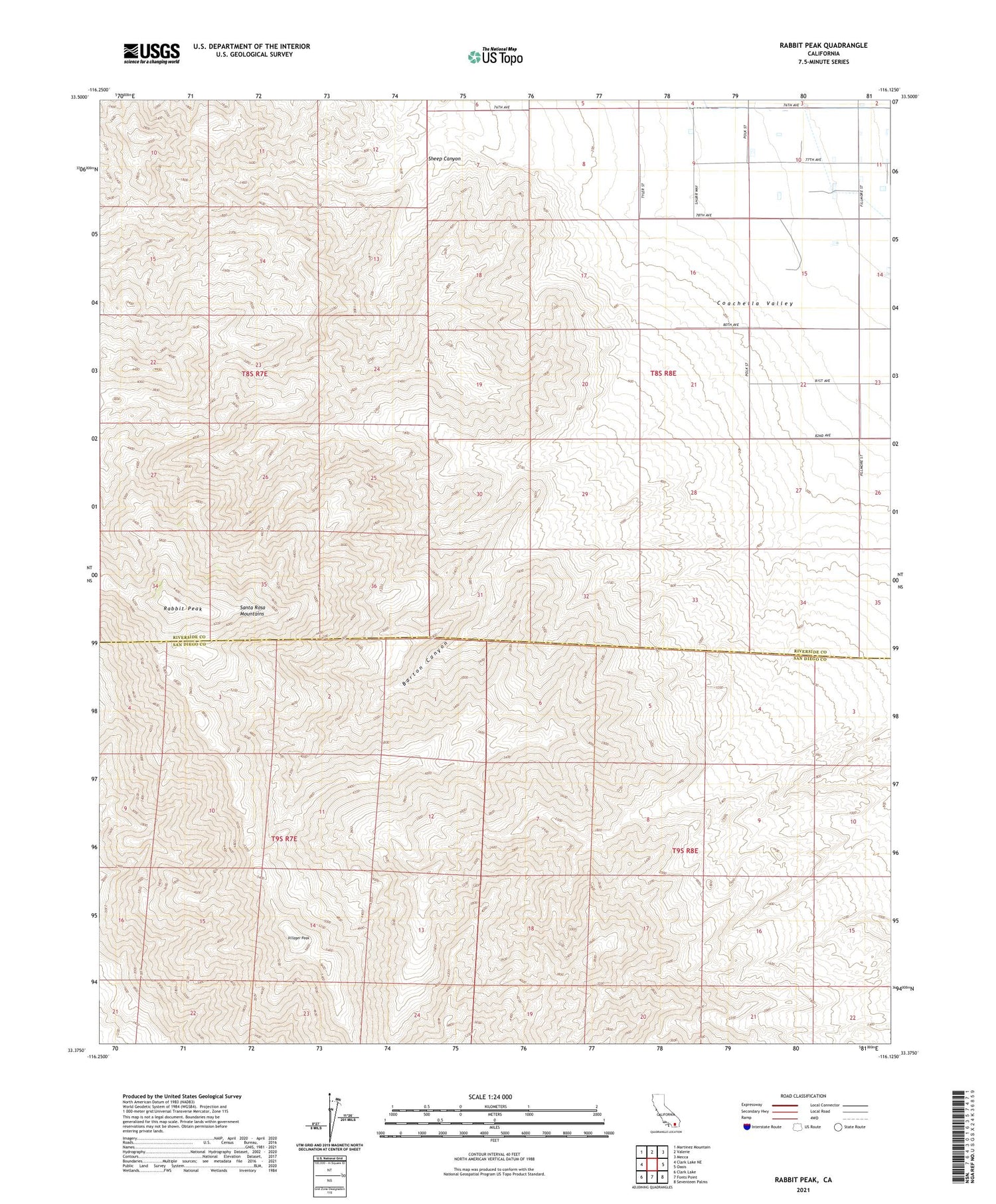
2021 topographic map quadrangle Rabbit Peak in the state of California. Scale: 1:24000. Based on the newly updated USGS 7.5' US Topo map series, this map is in the following counties: Riverside, San Diego. The map contains contour data, water features, and other items you are used to seeing on USGS maps, but also has updated roads and other features. This is the next generation of topographic maps. Printed on high-quality waterproof paper with UV fade-resistant inks.
Quads adjacent to this one:
West: Clark Lake NE
Northwest: Martinez Mountain
North: Valerie
Northeast: Mecca
East: Oasis
Southeast: Seventeen Palms
South: Fonts Point
Southwest: Clark Lake
This map covers the same area as the classic USGS quad with code o33116d2.
Contains the following named places: Barton Canyon, Rabbit Peak, Santa Rosa Mountains, Sheep Canyon, Toro, Villager Peak


