MyTopo
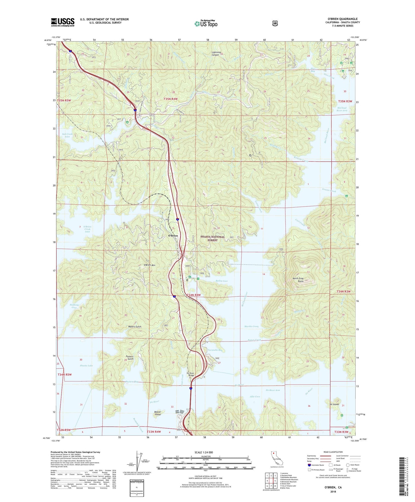
O'Brien California US Topo Map
Couldn't load pickup availability
Also explore the O'Brien Forest Service Topo of this same quad for updated USFS data
2022 topographic map quadrangle O'Brien in the state of California. Scale: 1:24000. Based on the newly updated USGS 7.5' US Topo map series, this map is in the following counties: Shasta. The map contains contour data, water features, and other items you are used to seeing on USGS maps, but also has updated roads and other features. This is the next generation of topographic maps. Printed on high-quality waterproof paper with UV fade-resistant inks.
Quads adjacent to this one:
West: Bohemotash Mountain
Northwest: Lamoine
North: Hanland Peak
Northeast: Bollibokka Mountain
East: Minnesota Mountain
Southeast: Bella Vista
South: City of Shasta Lake
Southwest: Shasta Dam
Contains the following named places: Allie Cove, Allie Cove Campground, American Trails Recreation Site, Azelle Creek, Bailey Cove, Bailey Cove Campground, Baird, Bass Mountain Marker, Beaver Island, Bridge Bay Resort, Bridge Bay Resort Seaplane Base, Cascade Cove Resort, Coal Creek, Curl Creek, Dead Horse Creek, Fall Creek, Goat Creek, Gray Rocks, Greens Creek, Greens Creek Campground, Halfway Cove, Hirz Bay, Hirz Bay Campgrounds, Hirz Creek, Holiday Harbor Resort, Keluche Creek, Lakeview Resort, Lightning Canyon, Lower Salt Creek Campground, Lower Salt Creek Resort, Marble Creek, Mariners Point Campground, McCloud River, McCloud River Arm, Moss Creek, Nelson Creek, Nelson Point Campground, North Gray Rocks, Oak Grove Campground, O'Brien, O'Brien Creek Inlet, O'Brien Mountain, Packers Bay, Packers Bay Marina, Packers Gulch, Pit River, Pit River Arm, Pit River Bridge, Potter Creek, Salt Creek Group Campgrounds, Salt Creek Inlet, Salt Creek Picnic Area, Shasta Iron Mine, Shasta Lake, Shasta Marina, Ski Island, Ski Island Campground, Turntable Bay, Turntable Forest Service Facility, Upper Salt Creek Campground, Upper Salt Creek Resort, Waters Gulch, Wintoon Campground, Ycotto Creek


