
MyTopo
Orange Cove North California US Topo Map
Couldn't load pickup availability
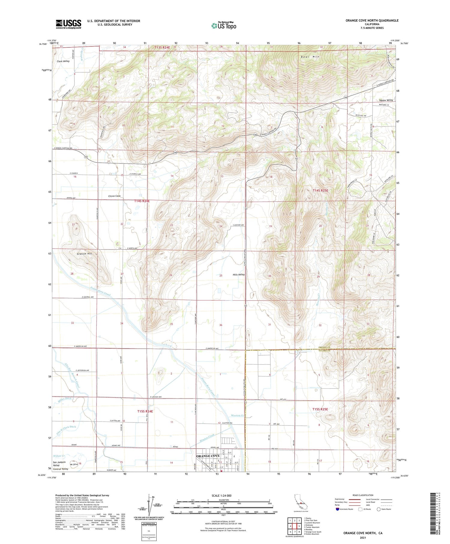
2023 topographic map quadrangle Orange Cove North in the state of California. Scale: 1:24000. Based on the newly updated USGS 7.5' US Topo map series, this map is in the following counties: Fresno, Tulare. The map contains contour data, water features, and other items you are used to seeing on USGS maps, but also has updated roads and other features. This is the next generation of topographic maps. Printed on high-quality waterproof paper with UV fade-resistant inks.
Quads adjacent to this one:
West: Wahtoke
Northwest: Piedra
North: Pine Flat Dam
Northeast: Luckett Mountain
East: Tucker Mountain
Southeast: Stokes Mountain
South: Orange Cove South
Southwest: Reedley
This map covers the same area as the classic USGS quad with code o36119f3.
Contains the following named places: Alta West Clark Ditch, Bear Mountain, Citrus Cove, Citrus Cove School, Citrus Middle School, Granite Hill, Hills Valley, Kaktus Korner, KMAK-FM (Orange Cove), KSEE-TV (Fresno), KVPT-TV (Fresno), KZJE-TV (Clovis), McCord Elementary School, Mount Olive, Orange Cove Fire Protection District of Fresno and Tulare Counties, Saint Rita Indian Mission, Squaw Valley, Wooten Creek, ZIP Code: 93646


