MyTopo
Tucker Mountain California US Topo Map
Couldn't load pickup availability
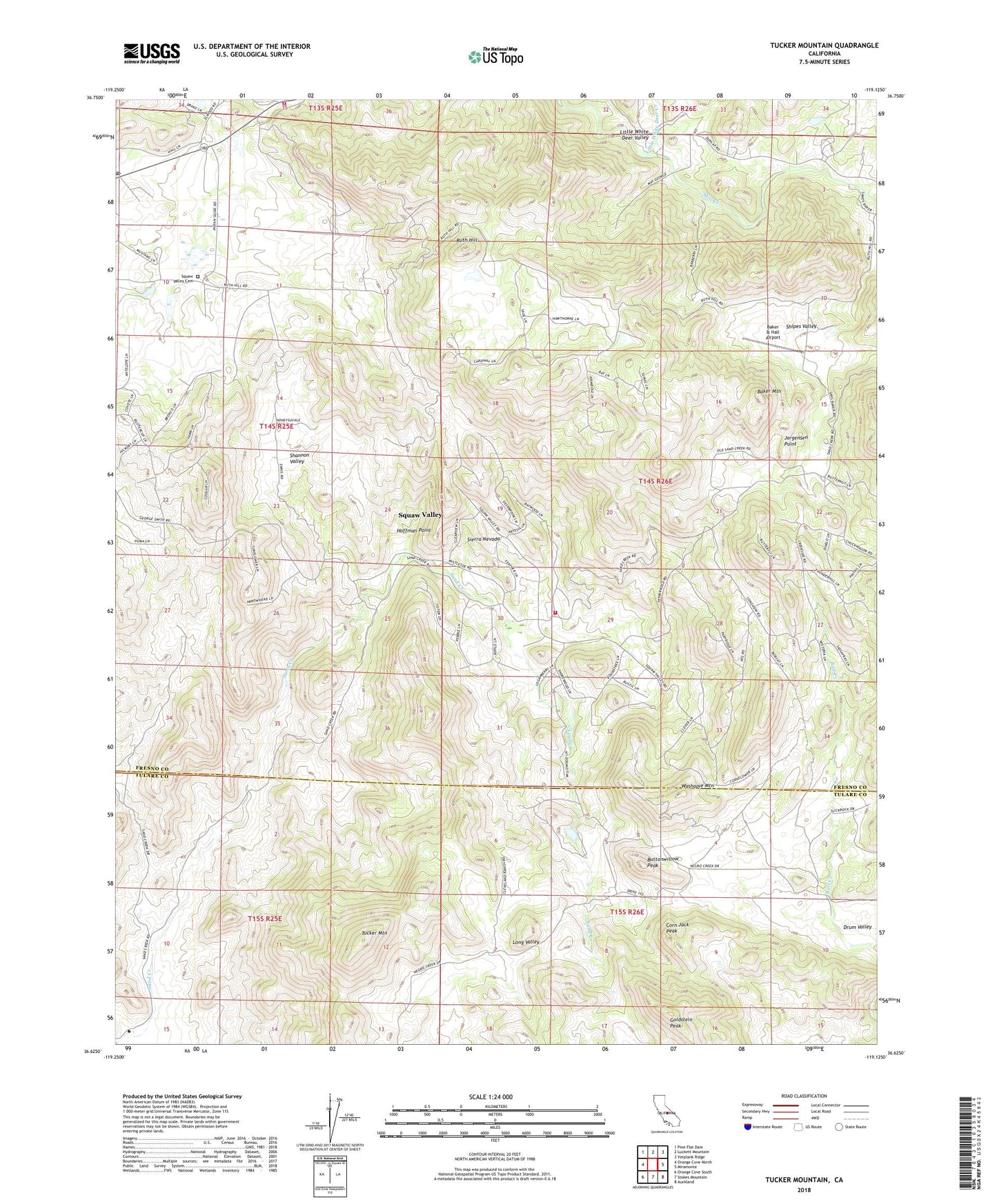
2023 topographic map quadrangle Tucker Mountain in the state of California. Scale: 1:24000. Based on the newly updated USGS 7.5' US Topo map series, this map is in the following counties: Fresno, Tulare. The map contains contour data, water features, and other items you are used to seeing on USGS maps, but also has updated roads and other features. This is the next generation of topographic maps. Printed on high-quality waterproof paper with UV fade-resistant inks.
Quads adjacent to this one:
West: Orange Cove North
Northwest: Pine Flat Dam
North: Luckett Mountain
Northeast: Verplank Ridge
East: Miramonte
Southeast: Auckland
South: Stokes Mountain
Southwest: Orange Cove South
Contains the following named places: Baker & Hall Airport, Baker Mountain, Baker Ranch, Buttonwillow Peak, CAL FIRE Sand Creek Station, CAL FIRE Squaw Valley Station, Corn Jack Peak, Drum Valley, Drum Valley School, Goldstein Peak, Harlan Ranch, Hoffman Point, Jorgensen Point, Little White Deer Creek, Little White Deer Valley, Metcalf Ranch, Nance Ranch, Rector Ranch, Ruth Hill, Sand Creek 1691 Dam, Sand Creek Reservoir, Sequoia Safety Council Ambulance Squaw Valley Station, Shannon Valley, Shipes Valley, Smith Ranch, Squaw Valley, Squaw Valley Cemetery, Squaw Valley Census Designated Place, Squaw Valley Post Office, Squaw Valley School, Stoddard Ranch, Tucker Mountain, Washapie Mountain, ZIP Code: 93675