MyTopo
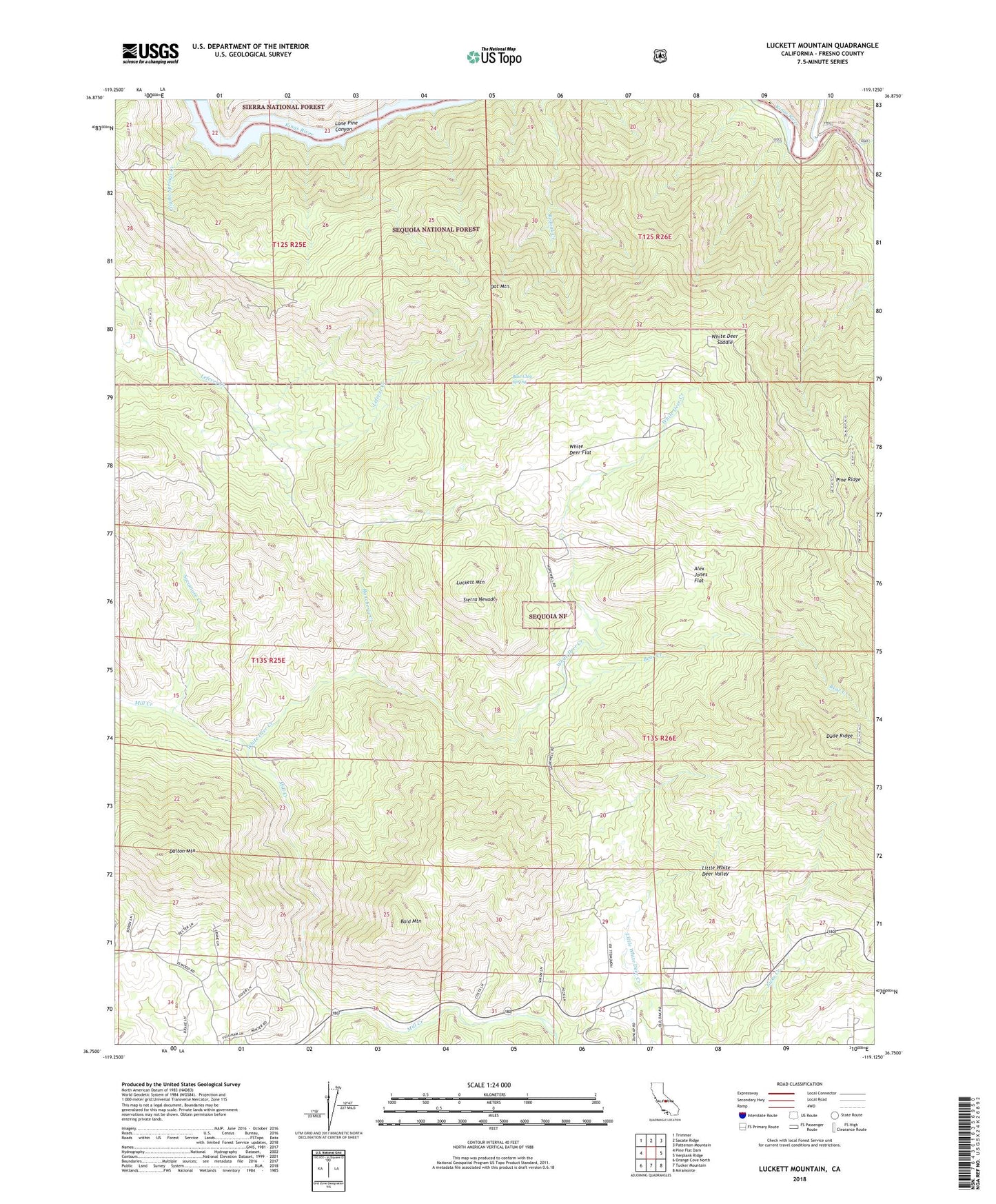
Luckett Mountain California US Topo Map
Couldn't load pickup availability
Also explore the Luckett Mountain Forest Service Topo of this same quad for updated USFS data
2021 topographic map quadrangle Luckett Mountain in the state of California. Scale: 1:24000. Based on the newly updated USGS 7.5' US Topo map series, this map is in the following counties: Fresno. The map contains contour data, water features, and other items you are used to seeing on USGS maps, but also has updated roads and other features. This is the next generation of topographic maps. Printed on high-quality waterproof paper with UV fade-resistant inks.
Quads adjacent to this one:
West: Pine Flat Dam
Northwest: Trimmer
North: Sacate Ridge
Northeast: Patterson Mountain
East: Verplank Ridge
Southeast: Miramonte
South: Tucker Mountain
Southwest: Orange Cove North
This map covers the same area as the classic USGS quad with code o36119g2.
Contains the following named places: Alex Jones Flat, Bald Mountain, Bear Creek, Blue Clay Spring, Clingans Junction, Cottonwood Springs Creek, Coyote Springs Creek, Dalton Mountain, Dude Ridge, Hopewell School, Hume Lake Ranger Station, Jacks Creek, Kellers Ranch, Lone Pine Canyon, Luckett Mountain, North Fork Kings River, Oat Mountain, Rancheria Creek, Sycamore Creek, White Deer Creek, White Deer Flat, White Deer Saddle, ZIP Code: 93621