MyTopo
Orestimba Peak California US Topo Map
Couldn't load pickup availability
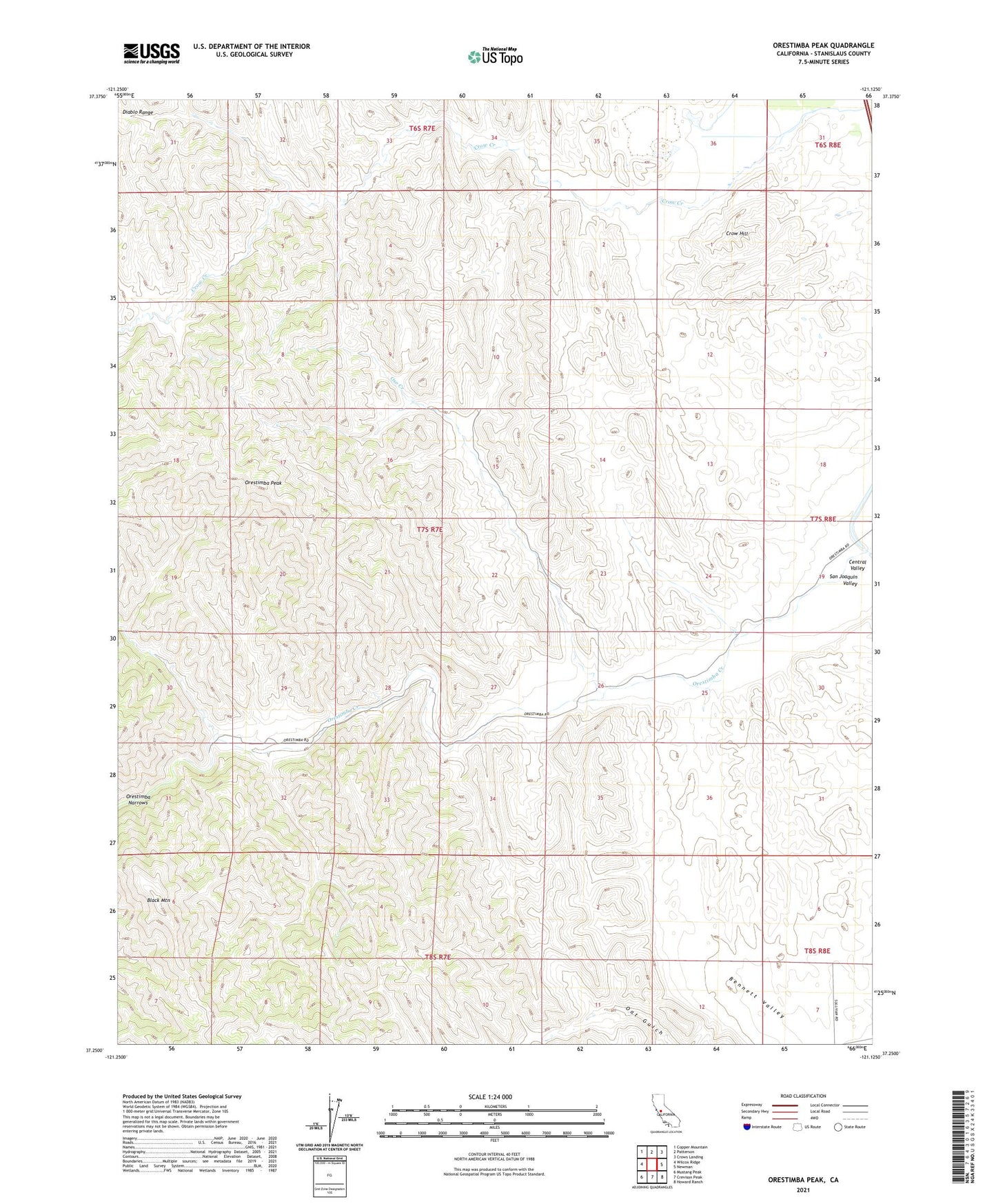
2021 topographic map quadrangle Orestimba Peak in the state of California. Scale: 1:24000. Based on the newly updated USGS 7.5' US Topo map series, this map is in the following counties: Stanislaus. The map contains contour data, water features, and other items you are used to seeing on USGS maps, but also has updated roads and other features. This is the next generation of topographic maps. Printed on high-quality waterproof paper with UV fade-resistant inks.
Quads adjacent to this one:
West: Wilcox Ridge
Northwest: Copper Mountain
North: Patterson
Northeast: Crows Landing
East: Newman
Southeast: Howard Ranch
South: Crevison Peak
Southwest: Mustang Peak
This map covers the same area as the classic USGS quad with code o37121c2.
Contains the following named places: Black Mountain, Crow Hill, Newman Division, Orestimba Narrows, Orestimba Peak, Oso Creek, ZIP Code: 95360