MyTopo
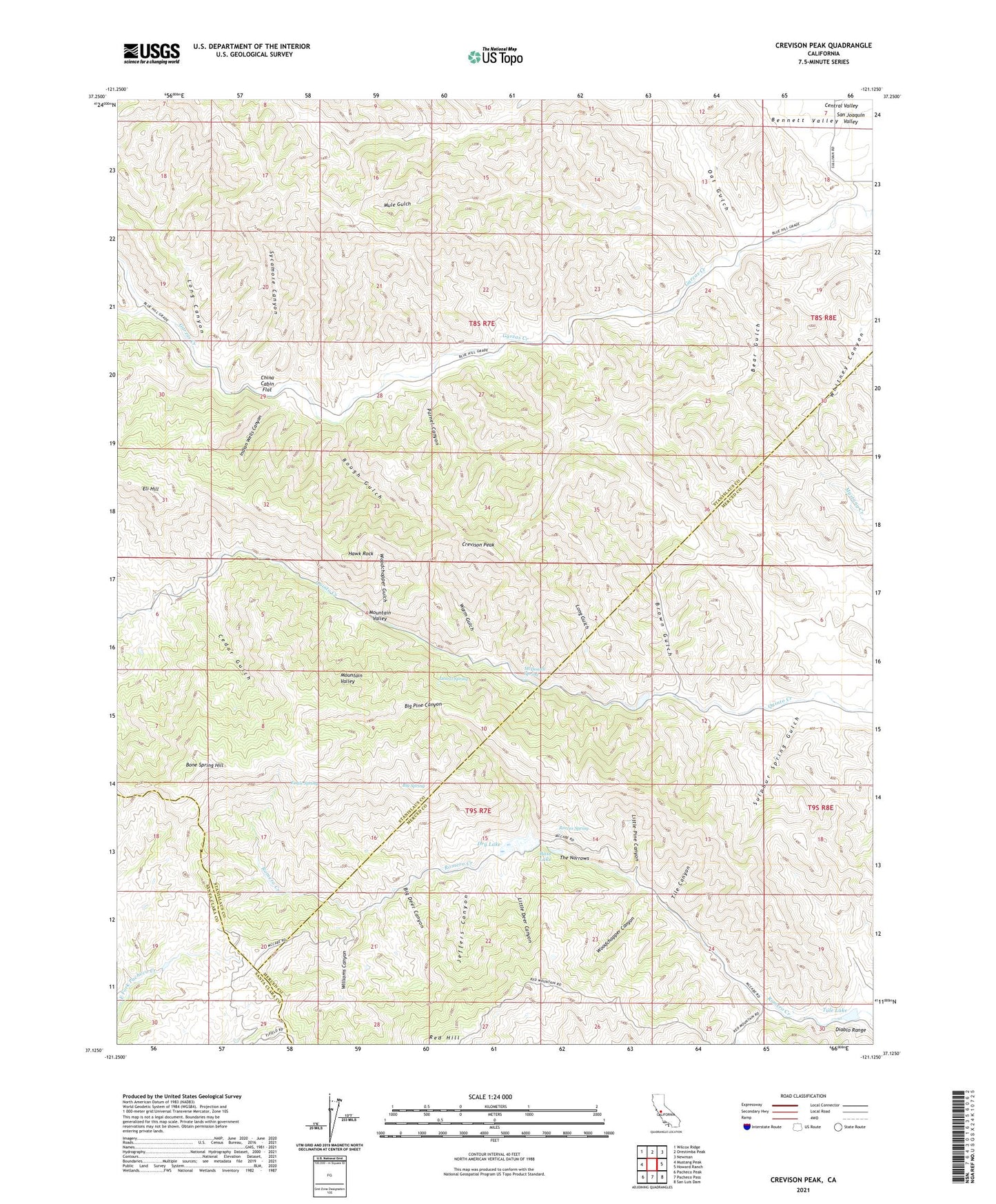
Crevison Peak California US Topo Map
Couldn't load pickup availability
2021 topographic map quadrangle Crevison Peak in the state of California. Scale: 1:24000. Based on the newly updated USGS 7.5' US Topo map series, this map is in the following counties: Stanislaus, Merced, Santa Clara. The map contains contour data, water features, and other items you are used to seeing on USGS maps, but also has updated roads and other features. This is the next generation of topographic maps. Printed on high-quality waterproof paper with UV fade-resistant inks.
Quads adjacent to this one:
West: Mustang Peak
Northwest: Wilcox Ridge
North: Orestimba Peak
Northeast: Newman
East: Howard Ranch
Southeast: San Luis Dam
South: Pacheco Pass
Southwest: Pacheco Peak
This map covers the same area as the classic USGS quad with code o37121b2.
Contains the following named places: Bald Eagle Mine, Bass Lake, Bear Gulch, Big Deer Canyon, Big Pine Canyon, Big Spring, Bone Spring Hill, Brown Gulch, Cedar Gulch, China Cabin Flat, Crevison Peak, Dry Lake, Eagle Spring, Eli Hill, Fifield Ranch, Hawk Rock, Indian Wells Canyon, Jeffers Canyon, Laurel Spring, Little Deer Canyon, Little Pine Canyon, Long Canyon, Long Gulch, McDowell Spring, Mountain Valley, Mule Gulch, Oat Gulch, Parnel Canyon, Reeves Spring, Richard Creek, Richey Camp, Rough Gulch, Sulphur Spring Gulch, Sycamore Canyon, The Narrows, Tile Canyon, Tule Lake, Warm Gulch, Williams Canyon, Woodchopper Canyon, Woodchopper Gulch