
MyTopo
Orick California US Topo Map
Couldn't load pickup availability
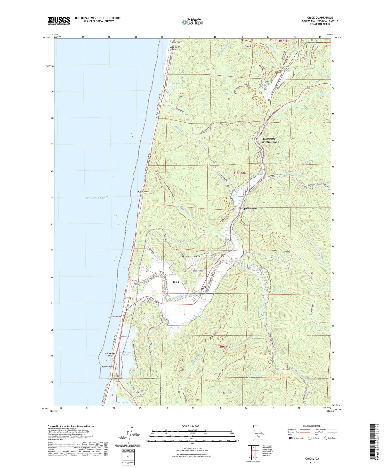
2021 topographic map quadrangle Orick in the state of California. Scale: 1:24000. Based on the newly updated USGS 7.5' US Topo map series, this map is in the following counties: Humboldt. The map contains contour data, water features, and other items you are used to seeing on USGS maps, but also has updated roads and other features. This is the next generation of topographic maps. Printed on high-quality waterproof paper with UV fade-resistant inks.
Quads adjacent to this one:
North: Fern Canyon
Northeast: Ah Pah Ridge
East: Holter Ridge
Southeast: Bald Hills
South: Rodgers Peak
Southwest: Trinidad OE N
This map covers the same area as the classic USGS quad with code o41124c1.
Contains the following named places: Berry Glenn, Big Tree Trail, Boyes Creek, Cathedral Tree Trail, Elam Creek, Elk Grove, Elk Prairie, Elk Prairie Trail, Espa Lagoon, Freshwater Lagoon, Freshwater Rocks, Gans Prairie, Godwood Creek, Gold Bluffs, Gyon Bluffs, Hufford Ranch, Humboldt County Prairie Creek Fish Hatchery, Johnson Creek, Little Lost Man Creek, Lookout Point, Lost Man Creek, Major Creek, May Creek, McArthur Creek, Miners Ridge Trail, Mussel Point, Ore'q, Orick, Orick Census Designated Place, Orick Elementary School, Orick Hill, Orick Post Office, Orick Volunteer Fire Department, Prairie Creek, Redwood Creek, Redwood Creek Beach County Park, Skunk Cabbage Creek


