MyTopo
Fern Canyon California US Topo Map
Couldn't load pickup availability
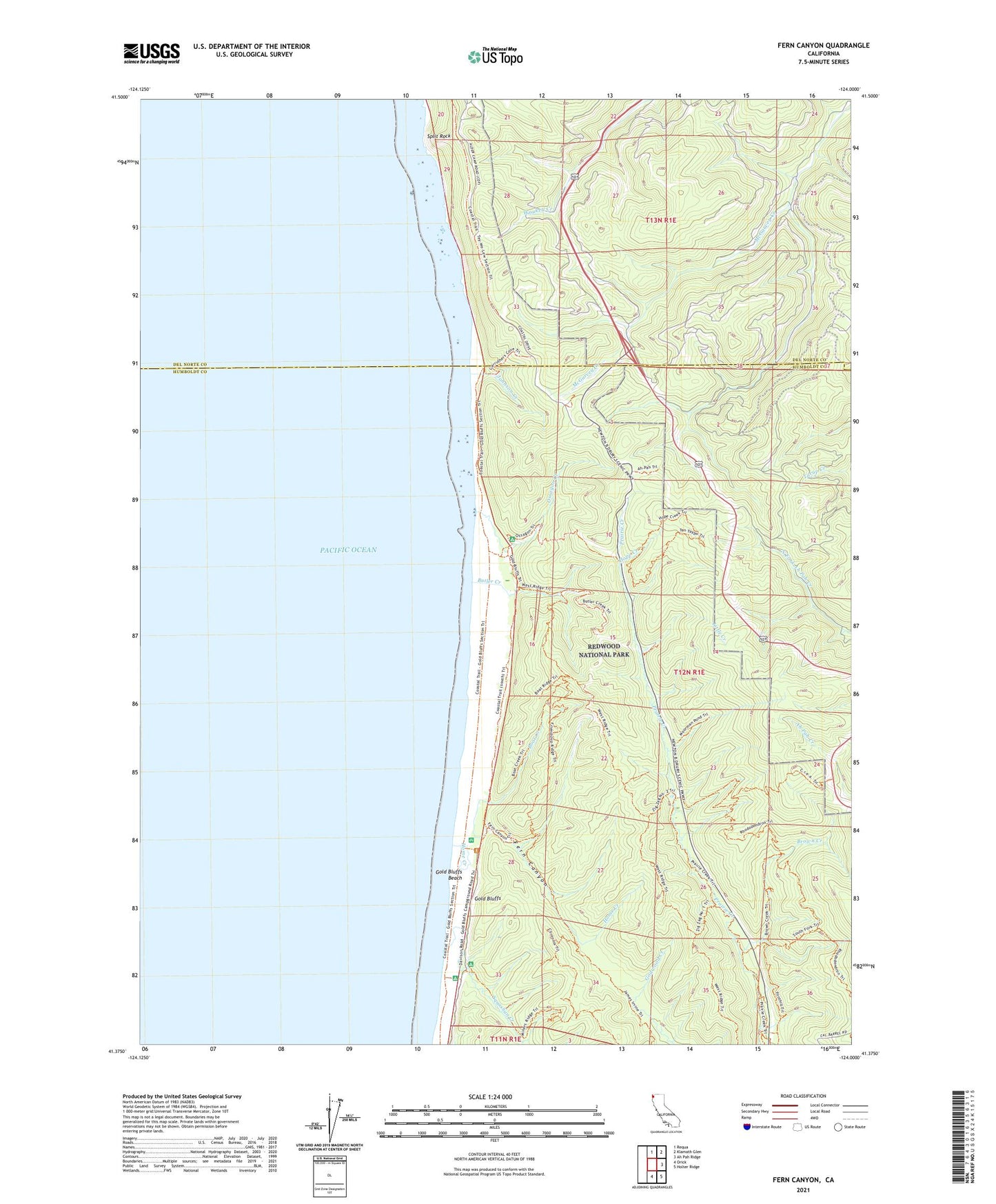
2021 topographic map quadrangle Fern Canyon in the state of California. Scale: 1:24000. Based on the newly updated USGS 7.5' US Topo map series, this map is in the following counties: Humboldt, Del Norte. The map contains contour data, water features, and other items you are used to seeing on USGS maps, but also has updated roads and other features. This is the next generation of topographic maps. Printed on high-quality waterproof paper with UV fade-resistant inks.
Quads adjacent to this one:
North: Requa
Northeast: Klamath Glen
East: Ah Pah Ridge
Southeast: Holter Ridge
South: Orick
This map covers the same area as the classic USGS quad with code o41124d1.
Contains the following named places: Boat Creek, Brown Creek, Butler Creek, Crea Trail, Fern Canyon, Foothill Trail, Gold Bluffs Beach, Home Creek, Hope Creek, Hope Creek Trail, James Irvine Trail, Johnson Creek, Little Creek, Loop Trail, Murrelet State Wilderness, Ossagon Creek, Prairie Creek Redwoods State Park, Redwood National Park, Rhododendron Trail, South Fork Trail, Split Rock, Squashan Creek, Ten Tapo Trail, West Ridge Trail, Zigzag Trail, Zigzag Trail Three, Zigzag Trail Two