MyTopo
Pacheco Pass California US Topo Map
Couldn't load pickup availability
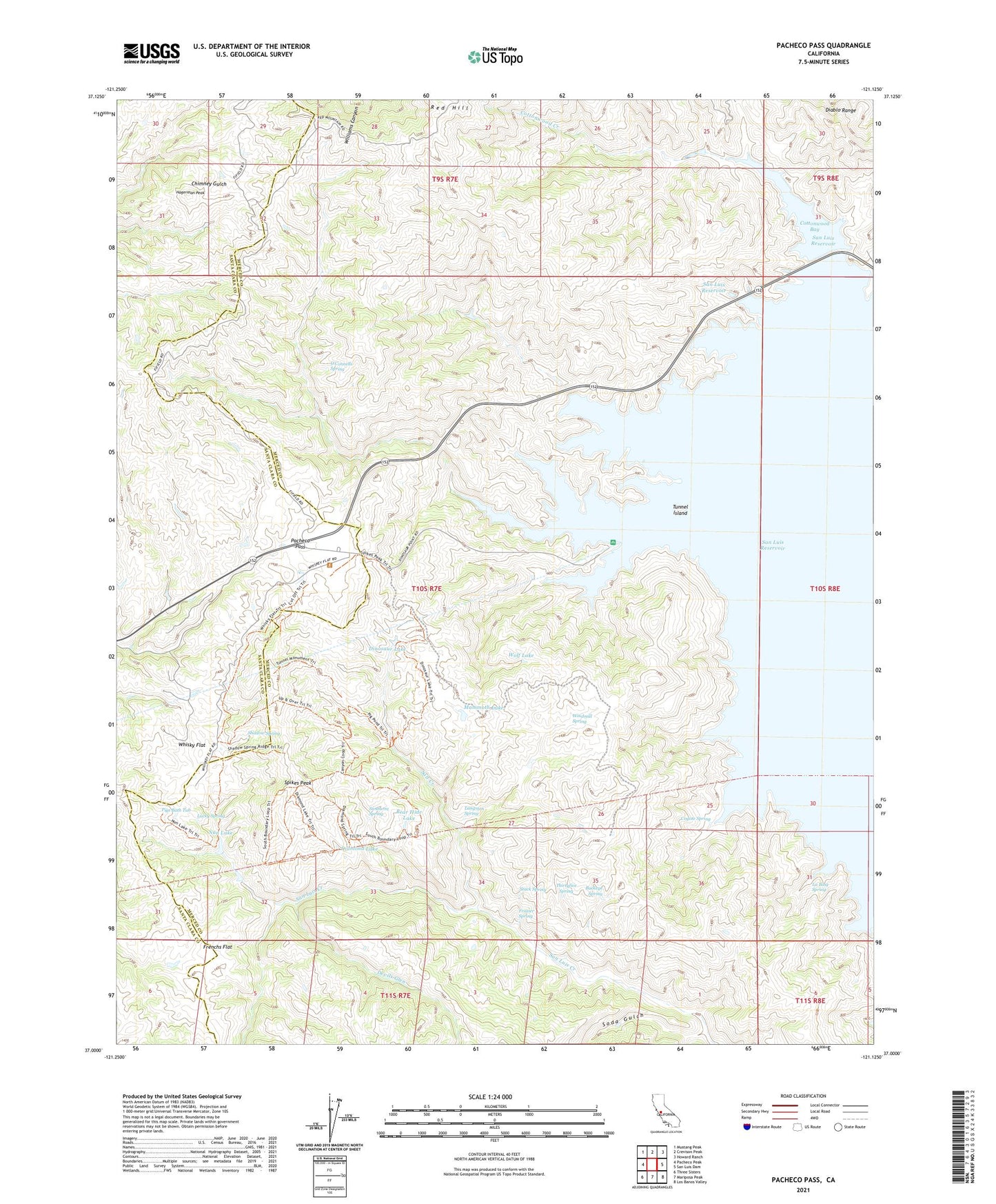
2021 topographic map quadrangle Pacheco Pass in the state of California. Scale: 1:24000. Based on the newly updated USGS 7.5' US Topo map series, this map is in the following counties: Merced, Santa Clara. The map contains contour data, water features, and other items you are used to seeing on USGS maps, but also has updated roads and other features. This is the next generation of topographic maps. Printed on high-quality waterproof paper with UV fade-resistant inks.
Quads adjacent to this one:
West: Pacheco Peak
Northwest: Mustang Peak
North: Crevison Peak
Northeast: Howard Ranch
East: San Luis Dam
Southeast: Los Banos Valley
South: Mariposa Peak
Southwest: Three Sisters
This map covers the same area as the classic USGS quad with code o37121a2.
Contains the following named places: Bear Hide Lake, Buckeye Spring, Cottonwood Bay, Cottonwood Creek, Coyote Spring, Coyote Springs Area Campground, Devils Glen, Diamond Lake, Dinosaur Lake, Dinosaur Point Boat Launch Area, Frazier Spring, Frenchs Flat, Hagerman Peak, Hidden Creek, La Baig Spring, Langston Spring, Lucky Spring, Mammoth Lake, Nun Lake, O'Connells Spring, Onion Valley Spring Two, Pacheco Pass, Pacheco State Park, Pigs Bath Tub, Red Hill, Salt Creek, San Luis Reservoir Seaplane Base, San Luis Reservoir Wildlife Area, Shadow Spring, Soda Gulch, Spicer Creek, Spikes Peak, Stack Spring, Sunburnt Spring, Thirtyfive Spring, Tunnel Island, Upper Cottonwood Creek Wildlife Area, Whisky Flat, Whistler Point Area Campground, Windmill Spring, Wolf Lake