MyTopo
Pacheco Peak California US Topo Map
Couldn't load pickup availability
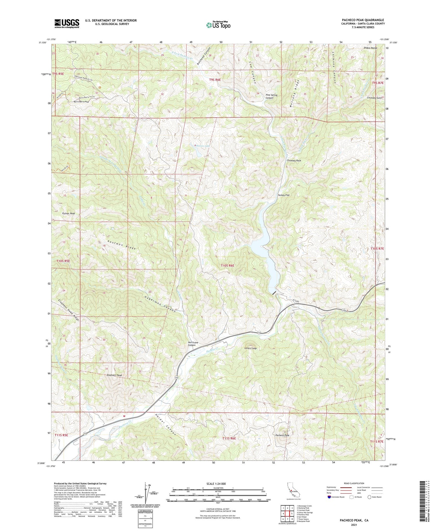
2021 topographic map quadrangle Pacheco Peak in the state of California. Scale: 1:24000. Based on the newly updated USGS 7.5' US Topo map series, this map is in the following counties: Santa Clara. The map contains contour data, water features, and other items you are used to seeing on USGS maps, but also has updated roads and other features. This is the next generation of topographic maps. Printed on high-quality waterproof paper with UV fade-resistant inks.
Quads adjacent to this one:
West: Gilroy Hot Springs
Northwest: Mississippi Creek
North: Mustang Peak
Northeast: Crevison Peak
East: Pacheco Pass
Southeast: Mariposa Peak
South: Three Sisters
Southwest: San Felipe
This map covers the same area as the classic USGS quad with code o37121a3.
Contains the following named places: Bell Station, Bullhead Canyon, Burra Burra Peak, Canada De La Dormida, Cedar Creek, Chimney Canyon, Chimney Gulch, Chimney Rock, Coon Creek, Cow Canyon, Department of Forestry and Fire Protection Station 31 Pacheco, Dowdy Ranch, East Fork Pacheco Creek, Elephant Head, Elephant Head Creek, Elephant Head Ridge, Gulnac Peak, Hagerman Canyon, Harper Canyon, Hurricane Canyon, Kaufman Ridge, Lake Mountain, Lovers Leap, Mustang Ridge, North Fork Dam, North Fork Pacheco Creek, O'Connor Ranch, Pacheco Lake, Pacheco Peak, Pacheco Ranger Station, Pine Spring Canyon, Shaeirn Lake, Shaeirn Ranch, South Fork Pacheco Creek, Turkey Flat