MyTopo
Mississippi Creek California US Topo Map
Couldn't load pickup availability
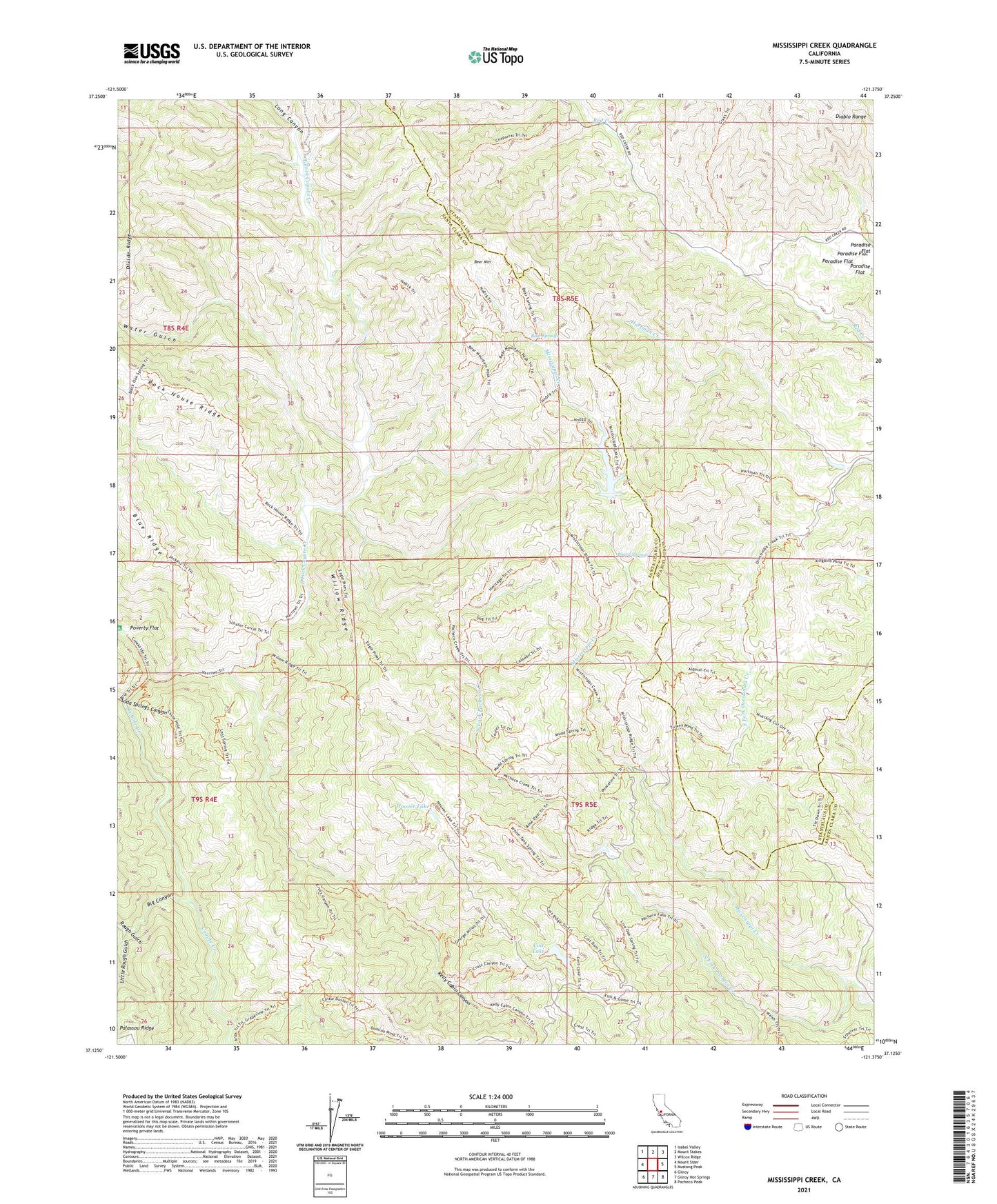
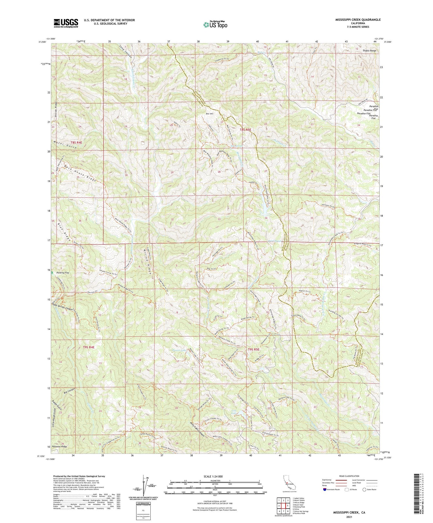
2021 topographic map quadrangle Mississippi Creek in the state of California. Scale: 1:24000. Based on the newly updated USGS 7.5' US Topo map series, this map is in the following counties: Santa Clara, Stanislaus. The map contains contour data, water features, and other items you are used to seeing on USGS maps, but also has updated roads and other features. This is the next generation of topographic maps. Printed on high-quality waterproof paper with UV fade-resistant inks.
Quads adjacent to this one:
West: Mount Sizer
Northwest: Isabel Valley
North: Mount Stakes
Northeast: Wilcox Ridge
East: Mustang Peak
Southeast: Pacheco Peak
South: Gilroy Hot Springs
Southwest: Gilroy
This map covers the same area as the classic USGS quad with code o37121b4.
Contains the following named places: Bear Mountain, Bear Springs, Big Canyon, Board Springs, Coit Dam, Coit Lake, East Fork Coyote Creek, Hartman Creek, Hoover Lake, Kelly Cabin Canyon, Little Rough Gulch, Long Canyon, Middle Fork Coyote Creek, Mississippi Creek, Murry 1620-003 Dam, Paradise Flat, Rough Gulch, Soda Springs Canyon, Water Gulch, Willow Ridge