MyTopo
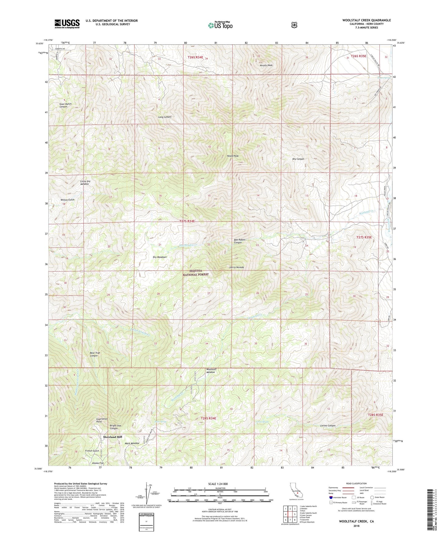
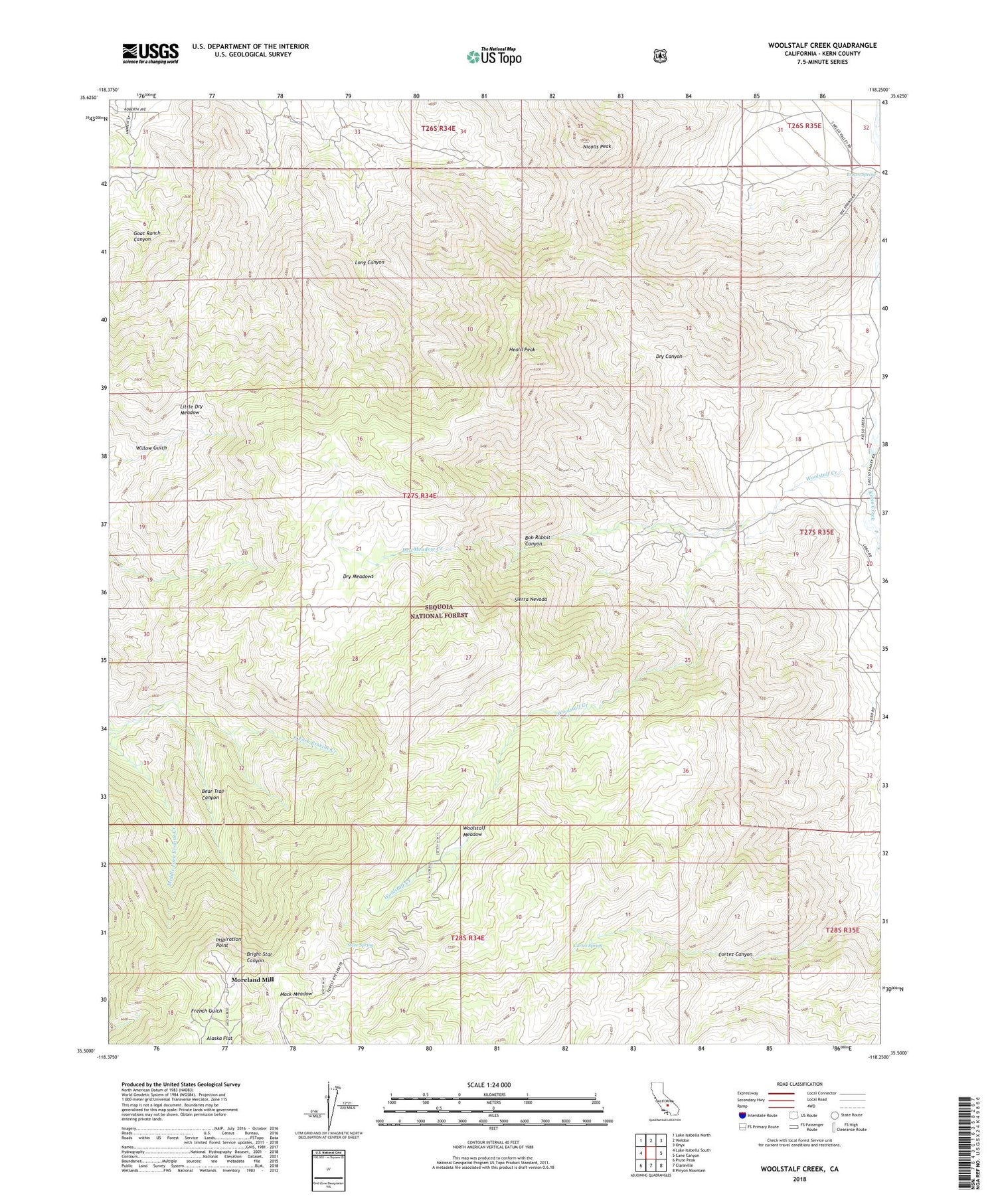
Woolstalf Creek California US Topo Map
Couldn't load pickup availability
2021 topographic map quadrangle Woolstalf Creek in the state of California. Scale: 1:24000. Based on the newly updated USGS 7.5' US Topo map series, this map is in the following counties: Kern. The map contains contour data, water features, and other items you are used to seeing on USGS maps, but also has updated roads and other features. This is the next generation of topographic maps. Printed on high-quality waterproof paper with UV fade-resistant inks.
Quads adjacent to this one:
West: Lake Isabella South
Northwest: Lake Isabella North
North: Weldon
Northeast: Onyx
East: Cane Canyon
Southeast: Pinyon Mountain
South: Claraville
Southwest: Piute Peak
This map covers the same area as the classic USGS quad with code o35118e3.
Contains the following named places: Bear Trap Canyon, Bob Rabbit Canyon, Bob Rabbit Place, Bright Star Mine, Brown Spring, Cortez Spring, Digger Pine Mine, Dry Canyon, Dry Meadow Creek, Dry Meadows, Heald Peak, Inspiration Point, Little Dry Meadow, Lone Star Mine, Lucky Box Mine, Mack Meadow, Moreland Mill, Nicolls Peak, Steve Spring, Woolstalf Creek, Woolstalf Meadow, ZIP Code: 93283