
MyTopo
Posey California US Topo Map
Couldn't load pickup availability
Also explore the Posey Forest Service Topo of this same quad for updated USFS data
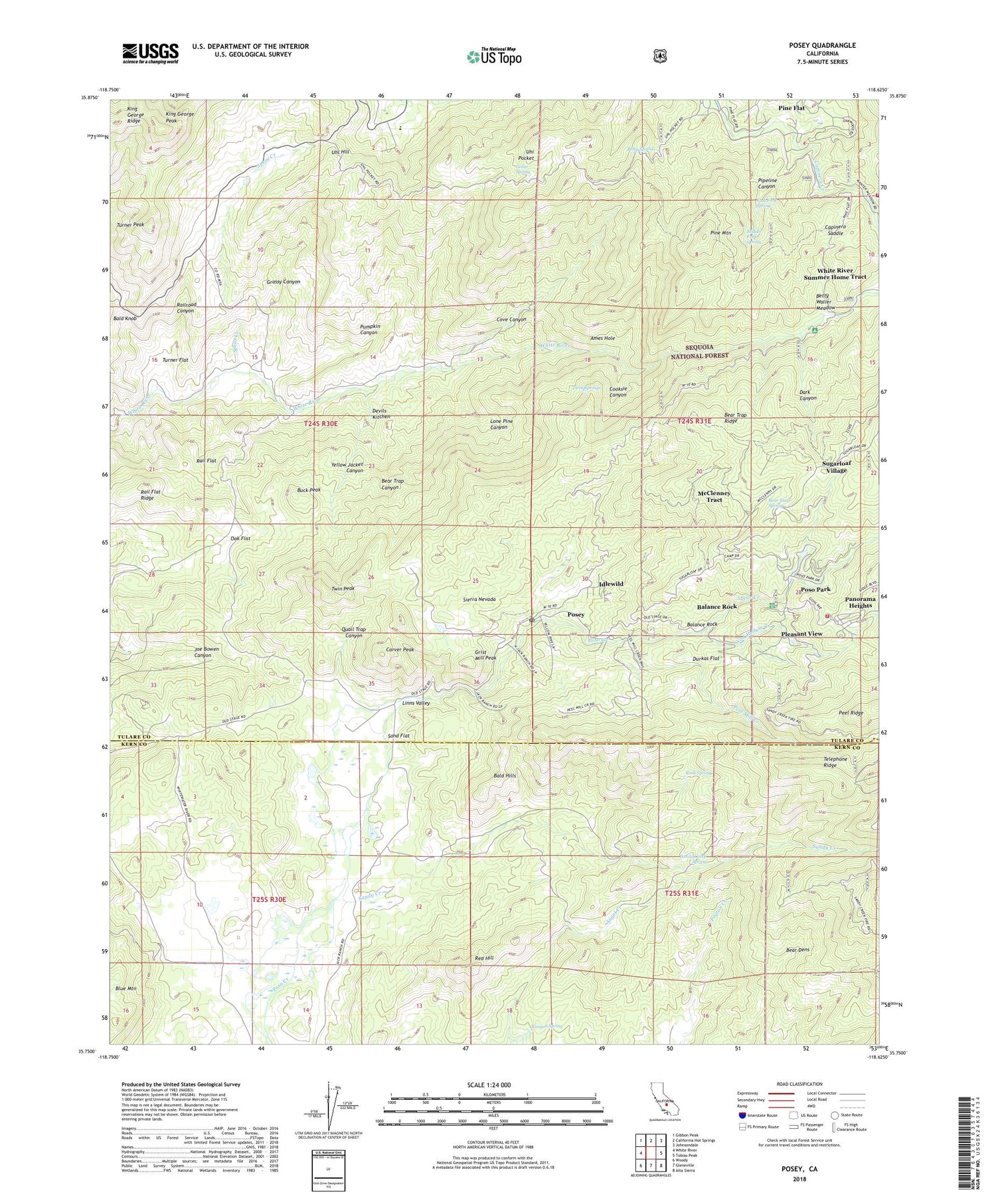
2021 topographic map quadrangle Posey in the state of California. Scale: 1:24000. Based on the newly updated USGS 7.5' US Topo map series, this map is in the following counties: Tulare, Kern. The map contains contour data, water features, and other items you are used to seeing on USGS maps, but also has updated roads and other features. This is the next generation of topographic maps. Printed on high-quality waterproof paper with UV fade-resistant inks.
Quads adjacent to this one:
West: White River
Northwest: Gibbon Peak
North: California Hot Springs
Northeast: Johnsondale
East: Tobias Peak
Southeast: Alta Sierra
South: Glennville
Southwest: Woody
This map covers the same area as the classic USGS quad with code o35118g6.
Contains the following named places: Ames Hole, Balance Rock, Balance Rock Post Office, Bald Hills, Bear Dens, Bear Trap Canyon, Bear Trap Ridge, Bear Trap Spring, Betty Spring, Betty Waller Meadow, Bowen Ranch, Buck Peak, Burton Ranch, California Hot Springs Fire Station 6, Capinero Saddle, Carver and Bowen Ranch, Carver Peak, Cedar Spring, Cedar Trough Landmark Object, Cooksie Canyon, Cove Canyon, Dark Canyon, Devils Kitchen, Durkas Flat, East Fork Spring, Grassy Canyon, Grist Mill Peak, Idlewild, Idlewild Census Designated Place, Jack Ranch, King George Peak, King George Ridge, Lone Pine Canyon, McClenney Tract Census Designated Place, Middle Fork Spring, Oak Flat, Old Sled Trail, Panorama Heights, Panorama Heights Census Designated Place, Peel Mill Creek, Pine Flat Census Designated Place, Pine Mountain, Pipeline Canyon, Pleasant View, Posey, Posey Census Designated Place, Posey Post Office, Poso Forest Service Station, Poso Park, Poso Park Census Designated Place, Pumpkin Canyon, Quail Trap Canyon, Rail Flat, Rail Flat Ridge, Railroad Canyon, Red Hill, Rock Spring, Runyon Spring, Sand Flat, Sandy Creek, Sandy Creek Spring, Sierra Christian Camp, Spear Creek, Speas Creek, Sugarloaf Village, Sugarloaf Village Census Designated Place, Tulare County Fire Department Battalion 2 California Hot Springs Fire Station 6, Tulare County Fire Department Battalion 2 Posey Fire Station 5, Turner Flat, Turner Peak, Twin Peak, Twin Springs, Uhi Pocket, Uhl Hill, Vincent Ranch, Von Hellum Creek, White River Campground, White River Summer Home Tract, Yellow Jacket Canyon, ZIP Code: 93260


