MyTopo
Woody California US Topo Map
Couldn't load pickup availability
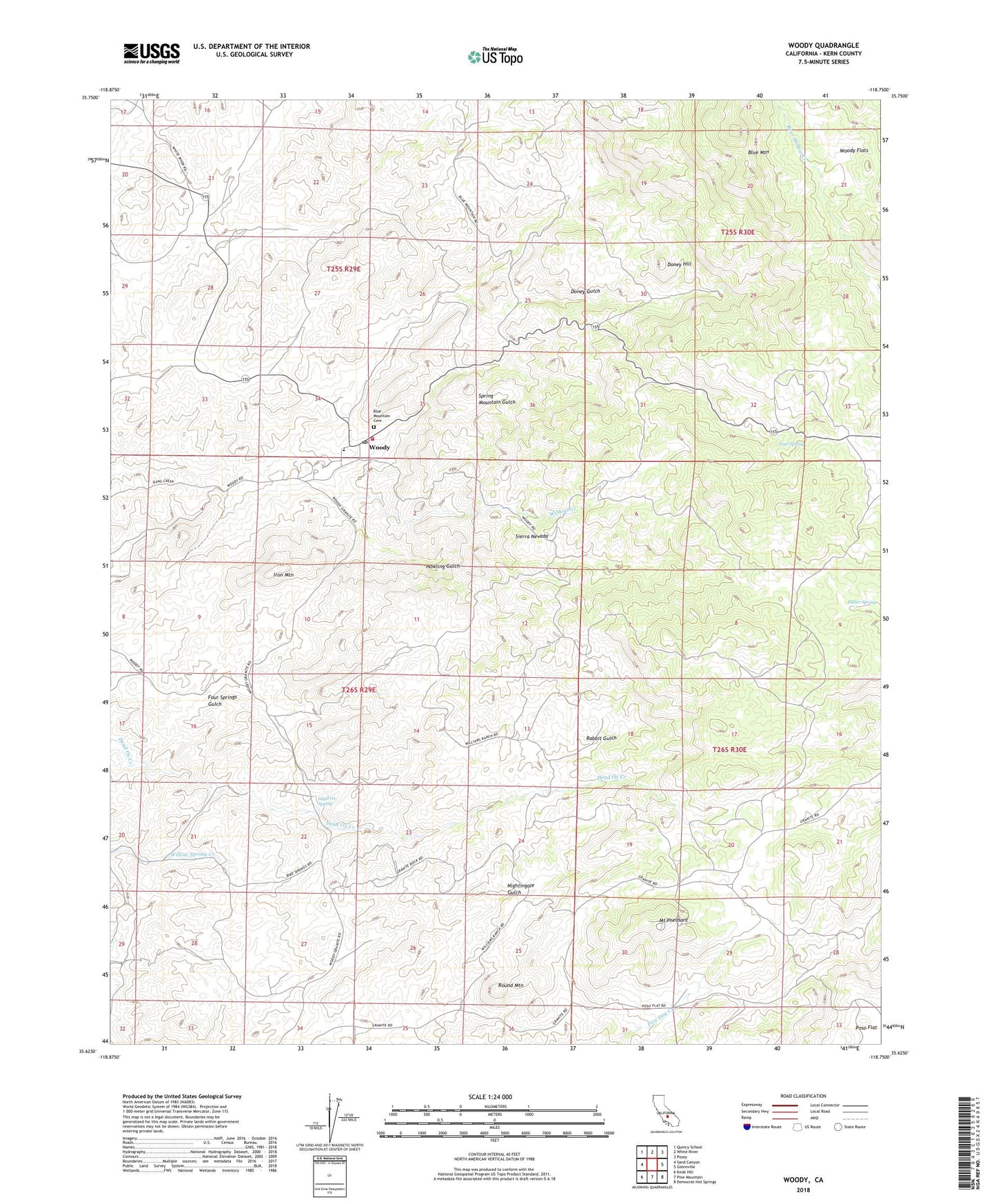
2022 topographic map quadrangle Woody in the state of California. Scale: 1:24000. Based on the newly updated USGS 7.5' US Topo map series, this map is in the following counties: Kern. The map contains contour data, water features, and other items you are used to seeing on USGS maps, but also has updated roads and other features. This is the next generation of topographic maps. Printed on high-quality waterproof paper with UV fade-resistant inks.
Quads adjacent to this one:
West: Sand Canyon
Northwest: Quincy School
North: White River
Northeast: Posey
East: Glennville
Southeast: Democrat Hot Springs
South: Pine Mountain
Southwest: Knob Hill
This map covers the same area as the classic USGS quad with code o35118f7.
Contains the following named places: Blake Elementary School, Blue Mountain Cemetery, Butler Spring, Dead Ox Spring, Doney Gulch, Doney Hill, Fine Spring, Howling Gulch, Iron Mountain, Jordon Ranch, KDNO-FM (Delano), Kern County Fire Department Station 35 Woody, Mount Pheasant, Rabbit Gulch, Round Mountain, Spring Mountain Gulch, Wildcat Creek, Woody, Woody Census Designated Place, Woody Flats, Woody Post Office, Woody Ranch, Woody School