MyTopo
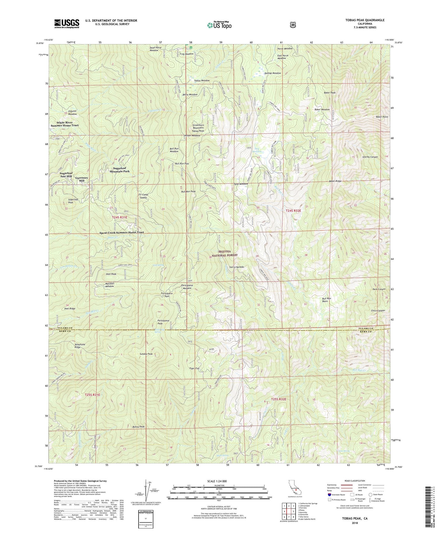
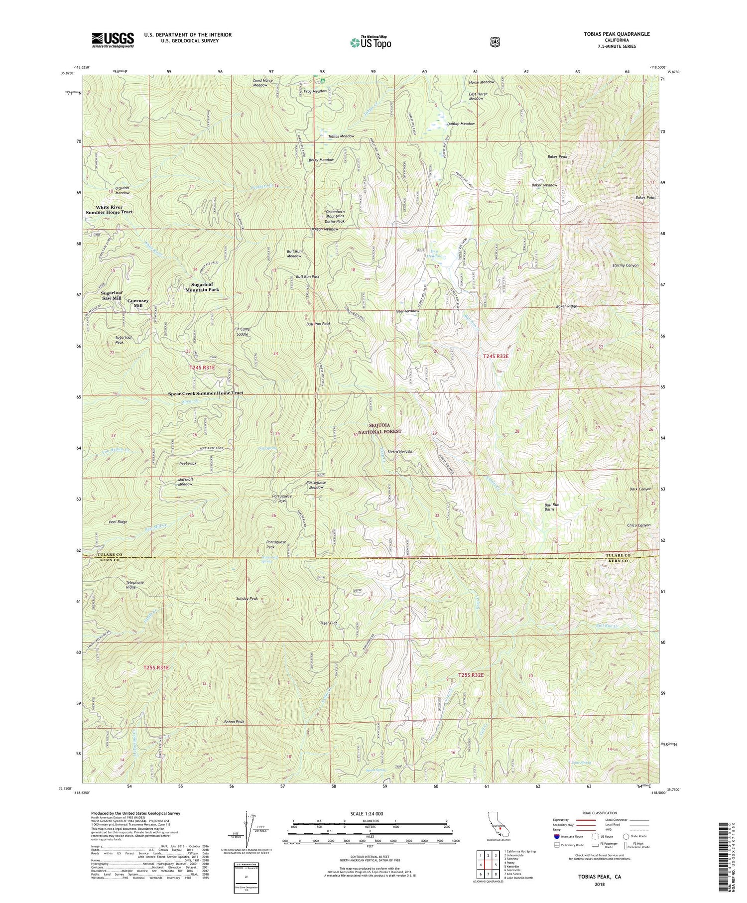
Tobias Peak California US Topo Map
Couldn't load pickup availability
Also explore the Tobias Peak Forest Service Topo of this same quad for updated USFS data
2022 topographic map quadrangle Tobias Peak in the state of California. Scale: 1:24000. Based on the newly updated USGS 7.5' US Topo map series, this map is in the following counties: Tulare, Kern. The map contains contour data, water features, and other items you are used to seeing on USGS maps, but also has updated roads and other features. This is the next generation of topographic maps. Printed on high-quality waterproof paper with UV fade-resistant inks.
Quads adjacent to this one:
West: Posey
Northwest: California Hot Springs
North: Johnsondale
Northeast: Fairview
East: Kernville
Southeast: Lake Isabella North
South: Alta Sierra
Southwest: Glennville
This map covers the same area as the classic USGS quad with code o35118g5.
Contains the following named places: Baker Meadow, Baker Peak, Baker Point, Baker Ridge, Berry Meadow, Betty Lou Mine, Black Sambo Mine, Bohna Peak, Bony Witt, Bull Run Basin, Bull Run Cattle Drive, Bull Run Meadow, Bull Run Pass, Bull Run Peak, Calf Creek, Camp Mountain Meadows, Cane Spring, Cold Spring, Cow Creek, Dead Horse Meadow, Deep Creek, Deer Creek Grove, Dry Meadow, Dunlap Meadow, East Horse Meadow, Fir Camp Saddle, Frog Meadow, Frog Meadow Guard Station, Frog Meadows Campground, Frog Meadows Guard Station, Gooseberry Campground, Greenhorn Mountains, Guernsey Mill, Horse Meadow, Marshall Meadow, Munn Camp, O'Quinn Meadow, Owl Mine, Panorama Campground, Peel Peak, Peel Ridge, Poison Meadow, Portuguese Meadow, Portuguese Pass, Portuguese Peak, Schultz Creek, Silver Strand Mine, Spear Creek Summer Home Tract, Spout Spring, Sugarloaf Campground, Sugarloaf Mountain Park, Sugarloaf Mountain Park Census Designated Place, Sugarloaf Peak, Sugarloaf Saw Mill, Sugarloaf Saw Mill Census Designated Place, Sunday Peak, Telephone Ridge, Tiger Flat, Tiger Flat Campground, Tip Top Mine, Tobias Lookout, Tobias Meadow, Tobias Peak, Tobias Trail, Tyler Meadow, Virginia Trail, Water Gap Spring, West Horse Meadow