
MyTopo
Oxbow Bridge California US Topo Map
Couldn't load pickup availability
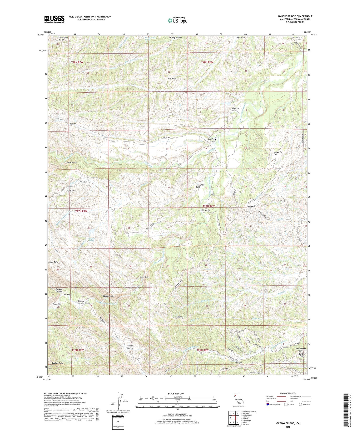
2021 topographic map quadrangle Oxbow Bridge in the state of California. Scale: 1:24000. Based on the newly updated USGS 7.5' US Topo map series, this map is in the following counties: Tehama. The map contains contour data, water features, and other items you are used to seeing on USGS maps, but also has updated roads and other features. This is the next generation of topographic maps. Printed on high-quality waterproof paper with UV fade-resistant inks.
Quads adjacent to this one:
West: Cold Fork
Northwest: Chickabally Mountain
North: Rosewood
Northeast: Mitchell Gulch
East: Blossom
Southeast: Red Bank
South: Lowrey
Southwest: Raglin Ridge
This map covers the same area as the classic USGS quad with code o40122b5.
Contains the following named places: Ant Flat, Boulder Point, Brushy Hollow, Brushy Hollow Spring, Cold Fork, Cracker Canyon, Deadman Crossing, Dipping Vat Flat, Fowler Place, Gilliam Place, Guyre Creek, Hatfield Place, Hercraff Place, Irish Place, Jackass Canyon, Manzanita Flat, McCartney Place, Middle Fork Guyre Creek, Mud Valley, Oxbow Bridge, Pete Hoff Place, Red Bank Gulch, Rocky Ridge, Scofield Flat, Sour Grass Gulch, South Fork Guyre Creek, Steep Hollow, Sulphur Gulch, Sulphur Spring, Swain Place, Table Mountain, Walker Place, Wildhide Gulch


