MyTopo
Redwood Point California US Topo Map
Couldn't load pickup availability
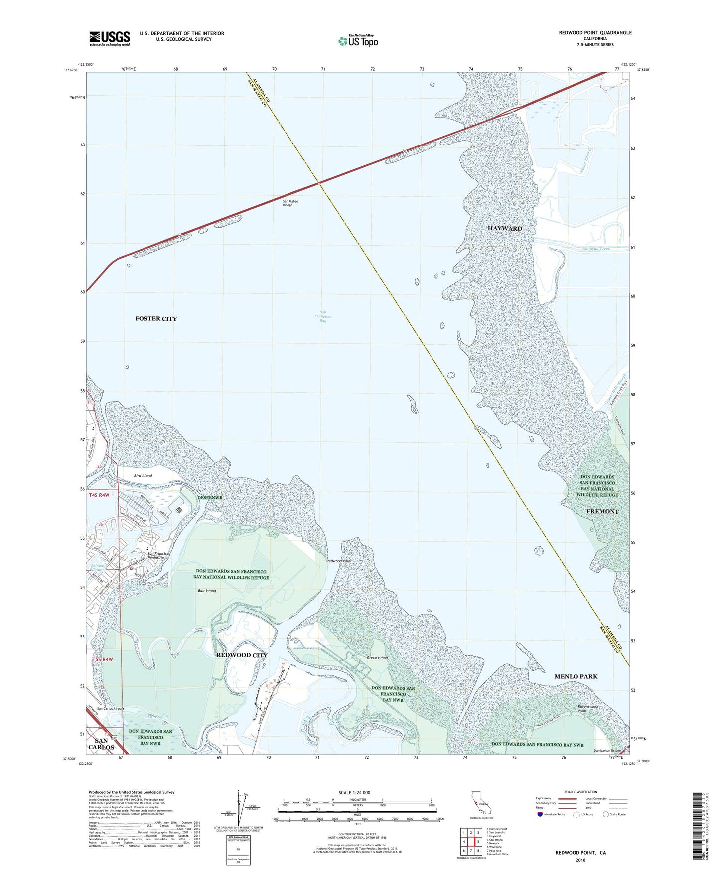
2021 topographic map quadrangle Redwood Point in the state of California. Scale: 1:24000. Based on the newly updated USGS 7.5' US Topo map series, this map is in the following counties: San Mateo, Alameda. The map contains contour data, water features, and other items you are used to seeing on USGS maps, but also has updated roads and other features. This is the next generation of topographic maps. Printed on high-quality waterproof paper with UV fade-resistant inks.
Quads adjacent to this one:
West: San Mateo
Northwest: Hunters Point
North: San Leandro
Northeast: Hayward
East: Newark
Southeast: Mountain View
South: Palo Alto
Southwest: Woodside
This map covers the same area as the classic USGS quad with code o37122e2.
Contains the following named places: Alameda Creek, Bair Island, Bay Slough, Bayside Community Church, Belmont Slough, Bird Island, Bowditch Middle School, Christ the Victor Lutheran Church, City of Foster City, City of Redwood City, Corkscrew Slough, Fire Station Number 2, First Slough, Greco Island, KNBR-AM (San Francisco), Mariner Park, Marlin Park, Mount Eden Creek, Petes Harbor, Port of Redwood City, Press Wireless Radio Station, Pulgas Creek, Ravenswood Point, Redwood City Fire Department Station 20, Redwood Creek, Redwood Point, Redwood Shores, Saint Lukes Catholic Church, San Mateo Bridge, Sandpiper School, Seaport Village North Shopping Center, Shannon Park, Smith Slough, South Bay Sewer Authority Treatment Plant, Steinberger Slough, Westpoint Slough, ZIP Codes: 94065, 94545