MyTopo
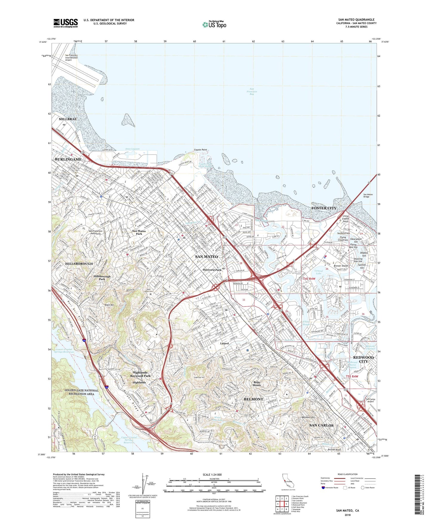
San Mateo California US Topo Map
Couldn't load pickup availability
2021 topographic map quadrangle San Mateo in the state of California. Scale: 1:24000. Based on the newly updated USGS 7.5' US Topo map series, this map is in the following counties: San Mateo. The map contains contour data, water features, and other items you are used to seeing on USGS maps, but also has updated roads and other features. This is the next generation of topographic maps. Printed on high-quality waterproof paper with UV fade-resistant inks.
Quads adjacent to this one:
West: Montara Mountain
Northwest: San Francisco South
North: Hunters Point
Northeast: San Leandro
East: Redwood Point
Southeast: Palo Alto
South: Woodside
Southwest: Half Moon Bay
This map covers the same area as the classic USGS quad with code o37122e3.
Contains the following named places: Abbott Middle School, Albion H Horrall Elementary School, Alexander Park, Alpine Park, Anza Expedition Historical Marker, Anza Lagoon, Aragon High School, Archurus Park, Arguello Park, Arundel Elementary School, Bay Meadows Airport, Bay Meadows Racetrack, Bay Tree Park, Bayfront Park, Bayside Middle School, Bayside Park, Baywood Elementary School, Baywood Park, Baywood Park Census Designated Place, Beach Park Plaza Shopping Center, Bel Mateo Shopping Center, Belameda Park, Belle Monte, Belmont, Belmont Channel, Belmont Creek, Belmont Hill, Belmont Hills Hospital, Belmont Sports Complex, Beresford Elementary School, Beresford Park, Beresford Recreation Center, Black Mountain, Boat Park, Boothbay Park, Borel Middle School, Borel Park, Borel Square Shopping Center, Brewer Island, Brewer Island Elementary School, Bridgepointe Shopping Center, Buena Vista School, Burlingame, Burlingame Country Club, Burlingame High School, Burlingame Village Park, Carlmont High School, Carlmont Village Shopping Center, Casanova Park, Catamaran Park, Central Elementary School, Central Lake, Central Middle School, Central Park, Charles Armstrong School, Charter Square Shopping Center, Cherry Canyon, Cipriani Elementary School, City of Belmont, City of Burlingame, City of San Mateo, Coyote Point, Coyote Point County Park, Coyote Point Marina, Coyote Point Yacht Harbor, Crocker 2014 Dam, Crocker Middle School, Crosby Commons Shopping Center, Crystal Springs Dam, Crystal Springs Shopping Center, Crystal Springs Uplands School, DeAnza Historical Park, Deepwater Slough, Devonshire, Dolphin Isle, Dolphin Park, Easton Creek, Eastside Park, Edgewater Park, Edgewater Place Shopping Center, El Portal del Sol School, Erckenbrack Park, Farragut Park, Fiesta Gardens International Elementary School, Fiesta Gardens Shopping Center, Fiesta Grounds, Flying Cloud Isle, Flying Mist Isle, Foster City, Foster City Recreation Center, Fox Mall Shopping Center, George Hall Elementary School, Globe Wireless Receiving Station, Gull Park, Hallmark Park, Harbor View Park, Hayward Park, Hayward Park Square, Highlands, Highlands Census Designated Place, Highlands Elementary School, Highlands-Baywood Park Census Designated Place, Hillcrest Circle Park, Hillsborough Park, Hillsborough Racquet Club, Hillsdale, Hillsdale High School, Hillsdale Shopping Center, Indian Springs Park, Japanese Gardens, John S Brooks Memorial Open Space, Johnville Park, Junipero Serra High School, KCSM-FM (San Mateo), Ketch Park, Kildeer Park, KKHI, KKHI-AM (San Francisco), Knolls Elementary School, KVSM, Lagoon Island Park, Laguna Park, Laguna Vista Park, Lake Raymundo, Lakeshore Park, Lakeshore School, Laurel, Laurel Creek, Laurel Creek 1070 Dam, Laurelwood Park, Laurelwood Shopping Center, Laureola Park, Laureola School, Laurie Meadows Park, Lawrence School, Leo J Ryan Memorial Park, Little Coyote Point, Longs Plaza Shopping Center, Los Prados Park, Los Prados Shopping Center, Louis Barrett School, Lower Crystal Springs Reservoir, Marine View Park, Marine World, Mariners Island Park, Marlin Cove Shopping Center, Marlin Park, McDougal Park, McKinley Elementary School, Meadow Heights Elementary School, Metro Center Shopping Center, Mills Creek, Nesbit Elementary School, North Hillsborough Elementary School, North Shoreview Elementary School, Notre Dame 619 Dam, Notre Dame de Namur University, O'Donnel Park, O'Neal Slough, O'Neill Slough, Paloma Playground, Park Elementary School, Parkside Aquatic Park, Parkside Elementary School, Parkside Plaza Shopping Center, Peninsula Country Club, Peninsula Tennis Club, Peninsular Ave School, Pershing Park, Pershing School, Phelps Slough, Polhemus Creek, Pompano Circle Park, Port O'Call Shopping Center, Port Royal Park, Pulgas Ridge, Ralston Middle School, Redwood Medical Clinic, Redwood Shores Lagoon, Robert E Woolley Peninsula Park, Roosevelt Elementary School, Ryder Court Park, Sailfish Isle, Saint Bartholomew School, Saint Catherine of Siena School, Saint Johns Cemetery, Saint Matthew Catholic School, Saint Timothy Elementary School, San Carlos, San Carlos Airport, San Mateo, San Mateo Commons Shopping Center, San Mateo Creek, San Mateo Fishing Pier, San Mateo High School, San Mateo Medical Center, San Mateo Municipal Golf Course, San Mateo Park, Sanchez Creek, Sea Cloud Park, Seal Slough, Shad Park, Shearwater Isle, Shooting Star Isle, Shorebird Park, Shoreview Park, Shoreview Shopping Center, Silver Penny Mobile Home Park, Skyline Quarry, Sugarloaf Hill, Sunfish Park, Sunnybrae Park, Surfbird Isle, Sutter Health Mills Health Center, The Carey School, Tidelands Park, Timberland Park, Town of Hillsborough, Trenton Playground, Turnstone Park, Twin Pines Park, Victoria Park, Washington Park, Washington Playground, Water Dog Lake, Water Dog Lake Park, West Hillsdale Park, Wood Lake Shopping Center, Woodlake Shopping Center, ZIP Codes: 94002, 94010, 94401, 94402, 94403, 94404


