MyTopo
Topo Valley California US Topo Map
Couldn't load pickup availability
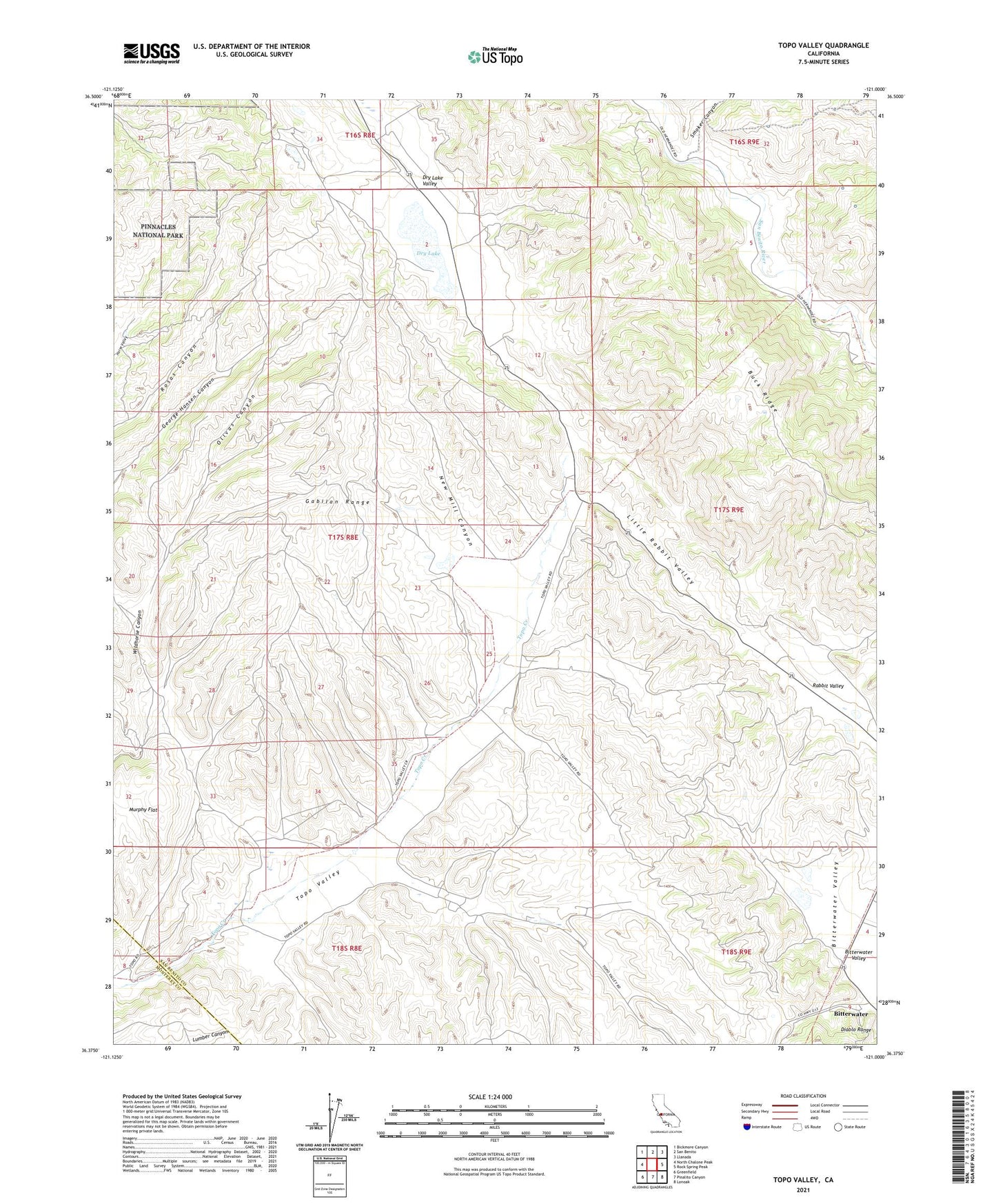
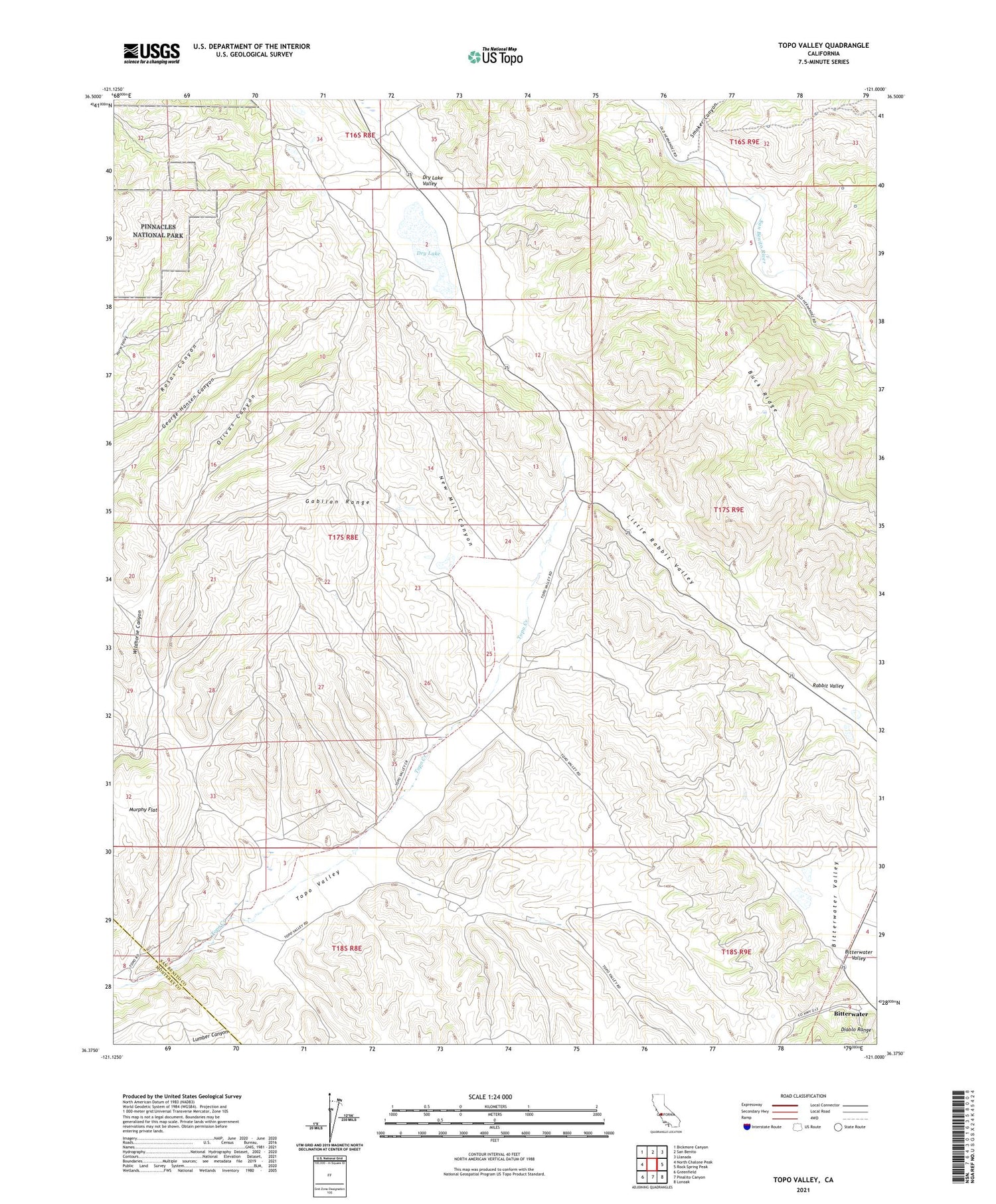
2021 topographic map quadrangle Topo Valley in the state of California. Scale: 1:24000. Based on the newly updated USGS 7.5' US Topo map series, this map is in the following counties: San Benito, Monterey. The map contains contour data, water features, and other items you are used to seeing on USGS maps, but also has updated roads and other features. This is the next generation of topographic maps. Printed on high-quality waterproof paper with UV fade-resistant inks.
Quads adjacent to this one:
West: North Chalone Peak
Northwest: Bickmore Canyon
North: San Benito
Northeast: Llanada
East: Rock Spring Peak
Southeast: Lonoak
South: Pinalito Canyon
Southwest: Greenfield
This map covers the same area as the classic USGS quad with code o36121d1.
Contains the following named places: Bitterwater, Bitterwater Valley, Buck Ridge, Dry Lake, Dry Lake Valley, Little Rabbit Valley, Murphy Flat, New Mill Canyon, Olivas Canyon, Rabbit Valley, San Andreas Rift Zone, Sans Ranch, Smoker Canyon, Tannehill Ranch, Topo Valley