MyTopo
Rosedale California US Topo Map
Couldn't load pickup availability
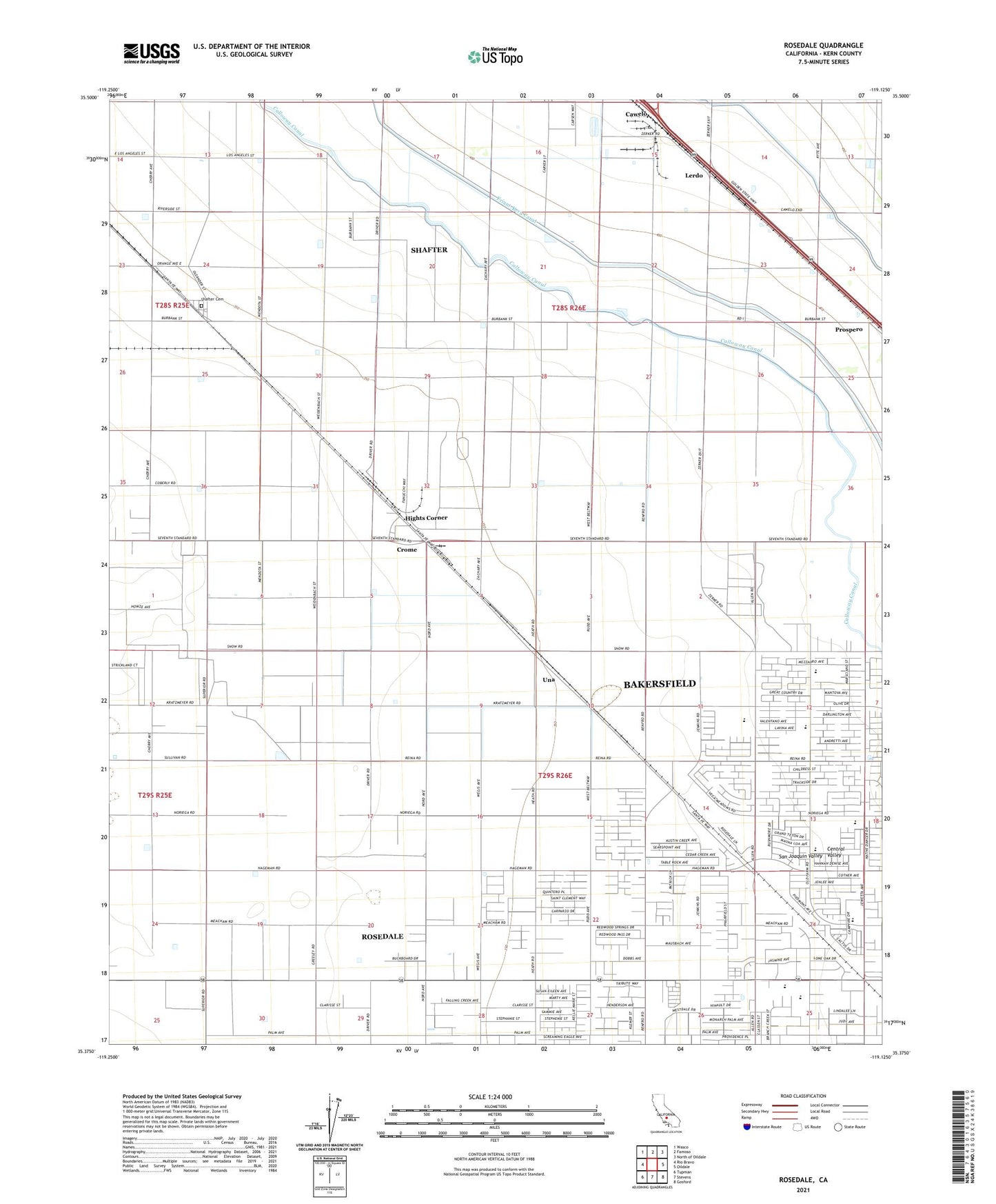
2021 topographic map quadrangle Rosedale in the state of California. Scale: 1:24000. Based on the newly updated USGS 7.5' US Topo map series, this map is in the following counties: Kern. The map contains contour data, water features, and other items you are used to seeing on USGS maps, but also has updated roads and other features. This is the next generation of topographic maps. Printed on high-quality waterproof paper with UV fade-resistant inks.
Quads adjacent to this one:
West: Rio Bravo
Northwest: Wasco
North: Famoso
Northeast: North of Oildale
East: Oildale
Southeast: Gosford
South: Stevens
Southwest: Tupman
This map covers the same area as the classic USGS quad with code o35119d2.
Contains the following named places: Arkelo Ranch, Cawelo, Centennial Elementary School, City of Shafter, Crome, Greeley Oil Field, Greeley School, Hights Corner, KKBB-FM (Shafter), KXHA-FM (Shafter), Lerdo, Lerdo Primary School, Palm School, Prospero, Rosedale, Rosedale Census Designated Place, Rosedale Division, Rosedale Middle School, Rosedale North Elementary School, Rosedale Oil Field, Rosedale School District Office, Rosedale Station, Shafter Cemetery, Una, Una Siding, White Church, ZIP Code: 93314